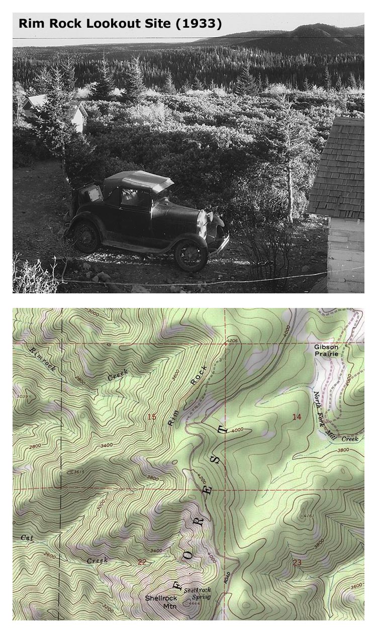
I do love it when I run across something that's been in plain sight, yet I've managed to miss somehow. That was the case when I was plowing through that vast archive of 1930s lookout pans, and came to "Rim Rock." I fully expected to find views from Mount Mitchell, ala the Rimrock Trail (and associated phone line). Much to my surprise, there is a little rim north of Shellrock Mountain (also the "other" Shellrock, this one part of the east wall of the Upper Hood River Valley) that once had a lookout and outbuildings. I've posted a snippet of the site, plus a map clip over here:
http://www.splintercat.org/PortlandHikers/RimRockLookout.jpg
There was a tower here - you can see its shadow in one of the other pans - and it looks like the road is still shown on the topo map. Those are the Mill Creek buttes in the right background.
Interesting! Yet I find it odd that (a) there was a lookout nearby Bald Butte (perhaps replacing this one), and (b) that two "Rim Rock" lookouts existed. In this case, the spelling on both the old photo and on the topo is "Rim Rock" for the ridge top, and "Rimrock" for the creek that flows from it.
-Tom