I'm looking for some history on Frazier Mountain. Here's a snippet of a 1938 topo map that shows many of today's trail and road features, plus several lost to time:
http://www.splintercat.org/PortlandHikers/1938FrazierTopo.jpg
(depending on your browser, you may need to click the map to enlarge it)
What strikes me as odd is the fact that a road was built to the end of Indian Ridge for a lookout, and a spur nearly to the summit of Frazier Mountain... but no lookout? That seems odd, unless there was some logistic problem with Frazier that was only discovered after the road to the top was nearly completed. So one of my summer trips will be to bushwhack to the summit of Frazier Mountain and see what's there. Does anyone know the history of a lookout on Frazier?
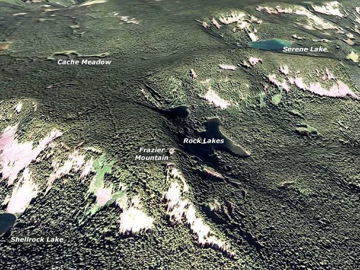
In preparation for that trip, the following Google Earth image shows some of the high spots, and there are, indeed, open areas on the summit:
http://www.splintercat.org/PortlandHikers/FrazierMountain.jpg
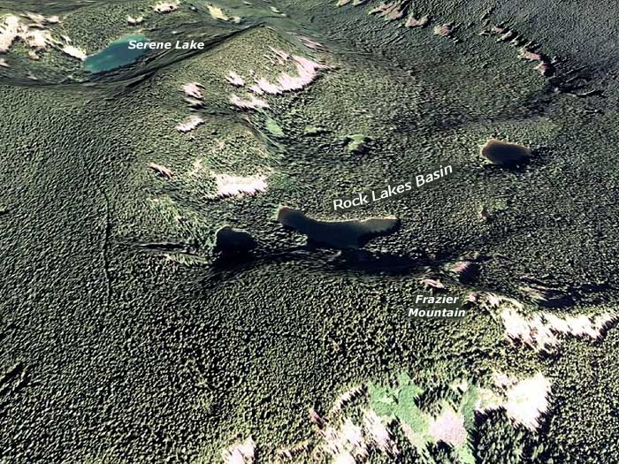
You can clearly see the road in the above view. But upon closer inspection, another segment of road shows up, south of Frazier Mountain. This rotated view shows that piece more clearly, as it heads toward Serene Lake:
http://www.splintercat.org/PortlandHikers/FrazierMountain2.jpg
Was this a fire break, or some other modern addition? It doesn't show on the old 1938 map, and doesn't look like an anomaly in the Google Earth photography. Odd.
Finally, on the 1938 map, the trail from Cottonwood Meadows to the Cache/Shellrock cutoff trail is shown as a main trail, where the Cache/Shellrock trail is a minor path. That also seems odd - ending a main trail at a lesser trail. It makes me wonder if the trail system in the area was in flux when this map was drafted.
Any details that you can shed some like on would be much appreciated! At one time, Donovan noted a large CCC camp in the vicinity of the High Rock turnaround, I believe, so maybe some of these mysteries are tied to the CCC camp being in the vicinity..?
Tom