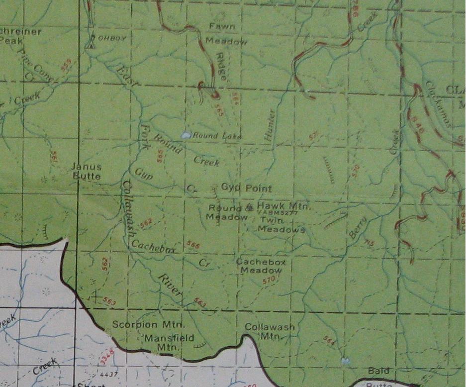
I recall a thread a while back on the 563 trail and had it in mind when I visited the UO Map library last week. I can report on the location as can be seen in
this snippet from the 1963 MHNF map.
My visit was very productive and I have enough lost trails to visit that I should be busy for the next several years tracking them down or until my arthritis keeps me on the couch. The inventory of the maps I imaged is in this
thread at PortlandHikers.org. I'm loading all this to Flickr - I have over 1000 photos in 4GB to process so it will take a couple of weeks to get it all up there. So far I've done the 1963 MHFS map - some of the originals are rotated 90-180 degrees - some sort of Flickr thing I haven't figured out yet.
North half -> 1-Columbia Gorge, Hood River, Zig Zag, Summit, Barlow Ranger Districts;
http://www.flickr.com/photos/21209133@N06/sets/72157603938415053/South half -> 2-Bear Springs, Collawash, Lakes, Estacada Ranger Districts.
http://www.flickr.com/photos/21209133@N06/sets/72157603938415055/I hope to image the entire collection of the Mt Hood Forest Service maps to compare trail changes from one printing to the next. As with the maps themselves, all images I've taken of the maps are in the Public Domain.
--Paul
Paul Turner