
Key Stats for the Plaza Creek Trail - 506
About
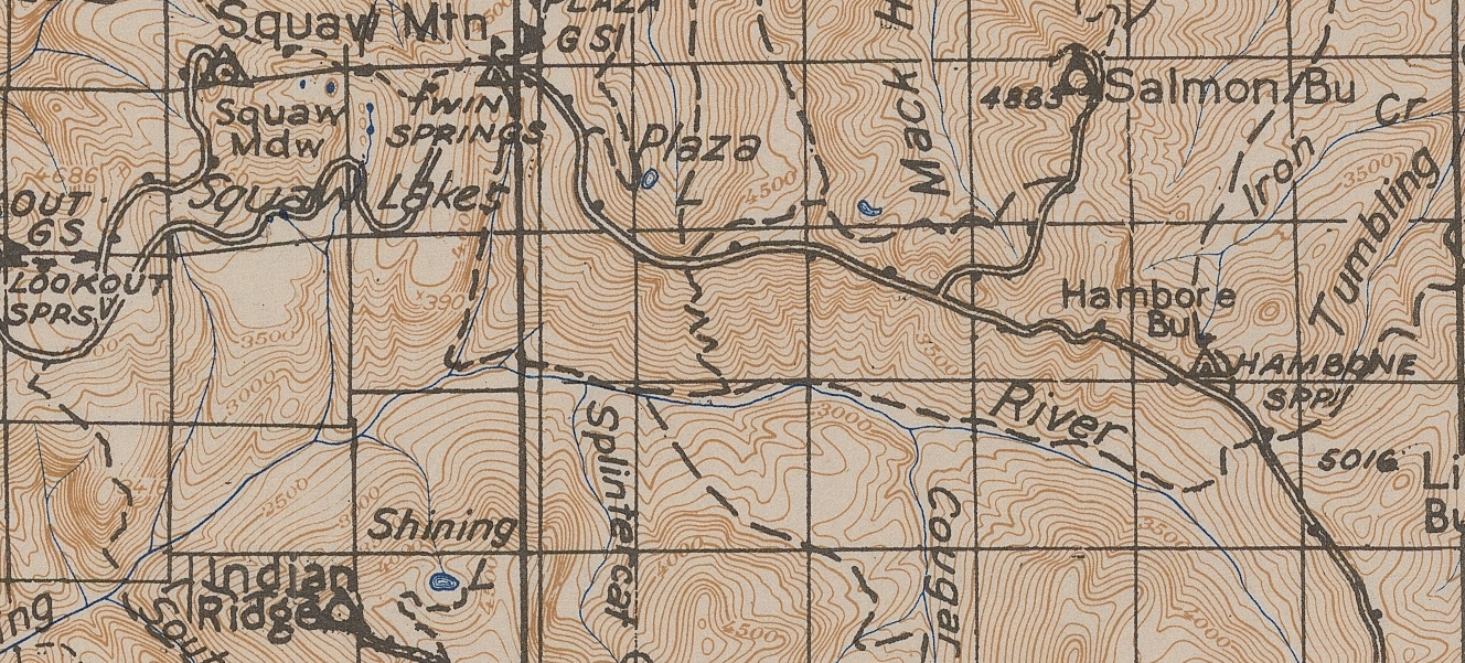
An abandoned trail leads from the lower end of the unmaintained Twin Springs Campground two miles down to the Roaring River.
Trail very faint after the second stream crossing, disappearing shortly after the crossing of Plaza Creek, about 1.7 miles from the Trailhead. Trail is faint in places but reasonably well flagged.
Not recommended for the average hiker. Stamina and navigational skills required.
The nearby Plaza Ranger Station was named by T.H. Sherard of the Forest Service because of a natural plaza or clearing, which afforded a fine view of Mt. Hood.1
This trail needs some friends and some further exploration. Dropped from USGS maps. It would be interesting to see if someone can find where it joins with the trail that used to go east/west along the Roaring River. Shows on some old maps – here is one example:
Directions
Travel Hwy 224 thru Estacada – approximately 6.1 miles from Estacada, turn left onto Forest Road 4610 – this is almost directly across from the Promontory Park marina. Travel approximately 17.5 miles on Road 4610 to the abandoned Twin Springs campground on the right. There is a enough space to park off the road. There are no signs. The trail takes off from the lower end of the campground.
1Oregon Geographic Names, McArthur, Lewis.
Map and Elevation Profile
Trip Reports
No trip reports found.
Comments
Plaza Creek Trail 506 — No Comments
HTML tags allowed in your comment: <a href="" title=""> <abbr title=""> <acronym title=""> <b> <blockquote cite=""> <cite> <code> <del datetime=""> <em> <i> <q cite=""> <s> <strike> <strong>