
Historical Items
This archive holds over 80 historical documents, maps, books, photos, and records relating to the Mt. Hood National Forest and the Clackamas River Ranger District, spanning from the 1890s to the early 2000s. Materials include government reports, personal diaries, field notes, survey maps, and photo galleries from the people who explored, managed, and advocated for these lands. Use the tabs below to browse by category. If you have items that you think would be useful to add to these lists you can send them to webmaster@trailadvocate.org.
Looking for something specific? The Search tool searches these historical documents together with our current trail data, historic topo and forest maps, and decades of forum discussion.
Documents (43)
Books & Booklets
- [Handbook] Forest Service Trail Handbook [1935] — All sorts of policy info including Plans, Location, Construction, Marking and Maintenance of trails.
- [Book] Looters of the Public Domain [Late 1800s–Early 1900s] — Describes a series of fraudulent land deals in the late 19th and early 20th century.
- [Booklet] Oregon’s Hidden Wilderness — Booklet created to showcase Bull of the Woods before it became official wilderness.
- [Book] The Use of the National Forests [1907] — Written by Gifford Pinchot. A foundational text explaining the what, why, and how of our National Forests. Large download.
Personal Accounts & Diaries
- [Article] Life at a Fire Lookout in the 1940s [1940s] — A first-hand account of what it was like to man a fire lookout during that era.
- [Diary] Diary of Helen and Elbert Brubaker — Fish Creek Mountain Lookout [1945] — Personal diary from their time staffing the Fish Creek Mountain Lookout in 1945.
- [Diary] Diary of a Trip over the Clackamas Watershed [1912] — A journey across the watershed in August 1912. Note: S.P. refers to Southern Pacific Railroad.
- [Oral History] Oral History — Marcelle Walker [1930s–1940s] — Transcript of an oral history from Marcelle Walker, who spent 7 years working around the district during the 30s and 40s.
- [Notes] Fishing the Upper Clackamas [1940s–1950s] — Personal notes about fishing the Upper Clackamas in the 1940s and 50s.
- [Notes] Trips to Big Bottom [1940s–1950s] — Personal notes about trips to the Big Bottom area in the 1940s and 50s.
- [Notes] Discovery of the Cold Water Corydalis — Notes about the original discovery of this rare plant species on the upper Clackamas River.
- [Notes] Proposed Powerplants on the Upper Clackamas — Notes about proposed new powerplant development on the Upper Clackamas River.
- [Letters] Letters to the Forest Service [1970s] — A collection of public letters written to the Forest Service during the 1970s.
Field & Botanical Reports
Horticultural Field Notes — Botanical field surveys of plant life in the district, collected by various researchers spanning over 60 years.
- [Field Report] Bailey — 1897
- [Field Report] Coville — 1897–98
- [Field Report] Coville — 1898
- [Field Report] Bailey — 1907
- [Field Report] Bailey — 1909
- [Field Report] Unknown author — 1909
- [Field Report] Unknown author — 1909 (second report)
- [Field Report] Fosberg — 1962
Oregon State Board of Horticulture — Forestry and Arid Land Interests
- [Gov’t Report] 1898 Edition — State forestry report covering arid land and forest management interests.
- [Gov’t Report] 1909 Edition — State forestry report covering arid land and forest management interests.
Government Reports & Handbooks
- [Gov’t Report] Civilian Conservation Corps (CCC) History in the Mt. Hood National Forest [1930s–1940s] — History of the CCC’s extensive work building trails and infrastructure throughout the Mt. Hood National Forest.
- [Gov’t Report] Hawk Mountain Cabin Work [2002] — Documentation of restoration and maintenance work performed at Hawk Mountain Cabin.
- [Gov’t Report] National Forest Development in the 1950s [1950s] — PDF from a retired ranger featuring aerial photos of the district alongside historical information on developments and logging activity.
- [Booklet] Oregon Forest Facts [1920s] — State Board of Forestry booklet covering Oregon’s forest resources and management.
- [Gov’t Report] Oregon Forest Fire Laws [1919] — Oregon state regulations governing forest fire prevention and response.
- [History] PGE History of the Clackamas River Area — Portland General Electric’s history of hydroelectric development and operations along the Clackamas River.
- [Gov’t Report] Sheep Grazing in the Cascade Mountains [1898] — Government report on sheep grazing activity and its effects on forest growth in the Cascades.
- [Handbook] US Forest Service Guard Handbook [1940s] — Partial handbook covering duties and procedures for Forest Service guards in the field.
- [Gov’t Report] US Forest Service Report — 1996 Closure of Fish Creek Drainage [1996] — Official report documenting the decision and rationale for closing the Fish Creek drainage area.
- [Booklet] Vacation Land in the National Forests in Oregon [1919] — Promotional booklet encouraging recreation in Oregon’s national forests.
Academic & Research
- [Reference] Background on Place Names — Historical background explaining how various locations in the Clackamas district received their names.
- [Biography] Biographical Memoir of Henry L. Abbot [1850s] — Abbot conducted topographic surveys in the district in the early 1850s. This memoir covers his life and contributions to western exploration.
- [Article] Lieutenant Abbot and Sam An-ax-shat [1850s] — Account of Abbot’s surveys in the district alongside Sam An-ax-shat, an Indian guide who helped him navigate the territory.
- [Academic] Mercury Mines Along the Clackamas [2004] — College paper by Michael O’Leary examining two mercury mines on the Oak Grove Fork of the Clackamas River.
- [Thesis] Oregon State Masters Thesis — La Dee Flats Logging Camp [1920s] — Academic thesis examining the La Dee Flats logging camp and operations in the 1920s.
- [Essay] The Mapping of Our National Forests [2014] — Historical essay by Peter L. Stark on the history of mapping national forest land from the early surveys to modern methods.
Oregon Sportsman Magazine
Historical issues of the Oregon Department of Fish and Wildlife’s outdoor magazine, covering wildlife, fishing, and the backcountry of Oregon.
- [Magazine] 1913 Edition
- [Magazine] 1914 Edition
- [Magazine] 1915 Edition
- [Magazine] 1916 Edition
- [Magazine] 1917 Edition
- [Magazine] 1918 Edition
News Articles
- [Article] The “New” Clackamas River Trail — Article from Northwest Magazine covering the opening and significance of the Clackamas River Trail.
- [Article] Mazamas Magazine — Trail Funding & the Clackamas River Trail [1974] — Discusses trail funding issues and the construction of the Clackamas River Trail.
- [Letter] Mazamas Letter — Roaring River Trail Proposal [1972] — The Mazamas’ letter to the Forest Service advocating for construction of a new Roaring River Trail.
- [Editorial] Trail Maintenance Editorial [1975] — Editorial discussing the lack of trail maintenance, plus a Forest Service Internal Memo written in response.
Maps (25)
Interactive Map Tools
Start here if you want to explore the district visually — these tools let you browse maps by location rather than scrolling a list.
- Historic Map Collection — Click on any area of the district and it displays all available historical map scans for that location. Includes Cadastral and Metsker maps. The page also allows to filter by scale, era, type or quad name.
- Overlay Map Tool — Display historical maps overlaid on modern maps with adjustable opacity for easy comparison.
Historical Map Scans
Scanned maps from the district’s history. Organized from high-quality topographic listings to recreation-era overview maps.
- Recreation & Overview Maps — Broader-scale maps from the 1920s–1940s. Interesting for context but lower in geographic detail.
- 1921 — Oregon Skyline Trail. See additional maps on the Skyline Trail page.
- 1936 — Mount Hood Recreation Area
- 1938 — Olallie Lake Area
- 1938 — Breitenbush Loop
- 1939 — Trails on Mount Hood (Front)
- 1939 — Trails on Mount Hood (Back) — Includes Timberline trail log.
- Photo Scans of Historical Maps — Relatively low-quality photos of additional historical maps. Interesting for context but limited in detail and accuracy.
- Undated early 1900s — Northern district overview
- Undated early 1900s — Northern district overview (second view)
- 1945 — Fireman’s Map, northern district
- 1945 — Fireman’s Map, southern district
- 1950s — Northeast district (estimated)
- 1950s — Central/west district (estimated)
- 1950s — Northwest district (estimated)
- 1950s — Northeast district, alternate view (estimated)
- 1950s — Central district (estimated)
New Wilderness Area Maps
Maps of wilderness areas and wild & scenic rivers designated in the 2009 Omnibus Public Land Management Act. Includes an overview and individual maps for each area.
- New Mt. Hood Wilderness Areas — Overview
- Big Bottom Wilderness
- Bull of the Woods Additions
- Clackamas Canyon Wilderness
- Collawash River Wild & Scenic River
- Eagle Creek Wilderness
- Fish Creek Wild & Scenic River
- Inch Creek Wilderness
- Memaloose Lake Wilderness
- Roaring River Wilderness
- Sisi Butte Wilderness
- South Fork Clackamas River Wild & Scenic River
- South Fork Roaring River Wild & Scenic River
Photos (10 galleries)
Each entry below links to a dedicated photo gallery. Click any gallery to browse its full collection.
-
 Breitenbush Lake — Historical photos of Breitenbush Lake and the surrounding high-elevation area.
 -
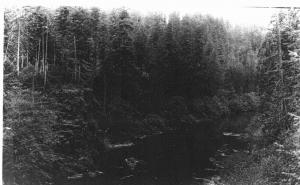 Clackamas River — Historical photos along the Clackamas River corridor.
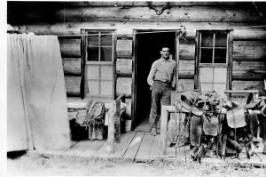
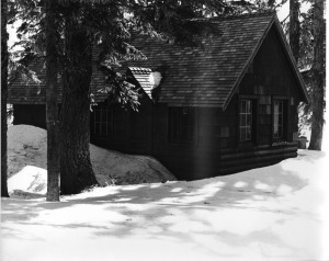
Guard Stations — Historical photos of Forest Service guard stations throughout the district.
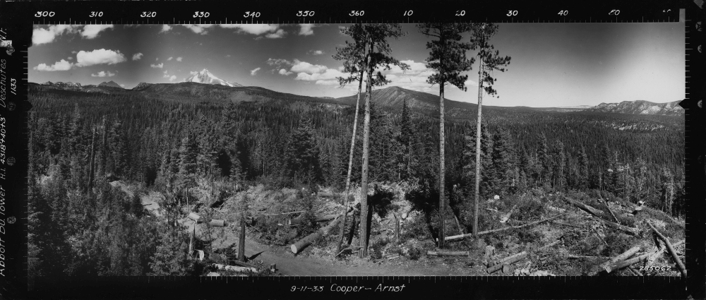
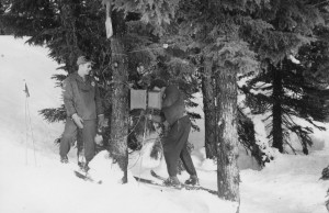
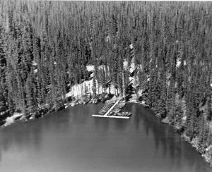
- Lookouts — Photos of old fire lookout towers and the views from their summits.
-
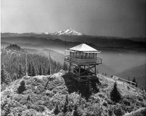
Ground-level lookout photos — Photos of lookout structures, equipment, and staff.
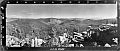
Panoramic photos from lookout summits — Wide-angle panoramas taken from old lookouts in the Mt. Hood National Forest.
Additional panoramic photos — The Nature Conservancy’s collection, mostly in Oregon with some from Washington and California.
External page with additional details and context for the panoramic lookout photos.
Miscellaneous — A collection of historical photos from the district that don’t fit neatly into other categories.
Olallie Area — Historical photos of the Olallie Lake area and surrounding high country.
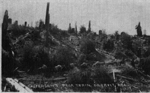
Pack Trains — Historical photos documenting pack train operations used to supply remote backcountry work crews and camps.
Rebuilding the Collawash Canyon [1965] — Photos documenting the restoration of trails and infrastructure in the Collawash Canyon.
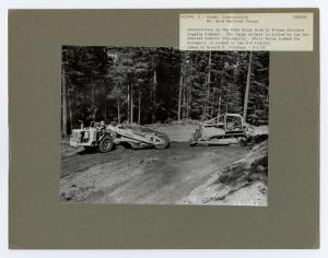
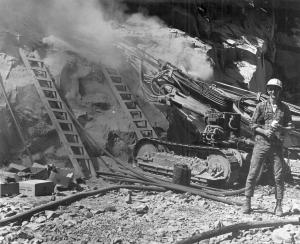
Road Construction — Historical photos of road building activity in the district.
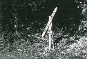
Signs — Historical photos of trail signs and Forest Service signage throughout the district.
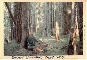
Trails — Historical photos of trails in the district, showing conditions and scenery from earlier eras.
Trail Info (22)
Trail Logs
Official logs recording trail conditions, distances, and notes from field inspections. A useful resource for understanding how trails have changed over time.
- [Trail Log] Corral Springs Trail [Undated]
- [Trail Log] Grouse Point Trail [1968]
- [Trail Log] Grouse Point Trail [1979]
- [Trail Log] Hillockburn Trail [1964]
- [Trail Log] Huxley Lake Trail [Undated]
- [Trail Log] Serene Lake Trail [Undated]
- [Trail Log] Various Trails — Undated collection — A compilation of trail logs for multiple trails with no specific date.
Trail Notes
Personal notes and observations from individuals who traveled or worked on district trails.
- [Notes] Hambone Trail Notes [1970s] — Field notes and observations about the Hambone Trail from the 1970s.
- [Notes] Trail Notes — Howard Rondthaler (“Rondy”) [1970] — Personal trail notes from longtime district figure Howard Rondthaler.
- [Notes] Trail Notes — Sounds of Two Rivers Trail [1973] — Field notes on the Sounds of Two Rivers Trail.
Trail Plans & Proposals
Historical planning documents showing proposed trail routes and inventories — useful for understanding how the trail system developed and what was considered but never built.
- [Plan] Dry Ridge Trail Re-Route [1975] — Documents and rationale for a proposed re-route of the Dry Ridge Trail.
- [Plan] Existing and Proposed Trails — Rock Lakes Basin [Undated] — Planning map and notes for trail development in the Rock Lakes Basin.
- [Plan] Mt. Hood National Forest — Existing and Proposed Trails [1975] — District-wide trail inventory and proposal document.
- [Map] Mt. Hood National Forest Trail Map — Bull Run District [1948] — Official trail map for the Bull Run District.
- [Plan] Pansy Lake Trail Re-Route [Undated] – Project map of a re-route of the Pansy Lake trail from the west side of the lake to the east side as well as portions of the Mother Lode and Twin Lakes trails.
- [Flyer] Rock Lakes Basin Flyer [Undated] — Informational flyer about the Rock Lakes Basin trail area.
- [Gov’t Report] Trail Inventory — Oregon National Forest [1916] — Early comprehensive inventory of trails in the Oregon National Forest (predecessor to the Mt. Hood National Forest).
Discussions & Historical Records
- [Discussion] Old Discussions about Wilderness Designation — Archived discussion threads about the impact of wilderness designation on district trails.
- [Archive] Old Discussion Threads (prior to 2010) — HTML format — Archived forum discussions in date order, covering a range of trail and wilderness topics.
- [Archive] Old Discussion Threads (prior to 2010) — PDF format — Same archive grouped by month, in PDF format.
- [History] Oregon Skyline Trail — Documents, maps, and historical information on the Oregon Skyline Trail (OST), the predecessor to the Pacific Crest Trail through this region.
- [Gov’t Report] US Forest Service Recreation Report [1891–1942] — Comprehensive recreation report covering over 50 years of Forest Service activity in the district.