
Current and Historical Maps
Wondering if an old trail route still exists today? Our map overlay tool lets you stack any of our historical maps against modern topo layers and adjust transparency to compare them side by side.
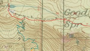
USGS Historical Map Viewer is another interesting utility to look at historical maps. This is sponsored by the USGS and it has historical maps for all over the country.
 Warning
Very large map downloads on the following page. These maps should be downloaded locally for extended use.
Browse our collection of almost 200 topographic, forest, and township maps covering the Mt. Hood National Forest area — use the interactive map to find maps by location, or search and filter by scale, era, or quad name.
Maps of the Most Recent Wilderness Areas
New Mt Hood Wilderness areas overview → Overview map of the most recent wilderness areas in the Mt Hood NF
Big Bottom Wilderness → Big Bottom Wilderness – 10 miles Southeast of Ripplebrook along the Clackamas River corridor
Bull of the Woods Additions → Various additions to the Bull of the Woods Wilderness
Clackamas Canyon Wilderness → Clackamas Canyon Wilderness – from The Narrows south to Indian Henry Campground on the west side of the Clackamas River
Collawash River Wild Scenic River map → New Wild and Scenic River designation for the Collawash River
Eagle Creek Wilderness Map → Addition to the west side of the Salmon Huckleberry Wilderness area around Eagle Creek
Fish Creek Wild Scenic River map → New Wild and Scenic River designation for Fish Creek
Inch Creek Wilderness → Addition to the east side of the Salmon Huckleberry Wilderness area
Memaloose Lake Wilderness → Memaloose Lake Wilderness – new Wilderness area around Memaloose Lake
Roaring River Wilderness → – Large new Wildnerness area around the Roaring River
Sisi Butte Wilderness → Sisi Butte Wilderness – Surrounds Sisi Butte
South Fork Clackamas River Wild Scenic River map → Map showing New Wild and Scenic River designation for the South Fork Clackamas River
South Fork Roaring River Wild Scenic River Map → Map showing New Wild and Scenic River designation for the South Fork Roaring River
Historical Map Scans (1921-1951)
1936 map of Mount Hood Recreation Area
1951 map of trails on Mt Hood
1939 map of Trails on Mount Hood – Map Front
1939 map of Trails on Mount Hood – Map Back – Shows Timberline trail log
1921 map of the Oregon Skyline Trail See other maps on the Skyline Trail page
1938 map of Olallie Lake Area
1938 map of Breitenbush loop