I made it back across 46 last Thursday night and Friday. After fishing Harriet until sunset Thursday (yeah, I have a thing for trout LOL), then spending the night at the Lowe Pit, I headed south on 4670 to see if it was now clear to Graham Pass. Friday morning was misty and rainy. (BTW: I do like my old-school camping gear...)

Sure enough the snow on 4670 from last week had melted. Green light.

(4670 just south of Granite Peaks road)
The road down to Graham Pass was easy traveling with the occasional snow leftovers on the uphill shadowed side. I could see that a few logs that had fallen across the road had been recently removed (fresh sawdust). Looking down 6350 at Graham the road looked to be in great shape. About a mile back I had seen the only people I saw all day on the road. They said that they went to Elk Lake trailhead, a good sign. I figured it was their tracks down the road...

Rho Ridge Trail from here looked wonderful from this entry.

I decided to go south on 6350 (away from the Collawash, Pansy Lake can wait until later...) I was a little surprised that there were not signs posted to keep me away from the south end of Rho Ridge. The maps I had seen implied that the South end of the ridge end had been burnt from Lionshead... I expect that this road section might be closed before much longer.
Almost to Hawk Mtn., where the map says Hunter Creek starts, I began to see the first signs of the fire.

As I rounded the bend and came to the next hogsback the signs of fire became quite bad.


The image below is looking up hill towards the south from the last corner before 4-way intersection

I made it to the 6350/6351/4671 4-way intersection. At this point I had already seen worse, so by my measure it wasn't too bad...

I made it to the south Rho Ridge trailhead, but before walking in decided to go a little further south... I was curious about the road to Round lake. I went down the road a little ways past Cachebox Meadow and springs area. It was burnt on both sides of the road. I cleared out a small tree that had fallen across the road. Looks like I was first into this area this year.

Near the "Gravel Pit" at the top of the hill I saw a sign from the fire crews last fall. It makes good sense that they used this area for a Medivac site...

I went down the road to the junction near Maryanne Spring is on the maps and looked down the cutoff to 6370 (to Round Lake and Ogre Creek road end). It looked okay down in that valley from here, green and healthy as far as I could see in. Looks like the fire didn't go into that valley, but instead had stayed up on the ridge. This is a very good thing.

Okay, back up to the trailhead. Time for lunch and a little hike. I could still plainly make out the tread of the trail here. The bear grass sure is a tough survivor plant.

Hiking in it looked like the trail had much use last fall. I would guess that a lot of firefighters had used it for access to the area. Some of the huckleberries were coming back strong.

Across the Mt Jefferson facing side of the hill some of the trees had survived. I kept on going upwards. I was curious about the "deep woods" section that I remembered starting at the top of the hill before it dropped into the valley west of the ridge.

As I climbed up and around the corner, I saw it getting progressively worse. By the time I got to the top of the ridge it became some of the worst I had seen all day. Completely burnt with nothing sprouting up in many areas nearest the crest.


The trail tread was still visible, and I made it to where the trail dropped down. I stopped a little ways down the hill noticing that as the trail went down the burn was not as severe.
I turned back at that point. I had seen enough to answer most of my questions. The only one remaining was the condition of the cabin on the lookout. It was late enough in the day that I decided to make that another trip. It was kinda depressing walking through the burnt woods...
I went back to the trailhead and decided to see if I could complete a loop (rather than backtracking) by going back down 4671 to where the "do not enter" signs were last week.
4671 was pretty burnt on both sides at this end. I encountered a big log (3 ft plus diameter) that had fallen across the road and been cut away. The sawdust looked like this year's cut.

I made it to where the sign was and proceeded back down to the way out.
All and all it was a good day. I would not be at all surprised to see some of the areas that I was in south of Graham to be marked as "closed" pretty soon. Some parts were pretty badly burnt, while in other places it was spotty.
The south end of the Rho Ridge trail has forever changed. Good thing it has a north end.
Ted
Thanks for another excellent report. Really appreciate all the photos. It's sad to see all those burnt trees but good to see some green ones still left. Nice to know that the snow has melted out now.
And the following Friday afternoon I went back to complete my mission. I wanted to see HMLO post Lionshead for myself.
Rather than approaching from the (long) north or the (burnt) south, I approached from the east (I'll let you guys figure this one out. I think I may have found some of the old #560 or #570 tread, see the 1966 or 1963 maps...)
For a little ways after I left the road there were the indicators of a slight burn, but that cleared up soon enough and I was in the familiar green happy forest paralleling a creek.

As I bushwhacked and looked for more tread I found the occasional section of snow still remaining in the shadows. After running into a few thickly brushy spots, and finding no new tread, I decided to cross the creek that I knew I had eventually to go over. I figured that this was as good as a place as any. Much to my surprise I popped out in a familiar place. I had seen these logs before.

The snow runoff creek was forded by these logs, and a deep well established trail led away from the creek on both sides. I knew exactly where I was at from two years ago. Hooray, I had avoided the entire burnt area of the south end to get here, and saved perhaps almost a mile in the process. I went up the trail.

Soon enough I saw the familiar spring box. It was full to the top and the pipe was flowing out slowly. I took a vine maple branch and (unsuccessfully) tried to snake it out from both ends. The next time someone remembers to bring a "hand-snake" up there it would be helpful... I emptied and refilled my bottles with the cold fresh stuff after having a long drink. There was still more trail to go.

I crossed a few snow covered sections of trail that will likely be gone in a week... Round Meadow was as beautiful as ever.


I came to the junction and went up the hill hoping for the best.

A little blowdown that sheltered some snow, not bad.

As I made it towards the top I began to see more and more signs of the fire. I crested the hill and saw what I was looking for.

Beautiful condition. Untouched by the fire that had made it to within 100 feet of so of the cabin.


I opened up the door, un-shuttered and opened the windows, and let some fresh air in.
The fire had got quite close, and somehow I sensed that some heroic acts had taken place on this hallowed ground.

Down the steep slope to the northeast the ground had been thoroughly cooked.

And to the south the fire had also approached, but had been stopped somehow.

I cleaned the place up a little, removing a few empty liquor bottles and sweeping the floor. I left the Idaho Russet Potato Vodka bottle that had a few fingers of quite nice smelling spirits in it. (If I still drank I would have most likely had a little sip, I still remember what the good stuff smells like, yes...)
The old "logbook" that was there a few years back was gone, so I started a new registry on some target sheets that had been left in the cupboards. Perhaps somebody will bring a new book up someday.

I sealed her up and went back down the hill. The trip back down to the road took about an hour.
I decided to complete the rest of the 4670/6350 ridge trip by going down towards 46.

Near the junction, just after the 4672 intersection the standard "road closed" barriers, gate, and notices were there. This gate was open, but I didn't really feel like going down to 46. I suspect that this section wasn't too badly burnt. Down 4672 I went, headed back north across the low roads to one of the "secret" camping spots for the night...

I was happy to see that the Berry Creek crossing was untouched. Somehow I have always liked that area, and the maps implied it might have been fire involved. Apparently not.
Another Friday well spent for me.
p.s. Granite Peaks road at the north end of Rho Ridge had a medium sized down tree across it at the cutoff road to Burnt Granite trail. I didn't feel like hand-sawing it, so it was still a no-go at this time (6/18/21). A gentleman who was excavating out the sides of 4670 said that 63 was gated at the intersection with 46, but open all the way up...

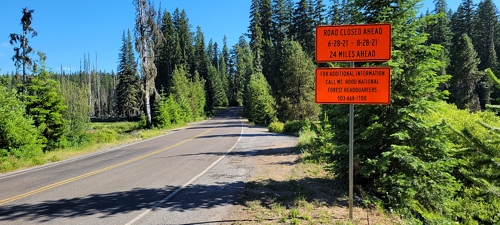
Kirk and I headed out that way yesterday and just a warning if anyone is considering heading that way - road 42 is now closed just short of where it intersects road 46 - they are replacing the old wooden bridge at Last Creek. According to the sign at Clackamas lake that warns you, it is scheduled to be closed until the end of August.
We ended up having to detour down 4220 to 4690 to get to 46. This adds about 15 miles each way. The good news is that 4220 has been improved significantly since the last time I drove it. It looks like it got a lot of work done last year during the fire to be used as a firebreak.
Some photos:
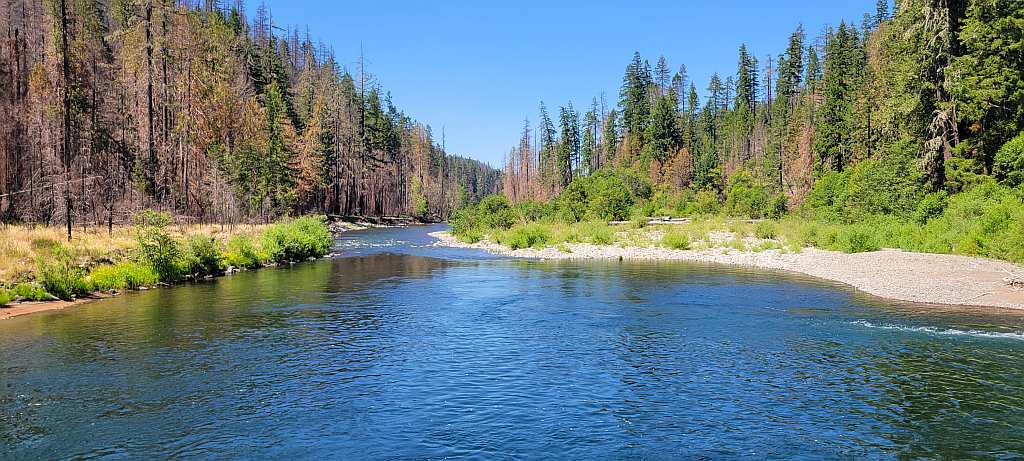
This is at the confluence of the Collowash and Clackamas rivers looking north:
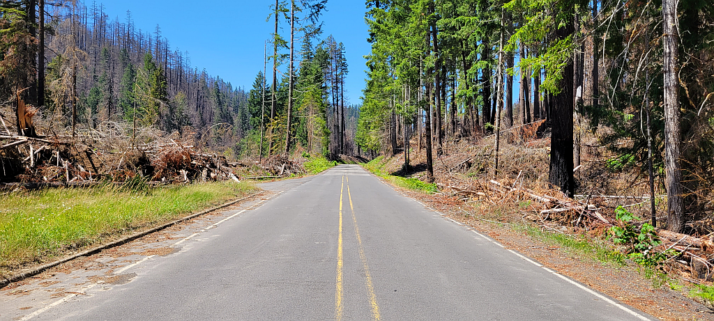
This is road 46 where it meets 63 looking north:
This is the closure gate just after 63 crosses the Clackamas: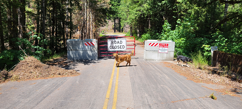
This is the bridge construction on 42 at Last Creek: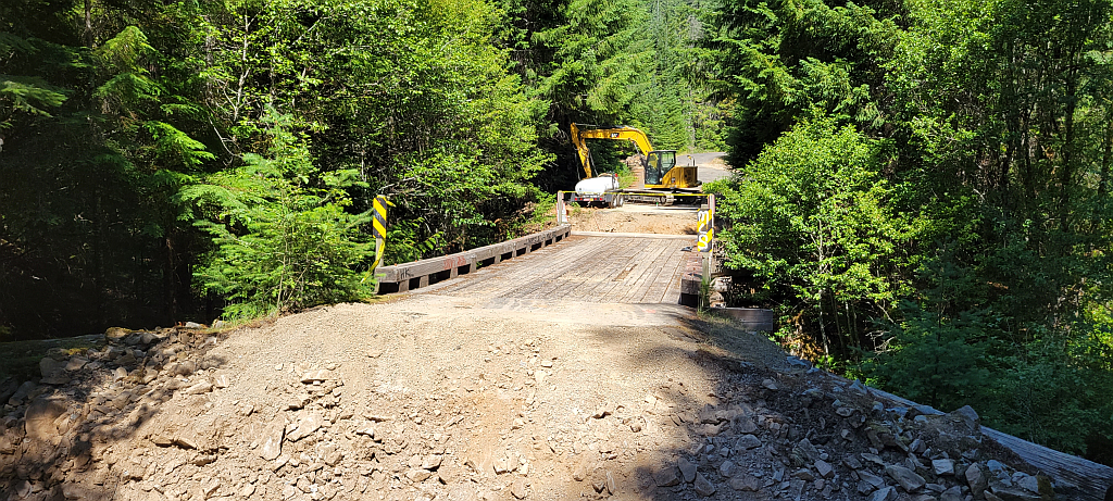
And finally, this is the sign at Clackamas Lake that warns you of the closure: