
kirk said
I didn't have much of an opportunity to look very far. I think I saw a blaze above the Shellrock trail headed up the ridge. It's just as described by Joe Keller, a few years back:"It started in the trees near the clearcut between Hideaway and Shellrock Lakes, close to Shellrock Lake. It went up the ridge"
It may have been easier trying to follow that old trail than the snowy way we went. I'd like to explore that old trail someday.
I'd be up for recreating that walk again some day.![]()
No snow at 4500' towards High Rock off 58. 10 bazilion mosquitoes though, more than I've ever seen. Clouds of them. Stay away from the meadows if you have any sense!!!!!!
I went up Abbott Road from 224 today and the road was snow free up until just about a mile before Twin Springs when it became, for me on a motorcycle, impassable. Will be another week, I think, before the road snow is all gone. Of course, it could be that Twin Springs is clear and the snow is limited to what I saw. The plan is to go back next Saturday and give the 506 a shot - if the weather cooperates.
--Paul
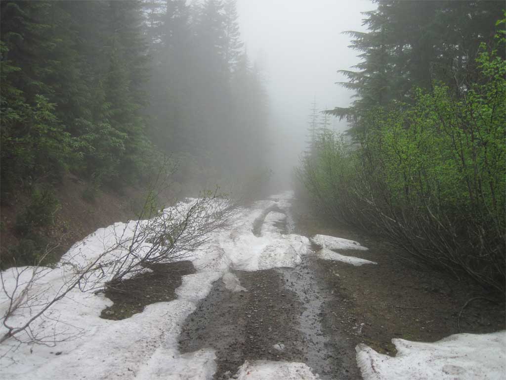
That looks like a little past Squaw Meadows? At any rate, it is good things are melting out.
I will be interested to see if you can continue the trail past the point where it meets the creek. We couldn't really find any trail past that point. It was very clear, easy to follow (even in the snow) until it hits the creek.
Rob Williams said
That looks like a little past Squaw Meadows? At any rate, it is good things are melting out.I will be interested to see if you can continue the trail past the point where it meets the creek. We couldn't really find any trail past that point. It was very clear, easy to follow (even in the snow) until it hits the creek.
Yes, past Squaw Meadows. BTW, thanks for posting your GPS track for the 506. The plan is to search for trail down to the river then back up and look for the 509. I plan to go upstream from there, trail or not, to where you guys came down for your Cougar Creek exploration and back up to the road. If I make good time and feel energetic I may go for the whole thing and come out at Hambone Springs - I'd love to travel that expanse of old-growth along the river - if not this trip, on another outing.
--Paul