
I took the opportunity yesterday to do a short hike on the Thunder Mountain and Skookum lake trails. Had almost no rain, but still got soaked due to all the brush being wet, and parts of the trail being VERY brushy.
The trail is recovering nicely from the burn a few years ago - the last time I hiked it parts of the trail were obliterated from the fire fighting work. That has been corrected and the trail is now easy to follow, except the few spots where Thimbleberry has overtaken it. This is probably the WORST time of year to hike this trail - all the underbrush has had all summer to grow up. I had forgotten how much elevation you lose going down to the lake. For some reason, I keep getting the beginning of this trail and Whetstone confused.....
A nice day in the woods and in the clouds. Not much of a view, but sometimes that is neat.
Now, some photos:
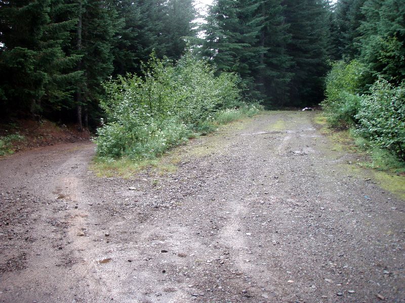
The trailhead on a short spur road - it is currently unmarked
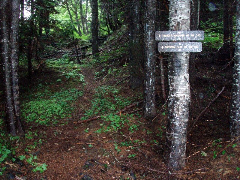
The new trail signs are up the trail a little bit - but you can't see them from the road.
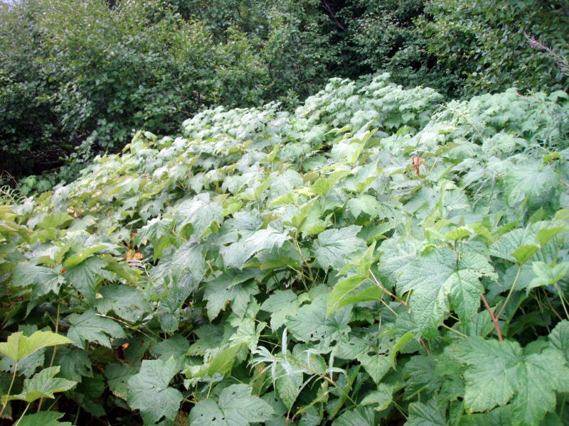
Here is one of the spots where Thimbleberry is overtaking the trail - the trail is down there somewhere!
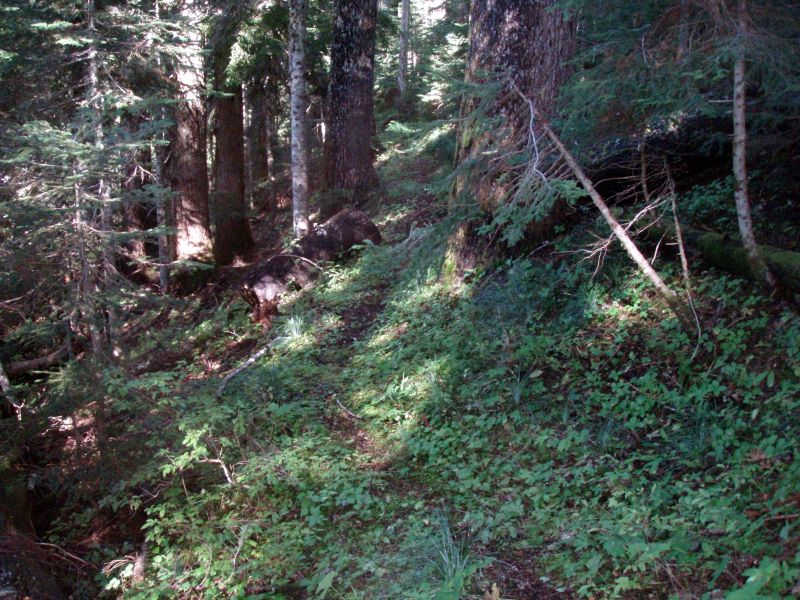
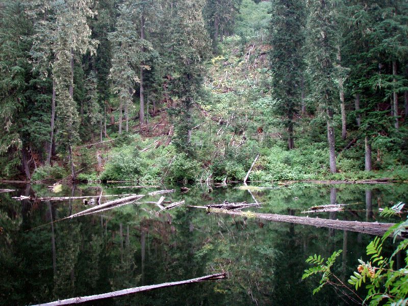
Here is a section of trail through unburned forest - it is really pretty
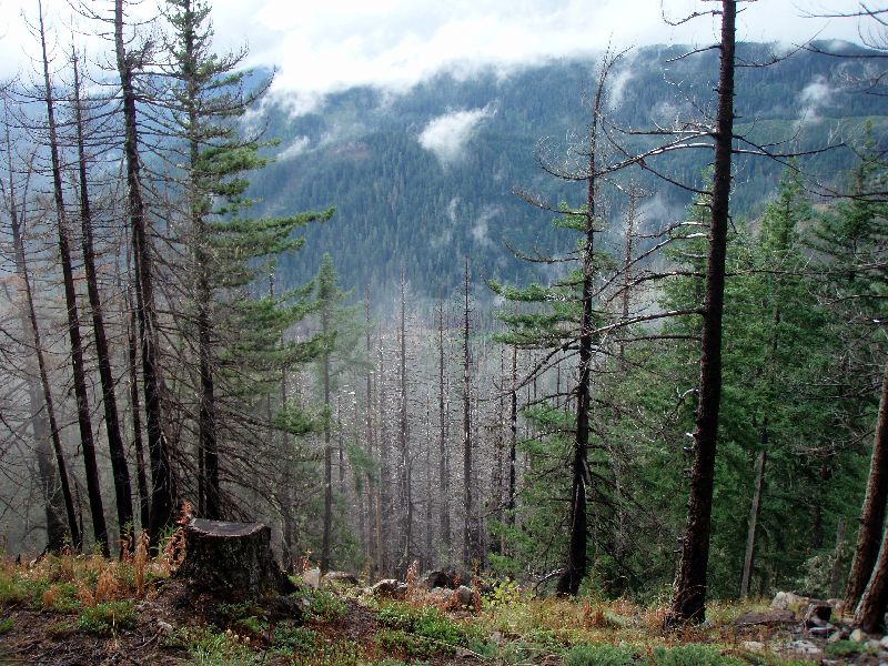
Here is looking SSE across the burned area. You can see some trees were killed, but many survived.
Lastly, here is an interesting photo of the landslide/avalanche that happened at Skookum lake a few years ago. The scar is being healed. Interesting to see nature at work.
Nice! I love that hike. I'm headed up there in a couple weeks. How are the roads? I remember the last time I went up there the roads were fine except for one rough spot on 6322. Are they still fine for passenger cars?
Better hurry up – they are calling for snow at 4500' this week….The higher elevation season is rapidly coming to a close. I'm hoping to get in 2 or 3 more hikes before the snow closes things up this year.
The roads up (6322 and 4620) were in pretty good shape. Brushed in in a few places, and the normal potholes, but no real issues. Should be easily accessible with a car.
One other thing I forgot to mention - comparing the GPS track to the track on the old topo maps, it is pretty close, except for the start of the trail. Looks like the trail used to end up farther down the road. I think I know where on the trail it used to go - I saw a 4 wheeler on the road when we were on the trail, and it wasn't that far. The trail now takes a sharp turn north to get back to the road. Does anyone know why that re-route was done? Just curious....
That is an obvious snow avalanche on Skookum Lake. I have seen the results through the years on several landscapes, but the looks are the same. I too, am hoping for several more weeks in the high country before the snow has it's way. I think this is more of a weathermen hipe right now then what we are actually going to get, but snow has had it's way in every month on the calendar in Oregon at some point. I have been in several snow storms in July and August in eastern Oregon, so it is not an uncommon event. It has all do with elevation and weather and now it is October! What happened to summer? Didn't we just have that a few weeks ago in September with all of those 90 degree days in a row? I know my garden didn't do squat this year.
Don
Rob Williams said:
Looks like the trail used to end up farther down the road....The trail now takes a sharp turn north to get back to the road. Does anyone know why that re-route was done? Just curious....
Originally the trail came down to the road north of where it does now. There is a bulldozed truck-wide tread it followed. Near the road it passed thru a wet area with levelish grade. This grew over quickly with thimble and salmonberry after the current trailhead was installed, which was at least 20 years ago. Last time I was there the old trail had disappeared in the brush. Once the trail began climbing into forest it was at that point still clear and easy to follow. It should be findable from above easier than from the road.
I haven't used that trail as I always come into that area from the Molalla side.