
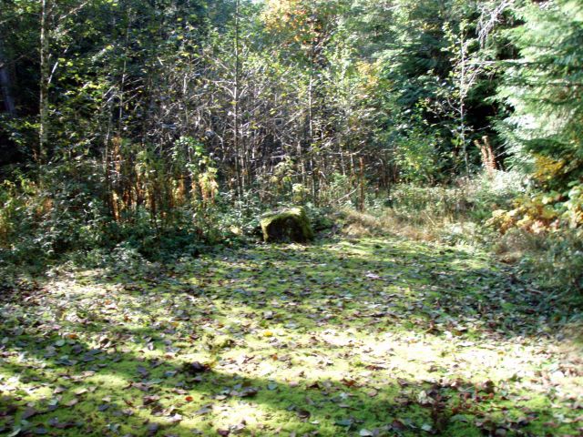
On Saturday, I finally got to do a hike I've been wanting to do for several years now - explore the southern end of the Fish Creek basin - specifically, the Wash Creek leg. There is a bridge that got washed out in the '96 floods - one of the reasons they decided to close and decommission the roads in the area. I've seen photos, but wanted to see it for myself. I've done several hikes up the Fish creek leg, however that side had a pretty well maintained track - a track that was maintained by 4 wheelers up until recently. The Wash creek side has no maintained track, and it was TOUGH going. We battled this (and worse) most of the 7 mile trek north, from the spot the road is closed up until the confluence of Fish and Wash creeks:
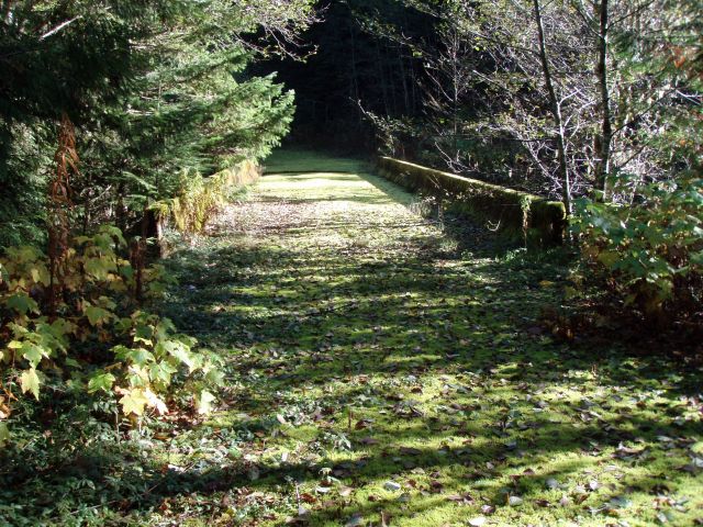
It may not look too bad, but those alders are THICK. This first picture was taken at the first bridge where Cedar creek meets Wash creek - one end of this bridge got washed out as well:
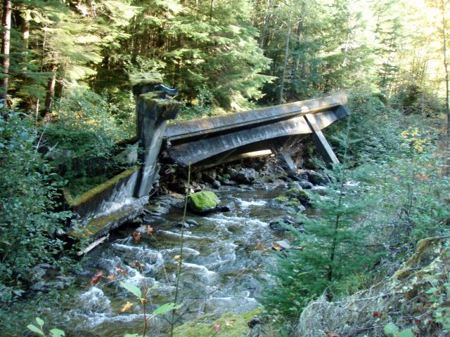
Next was the overturned bridge. It was amazing to see a bridge that not only got floated off its footings, but one end of it actually broke and twisted upside down! An absolutely amazing sight, especially seeing the creek so gentle this time of year - really makes you see the power of nature's fury (the end closest to the camera is the end that twisted - you are actually looking at the underside of the bridge:
The weather couldn't have been more perfect - I was hoping for no rain, but we had a touch of fog first thing in the morning, and then had blue skies the rest of the day. It was a long and grueling day, but seeing the bridge was worth the effort.
If anyone is thinking that these old roads are still passable, I would urge you to think otherwise. Parts are still passable, but a large part of them are not - they are just too thickly overgrown with alders - further, the duff is starting to build on the rocks, which makes it tough to know what you are stepping on. It isn't like walking on a "normal" decommissioned road. These have been very quickly re-absorbed by nature. Even the Fish Creek side is starting to degrade (the side that had been maintained by the 4 wheelers). The track is starting to get overgrown with weeds, but no alders (yet). Hopefully that track can be maintained as a user trail - it is a beautiful and interesting area.
It was great day to be in the woods, even if it was a rough road. I was hurting after we stopped for a bite to eat at the Wash Creek bridge. It was amazing seeing how the bridge had been moved a good distance from where it used to sit and was still largely intact.
I think the toughest going was between the twisted bridge and the bridge near the confluence of Wash and Fish creeks. I think it took an hour to go between those two bridges, and it's only a little over a mile. There were a lot more downed trees and blackberry vines tugging at my feet in that section, or maybe I was just getting tired. It's tough going on those torn up roads. Whoever tore up the roads did a very thorough job. Hopefully over the years they will become a little smoother.
By the time we drove up to retrieve Rob's truck there was a crescent moon and the stars were shining in all their glory. It's nice to see them away from the city.
Driving on those narrow forest service roads in the pitch dark makes 20mph seem like you are going REALLY fast!
Especially when you go several extra miles because someone (that would be me) missed a turn!
So I'm guessing you guys started at the southern end of the watershed and hiked north along the abandoned 54 road? I hiked that down to the bridge at the confluence with Cedar Creek on a scorching hot day last summer. I agree, that road is brutal, lots of animal trails, and some people had been down on some horses knocking over vegetation, but besides that you're ducking, climbing, and zig zagging for what feels like an eternity. It was shocking to see how aggressively that area was cut, there is virtually zero old growth from the top down to Cedar Creek. A few years before that I hiked up Fish Creek and camped at the confluence with Wash Creek, then spent the next day hiking up to the overturned bridge. That section was amazing, the scenery reminded me of Opal Creek or the Upper Collawash. Once again though, the going is brutal. I just picked up an 18" machete from work that I am going to try hacking away at the alders with on some of my frequented Fish Creek spots. Great Report!