AI Assistant
What trail am I on?...
 
Notifications
Clear all

What trail am I on? Spring 2013 edition

Posts: 839
Translate
English
Spanish
French
German
Italian
Portuguese
Russian
Chinese
Japanese
Korean
Arabic
Hindi
Dutch
Polish
Turkish
Vietnamese
Thai
Swedish
Danish
Finnish
Norwegian
Czech
Hungarian
Romanian
Greek
Hebrew
Indonesian
Malay
Ukrainian
Bulgarian
Croatian
Slovak
Slovenian
Serbian
Lithuanian
Latvian
Estonian
Member
Joined: 17 years ago

IMG_3785.jpgSo what happened to this thread? Did it die or what? I know life is a big distraction, but get over it. Do I need to post a photo and get this thing going again? Too late!


Reply
Posts: 463
 Kirk
Topic starter
Translate
English
Spanish
French
German
Italian
Portuguese
Russian
Chinese
Japanese
Korean
Arabic
Hindi
Dutch
Polish
Turkish
Vietnamese
Thai
Swedish
Danish
Finnish
Norwegian
Czech
Hungarian
Romanian
Greek
Hebrew
Indonesian
Malay
Ukrainian
Bulgarian
Croatian
Slovak
Slovenian
Serbian
Lithuanian
Latvian
Estonian
Member
Joined: 16 years ago

Yeah, since no one was able to figure out where my last photo was, I'll be able to bring it back someday.  I guess it was just too risqué. Wink


So what's your elevation here? Maybe 4,000' to 5,000'?


Reply
Posts: 713
Admin
Translate
English
Spanish
French
German
Italian
Portuguese
Russian
Chinese
Japanese
Korean
Arabic
Hindi
Dutch
Polish
Turkish
Vietnamese
Thai
Swedish
Danish
Finnish
Norwegian
Czech
Hungarian
Romanian
Greek
Hebrew
Indonesian
Malay
Ukrainian
Bulgarian
Croatian
Slovak
Slovenian
Serbian
Lithuanian
Latvian
Estonian
Member
Joined: 17 years ago

Looks like someplace I've been near Signal Butte.


Reply
Posts: 839
Translate
English
Spanish
French
German
Italian
Portuguese
Russian
Chinese
Japanese
Korean
Arabic
Hindi
Dutch
Polish
Turkish
Vietnamese
Thai
Swedish
Danish
Finnish
Norwegian
Czech
Hungarian
Romanian
Greek
Hebrew
Indonesian
Malay
Ukrainian
Bulgarian
Croatian
Slovak
Slovenian
Serbian
Lithuanian
Latvian
Estonian
Member
Joined: 17 years ago

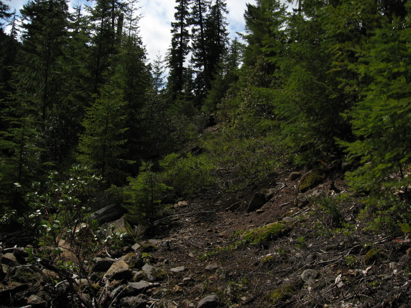
Kirk it is more 3500'-4000'ish. Donavon it isn't anywhere near Signal Buttes, more to the south of the district. Actually this is a current district trail that isn't on our current district map, aka 2002 version, but has new signs at the trailheads. This section of trail is through an old clearcut, so more light = more brush growing every year. Probably the most brushiest section on the whole trail. I throw off sticks and rocks with my hiking stick, but I didn't bring any other tools (i.e., loppers or handsaw) with me to work for this was a pleasure hike. Sometimes we must leave our tools at home and just hike for the pleasure of it all, lest we forget.

Don


Reply
Posts: 713
Admin
Translate
English
Spanish
French
German
Italian
Portuguese
Russian
Chinese
Japanese
Korean
Arabic
Hindi
Dutch
Polish
Turkish
Vietnamese
Thai
Swedish
Danish
Finnish
Norwegian
Czech
Hungarian
Romanian
Greek
Hebrew
Indonesian
Malay
Ukrainian
Bulgarian
Croatian
Slovak
Slovenian
Serbian
Lithuanian
Latvian
Estonian
Member
Joined: 17 years ago

Ok then. Now it reminds me of Rho Creek.


Don2


Reply
Page 28 / 56