Paul,
Good to know that there's another piece of the Rho Ridge trail still intact. There's been so much logging in that area that it might be hard to find the rest of it. I'll do some more looking around at the Collawash Mtn end to see how much farther I can follow it south and east.
Rob Williams said
I did a little looking at a few sites and there doesnt' appear to be any info on a lookout structure on Collawash Mtn. Maybe it was just an observation place like Baty Butte? I know Baty Butte had a phone line up to it but no structure.
Anyone else know?
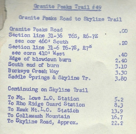
As far I know there was never a lookout on Collawash Mountain. I have an undated trail log from the FS which mentions Lookouts on Mt. Lowe and Hawk, but not on Collawash Mountain which is the next entry. I'm guessing this log dates from the 50's or earlier. It calls what we now call Rhododendron Ridge Trail the Skyline Trail. At that time both the Skyline and the Pacific Crest Trails followed Rhododendron Ridge for better than 10 miles.
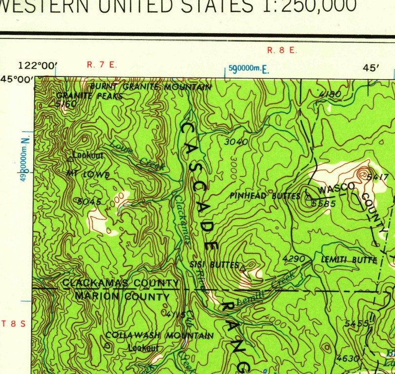
Here's a map snippet that suggests there was a lookout on Collawash Mountain. Is it a cartographic error? (Edit: Yep, it looks like they mislabeled Hawk Mountain as Collawash Mountain.)

kirk said
Here's a map snippet that suggests there was a lookout on Collawash Mountain. Is it a cartographic error? (Edit: Yep, it looks like they mislabeled Hawk Mountain as Collawash Mountain.)
Looks like you are right - that lookout is a mislabeled Hawk Mountain. Thanks for finding this - I will look for the same in my map collection.
I'm going to do Mount Lowe and Hawk on Tuesday.
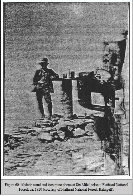
The trail and phone line to the top of Collawash Mtn had a purpose, presumably serving a temporary fire watch site on the exposed ridge. If so, I wonder what kind of setup might have existed up there. The photo below shows an example of an outdoor alidade stand with a phone nearby. Maybe there was something like that.

