
What trail am I on? Spring 2013 edition
B
kirk said How about Alder Flat? That's a pretty low trail.I'll call that close enough. Its actually the next section (or remnant) of the original Clackamas River Trail upstream. Your turn to post.
R
Bryon Boyce said I'll call that close enough. Its actually the next section (or remnant) of the original Clackamas River Trail upstream.So where is this mystery trail? I looked a bit at the old maps and don't recognize anything other than the "phantom" trail that shows on the current mytopo maps that was never built that went south from Indian Henry.
B
Its on the Riverside section of the trail along the Clackamas River south of Riverside Campground. There are discontinuous segments of trail scattered along the Clackamas from Alder Flat South, some of which still show up on the current forest service maps.
D
 So the thread dies again. Everyone must be out hiking and camping! That's where I am headed tomorrow for a few days. Here is a trail that was used a lot more in the past, but of late, is abandoned. Was once one of the many versions of the Skyline Trail that went through our district, but now is lost.
Don
So the thread dies again. Everyone must be out hiking and camping! That's where I am headed tomorrow for a few days. Here is a trail that was used a lot more in the past, but of late, is abandoned. Was once one of the many versions of the Skyline Trail that went through our district, but now is lost.
Don
D
I don't believe I have been there yet.
Sure looks promising tho.
Don 2
D
Donovan said I don't believe I have been there yet.
Donavon I don't believe you have been at this spot, but you have been on this trail a little further up the hill. Spent the last few days out on this trail getting to know it a little better. Don
D
Well, I guess I'll take a wild guess.
Burnt Granite?
Don 2
D
Good guess! It takes another 14 miles to reach the old trailhead now with the decom road situation. At least now PGE will keep the 4650 cleared of brush to access the powerlines , something the FS only did when they were logging in the area. It was a quiet 3 days, only heard an occasional airplane or rigs down on the 46 road.
So I guess it is now you turn to post one there D.
Don
D
So perhaps in more ways than one, the powerlines are our friend.
Don 2
D
So here is a trivia question for you. How many trails in our district go underneath power lines, current and abandoned trails included? I don't know myself, but I can think of several right off the top of my head. We are blessed with 3 power line corridors in our district, not sure about the other districts.
Don
R
Donald Presley said So here is a trivia question for you. How many trails in our district go underneath power lines, current and abandoned trails included? I don't know myself, but I can think of several right off the top of my head. We are blessed with 3 power line corridors in our district, not sure about the other districtsHere is my list:
- Baty Butte
- Burnt Granite (lower - abandoned)
- Clackamas River
- Fish Lake
- Lodgepole
- PCT
- Red Lake
- Sounds (it goes next to a powerline corridor - I don't think it goes under it - abandoned)
B
The Olallie Butte Trail follows the powerline corridor briefly at the start - without crossing under the powerline but parallel to it.
D
I had almost the same list, except I forgot Lodgepole and Red Lake trails. In addition to your list I had the Old Bagby Trail near Austin Point along the Collawash River and the South Fork Mtn Trail between Baty Butte and Bagby Hot Springs, both abandoned trails. Burnt Granite actually stays away from the powerlines, it just seems like it because you drive under them.
Don
D
And don't forget Dry Ridge.
D
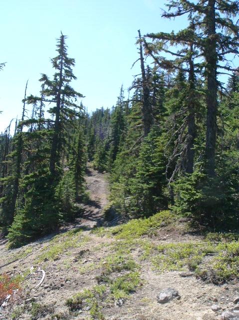
What trail am I on?
D
Is that Rho Ridge north of Mount Lowe?
Don
D
I thought it was just south of the summit, but close enough. You win!
D 2
D
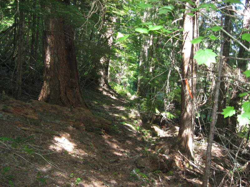
 So it is my turn again! I really don't get out on current trails too often these days. So the only one I could come up with was a abandoned trail a came across a few months ago that I haven't showed anybody yet, so here it is. This is where I first came across this trail, with the cut log and blaze on a tree nearby. The trail was only on a couple of the older maps, so you will need to go back into the 30's-40's to find it. It's in the Upper Clackamas River area above Austin Hot Springs.
Don
So it is my turn again! I really don't get out on current trails too often these days. So the only one I could come up with was a abandoned trail a came across a few months ago that I haven't showed anybody yet, so here it is. This is where I first came across this trail, with the cut log and blaze on a tree nearby. The trail was only on a couple of the older maps, so you will need to go back into the 30's-40's to find it. It's in the Upper Clackamas River area above Austin Hot Springs.
Don
D
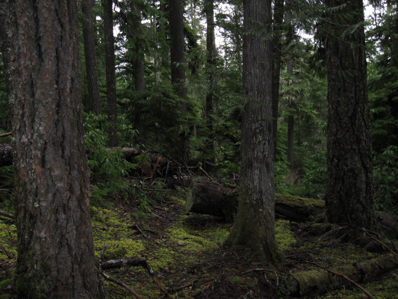
Gunna be a little bit tough if you haven't showed it to anybody yet.
But here it goes, looks like moderate elevation, say 3500'?
And, trail's entering a clearcut or a road prism?
D 2
D
Isn't that the point of it to make it hard to figure out? The trail does go that high and higher according to the old maps, but this location is 7-800 feet lower, more 27-2800' elevation. The photo was taken above a road prism just past a creek on a dead end spur road. I followed the trail for a 100 yards or so, but the bad news looks like it enters into a future thinning area with all the new flagging going on. Isn't it bad enough to wipe out a trail once with logging, but to do it again with a thinning operation on the trees 40-50 years later to seal the end of this trail. I don't know, it was my third attempt to locate this trail when I finally found something and followed it into a proposed thinning area. I thought why bother, except for the fact that nobody has found a segment of this trail so far to prove that it actually existed in the first place, other than a dotted line on an old map from 75 years ago.
Don
Log in to reply.