
What trail am I on? Spring 2013 edition
D
No takers? This trail is a dotted trail, so not a major route. No clue if it had a number or a name, but I call it by the name of the creek it follows. The maps show it going down to the Clackamas River and crossing to meet the Upper Clackamas River Trail at a junction with another trail that heads East up a prominent butte in the area.
Don
R
Well Don, your clues have confused me (which is not hard to do). I thought you might be referring to Oak Grove Butte, but I don't see any dotted trails that follow a creek that connect to a trail that goes to Oak Grove Butte. Since you said you just found the trail it can't be Switch creek (and switch creek is a dashed trail, not a dotted trail).
I'm going to need some more clues....
K
Somewhere near Granite Creek?
D
The trail is further up the river past Burnt Granite, but if you drive to the current trailhead access for Burnt Granite you drive within 2-3 miles of the mystery trail.
Don
B
Fawn Creek?
D
That would be correct. I only found a 1-200 yards segment above the 4671-170 road to the south of Fawn Creek. Below the road was a newer clearcut, so probably not much use looking into any further. I was more interested in locating the eastern portion that goes up Sisi Butte. Your turn to post one. DonBrianEdwards said Fawn Creek?
D
Chuck and I chased that trail up the otherside figuring it would be apparent at that spring, but it was dubious at best. I mean whether we were on tread or imaginary tread. You know how that is. Or game trails/imaginary tread/indian trail type trail.
D 2
B
 Abandoned trail in the district
D
You along Stroupe Creek?
D
Donovan said Chuck and I chased that trail up the otherside figuring it would be apparent at that spring, but it was dubious at best. I mean whether we were on tread or imaginary tread. You know how that is. Or game trails/imaginary tread/indian trail type trail. D 2I think it would be worth another look now that we have a wilderness without trails. Don
B
Yep
D
Just crin' to be sawed out. Nice.
D 2
D
 So I take it, it is my turn to post one? That trail along Stroupe Creek is a portion of the South Fork Mtn Trail that comes from South Fork Mtn and ends at Bagby Hot Springs. A good portion of it from our present trailhead for Baty Butte comes down Stroupe Creek, going through 3 clearcuts before crossing Nohorn Creek on over to Bagby.
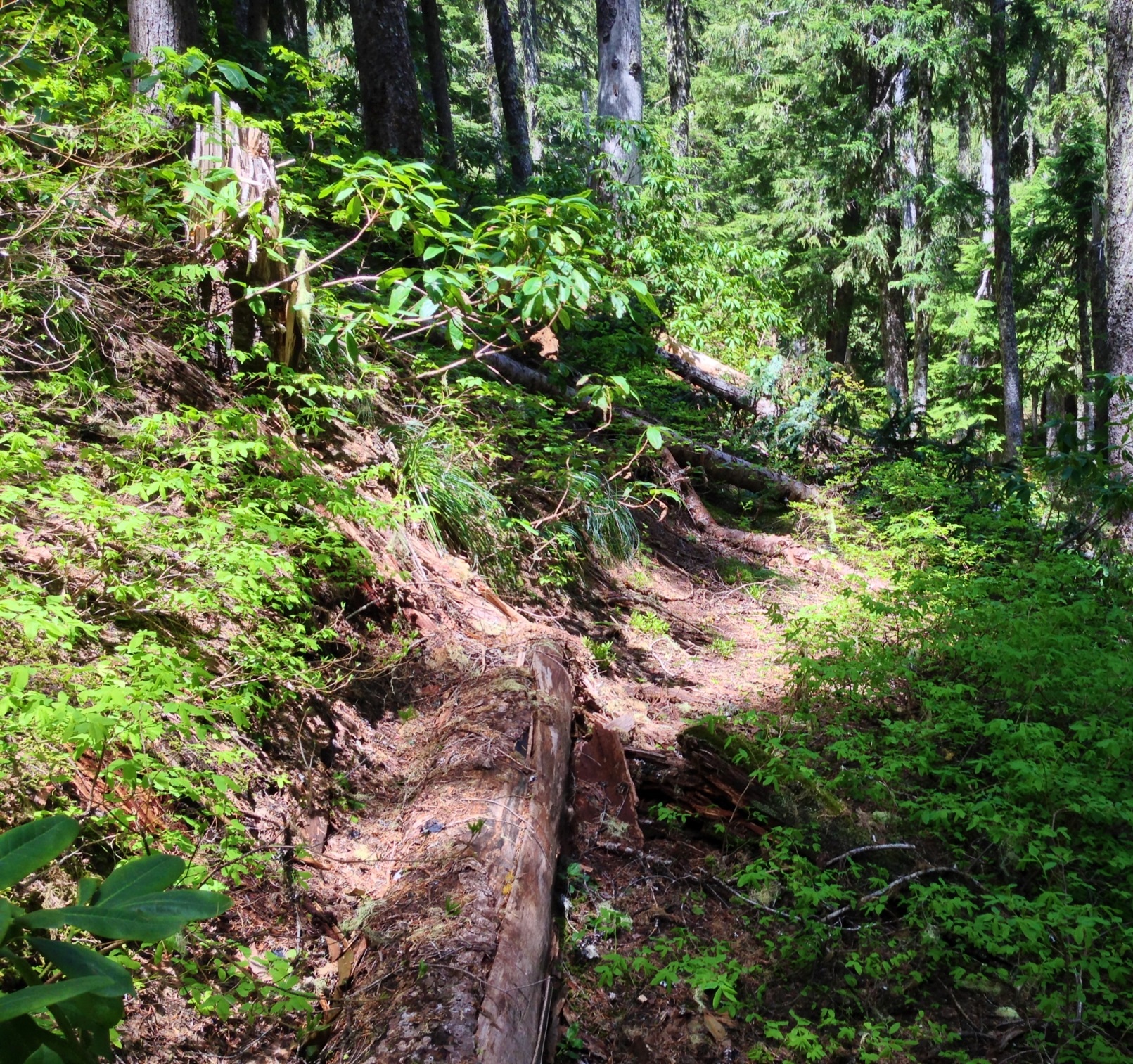
So here is a view from another abandoned trail in our district. Seeing how I spent most of my time tracking down these old gems, most of my pictures are from abandoned trails.
Don
So I take it, it is my turn to post one? That trail along Stroupe Creek is a portion of the South Fork Mtn Trail that comes from South Fork Mtn and ends at Bagby Hot Springs. A good portion of it from our present trailhead for Baty Butte comes down Stroupe Creek, going through 3 clearcuts before crossing Nohorn Creek on over to Bagby.
So here is a view from another abandoned trail in our district. Seeing how I spent most of my time tracking down these old gems, most of my pictures are from abandoned trails.
DonD
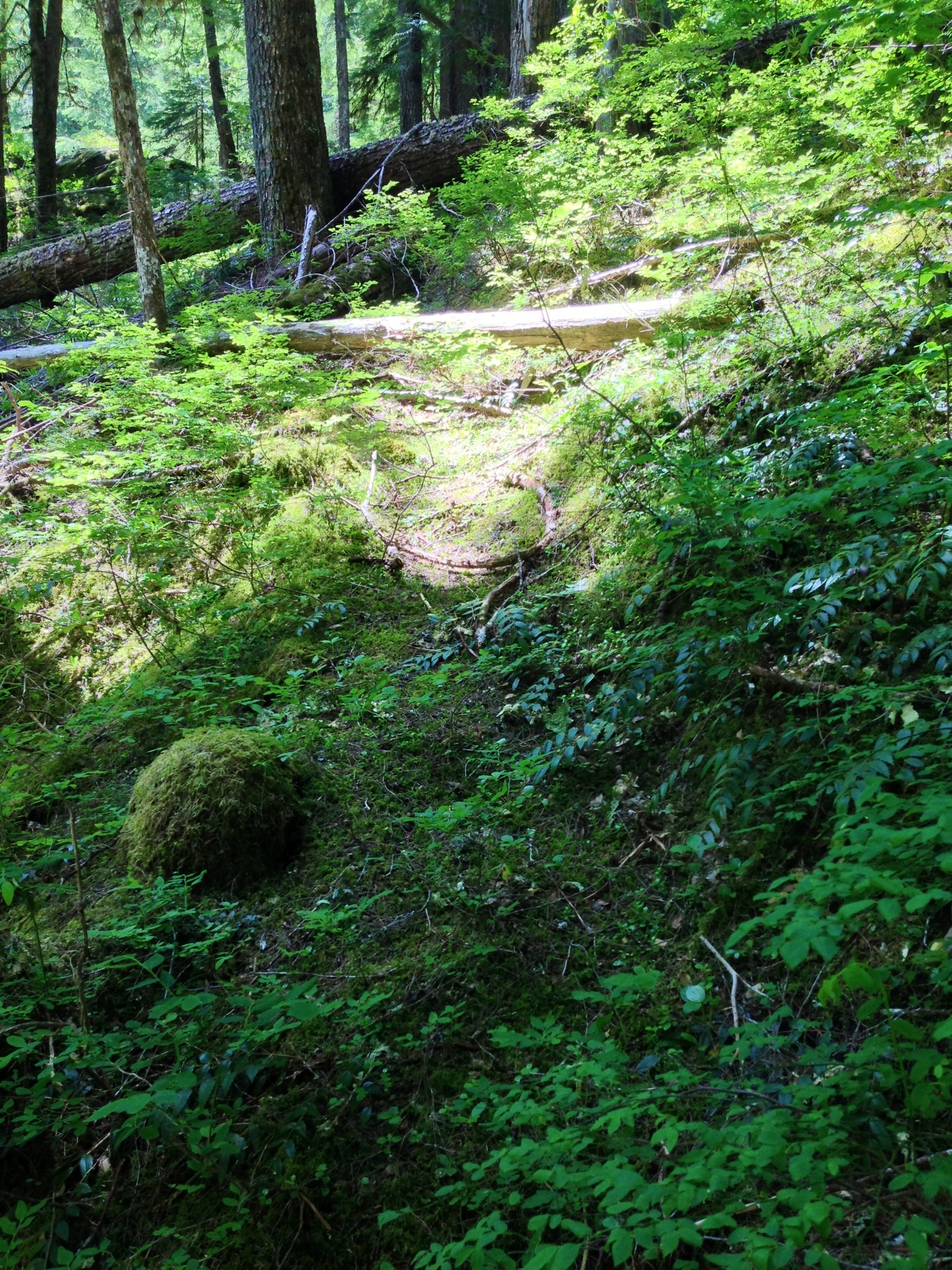
Looks a little bit steamy, if you catch my drift . . .
D 2
D
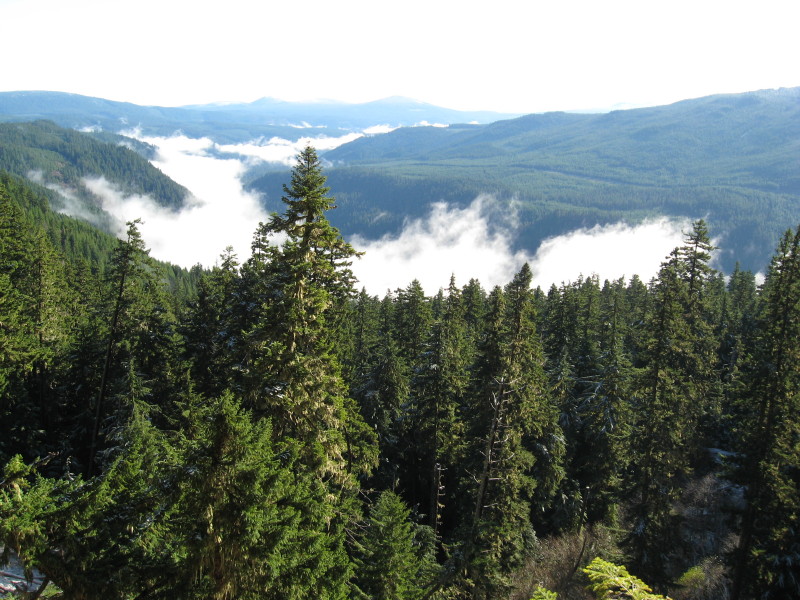
Austin is definitely in the area.
Don
B
Oak Grove Butte?
D
Yep!
B
Abandoned Trail
D
Brian that looks like a hundred other abandoned trails we have in our district, but my feet tell me I haven't been here. So enlighten us, is this abandoned trail in one of the new wilderness areas?
Don
D
Round Mountain?
D 2
Log in to reply.