
What trail am I on? Spring 2013 edition
K
Mea culpa, I meant to say Old Baldy Trail.  That gives me a few miles of trail anyway, not an unbald Baldy.
D
Yes, Don1, it is. To both questions.
Don2
D
You boys seem to need a clue.
I am standing in a man made clearing.
Don2
R
That looks kind of like the clearing on the White Iris trail, but I don't think the view is correct. (but I've been wrong before).
K
Donovan said You boys seem to need a clue. I am standing in a man made clearing. Don2Yes, I'm often told I need to get a clue.
D
Indeed there is a valley below.
Shining Lake is a pretty good guess tho.
Don2
R
Is this a current trail or an abandoned trail?
D
Very current. And popular with hiking clubs.
Don1
K
Are you on the 517 looking over the South Fork of the Roaring River?
D
Indeed I am. At the helipad.
The highest point on the trail I suspect, just before dropping down into Cache Meadows.
Don2
K
Oh great,  now I'm obligated to come up with a photo.
K
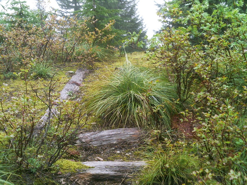
Okay, here's a picture of some tread.
 Where am I? (Hopefully I haven't posted this before.)
Where am I? (Hopefully I haven't posted this before.)D
Fish Creek Mountain, at the beginning leaving the cat track onto old tread?
Don2
K
No, it's not that trail. But, it is a "dividing" trail like that one. 
D
Hmm.
Ok then, Fanton Trail?
Don2
K
You're getting closer... Here's a bonus hint: I believe this small clearing was man made like the one in your last photo. 
D
Old Baldy Trail near Twin Springs Campground.
Don
K
Yes Don, it is the Old Baldy Trail. You're a few miles off on the exact location. I was just a little northwest of the junction with the Eagle Creek Trail. There were some old timbers arranged in a triangular pattern in this small clearing. Maybe they were a visual reference for an aerial survey? 
D
I believe that was also a helipad.
Somewhere I have a district map from the 60s that shows helipads.
I know of three others. Two on or near Rimrock Trail and one on the Baty/Joyce Lake divide trail.
Don2
K
Donovan said I believe that was also a helipad. Somewhere I have a district map from the 60s that shows helipads. I know of three others. Two on or near Rimrock Trail and one on the Baty/Joyce Lake divide trail. Don2If I remember correctly, we were fairly close to the road. So that would make sense for access purposes to the helipad. Here's a picture of the timbers:
 Rob has a better picture that shows the triangular layout.
Log in to reply.