
What trail am I on? Spring 2013 edition
R
The Pansy Lake guess was getting HOTTER.
B
I'll try Dickey Lake Trail 549.
If thats not right how about the top of the ridge connector trail 558,
Bryon
R
Bryon Boyce said I'll try Dickey Lake Trail 549. If thats not right how about the top of the ridge connector trail 558,You are too far east now. My last response had a clue in it.
K
Rob Williams said The Pansy Lake guess was getting HOTTER.Well with that CLUE, it must be Mr. Bagby's trail #544.
R
kirk saidDING, DING, DING!!!! We have a winner!!!!! Your turn to post a photo....Rob Williams said The Pansy Lake guess was getting HOTTER.Well with that CLUE, it must be Mr. Bagby's trail #544.
K
Okay, I finally found a picture for your sleuthing enjoyment. 
B
Welcome Lakes area probably above the campground.
Bryon
K
Bryon Boyce said Welcome Lakes area probably above the campground. BryonNope, you're not even in the neighborhood. It is in a wilderness area though.
D
 So what happened to this thread? Did it die or what? I know life is a big distraction, but get over it. Do I need to post a photo and get this thing going again? Too late!
K
Yeah, since no one was able to figure out where my last photo was, I'll be able to bring it back someday. I guess it was just too risqué.
So what's your elevation here? Maybe 4,000' to 5,000'?
D
Looks like someplace I've been near Signal Butte.
D
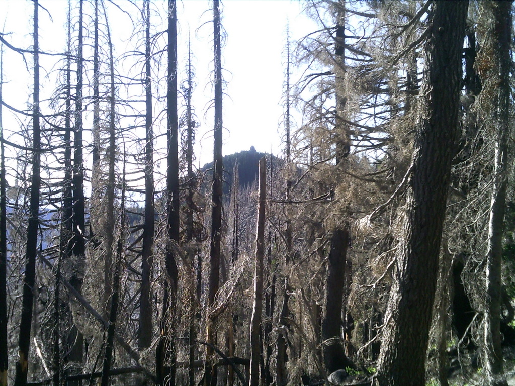
Kirk it is more 3500'-4000'ish. Donavon it isn't anywhere near Signal Buttes, more to the south of the district. Actually this is a current district trail that isn't on our current district map, aka 2002 version, but has new signs at the trailheads. This section of trail is through an old clearcut, so more light = more brush growing every year. Probably the most brushiest section on the whole trail. I throw off sticks and rocks with my hiking stick, but I didn't bring any other tools (i.e., loppers or handsaw) with me to work for this was a pleasure hike. Sometimes we must leave our tools at home and just hike for the pleasure of it all, lest we forget.
Don
D
Ok then. Now it reminds me of Rho Creek.
Don2
K
Don2, I think you might be onto something there. I've never been, but it sounds plausible given these most recent clues.
Kirk
D
Donovan said Ok then. Now it reminds me of Rho Creek. Don2Rho Creek Trail it is. I was up there last month when we had a VW campout. The clearcut section looks like it needs to be reamed out, but that was as far as I hiked. There were a few downed logs across the trail, but not bad. If I remember right, it was kind of a wet weekend and with a couple of the members having a birthday on 4/20, not alot of work got done trailwise, if you know what I mean. So Donavon it's your turn to post something. Don
D
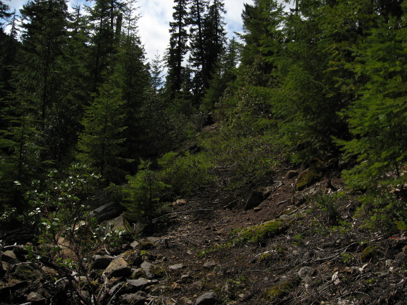
That's growing in nicely. Always good in areas like that to pull the baby trees right out of the earth mother to keep the corridor opener over time.
Two clearcuts, right? One uglier than the other if I remeber right.
I would like to get up there this year.
Picture on its way.
Don2
D
 What trail am I on?
K
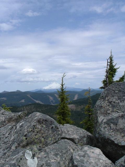
Are you at, or near the high point of the trail?
R
I'm thinking you are on the Rimrock overlook trail, out on the point.
D
That was pretty easy, huh.
Your turn Rob.
Log in to reply.