
What Trail am I am - Fall Edition
R
Since things have been so quiet around here, I thought would try and resurrect the what trail am I on thread. Since the old one had gotten so long, I thought I would start a new thread for fall.
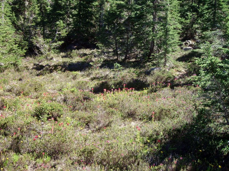
So, this picture was taken from a current district trail - what trail am I on?
D
I thought I knew where that was but I don't remember so much Paint Brush.
D.
B
Would this be somewhere in the Olallie Highlands?
Bryon
R
Bryon Boyce said Would this be somewhere in the Olallie Highlands? BryonYou would be very close, but not quite in the right area. I have a clue, but I think it might give it away, so I'll wait a bit to reveal it.
R
Well, it hasn't generated much interest, so I'll put my last clue out there. This picture was taken from a very popular and well travelled trail. It is very near the Olallie Lakes area.
D
Well I'll guess it's Olallie Butte trail?
If I am right, you have to show us some pictures from the summit.
Donovan
R
Donovan said Well I'll guess it's Olallie Butte trail?You are a little too far north
D
Would this be on the PCT near Pyramid Butte south of the Olallie Lakes area?
Don
R
Donald Presley said Would this be on the PCT near Pyramid Butte south of the Olallie Lakes area?We have a winner! Your turn to post a photo.
D
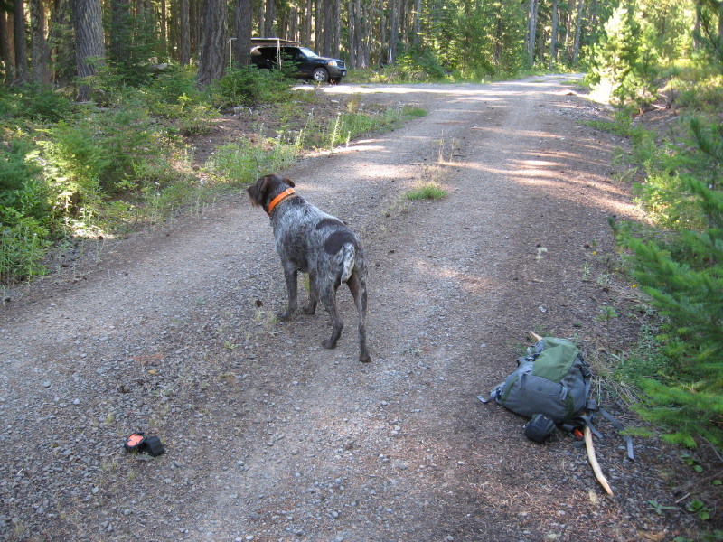 This photo is of an abandoned trail crossing in our district. As you can see in the photo of my rig in the background, I was able to camp close to the trail.
D
No guesses! Well this old trail goes into one of the new wilderness areas of our district. It is found on a couple of the older maps and seems to be a connector trail between two other old abandoned trails. It is probably only about 3 miles long, but I have only searched it out about a mile.
Don
R
Is that up high somewhere off 58?
D
Robert Koscik said Is that up high somewhere off 58?It is up high, but not off the 58. Look further to the south. It is a prominent peak in the area and is used as such. Don
D
Does it go into one of the "Are You Serious" Wildernesses?
D
R
Up Sisi? I know you've been snoopin around up there.
D
Yeah, the trail goes into one of the new "wilderness areas". So far, from what I have seen of this wilderness, it doesn't seem to include previously logged areas and roads like some of the other areas, but has it's boundary lines along existing roads and clearcuts.
This wilderness area doesn't have a current district trail, that's why my interest in trying to locate an abandoned one. What good is a wilderness area if you can't hike in it on a trail, but have to bushwack your way through. I suppose there are those who would argue with me on that, stating that isn't that the definition of a wilderness area not having been impacted by man.
Those who know me know that I am a friend of bushwacking, but I like hiking on a maintained trail a lot more, for I am able to enjoy my surroundings instead of constantly having to watch where I place my feet.
Don
D
Robert Koscik said Up Sisi? I know you've been snoopin around up there. We have a winner. I must have overlooked your posting last night when I was posting. The trail goes up the northside of Sisi from Bear Skull Springs near the Skyline Road. Lots of blazes. I probably won't get back up there til next summer, now that the snow is coming to the high country once again. I include a portion of my '38 map showing the trail. Your turn Bob to post a photo. Don
R
Hey you can't go up there without me! I've been wondering about that trail for some time. I thought it would be drier, how far east is that?
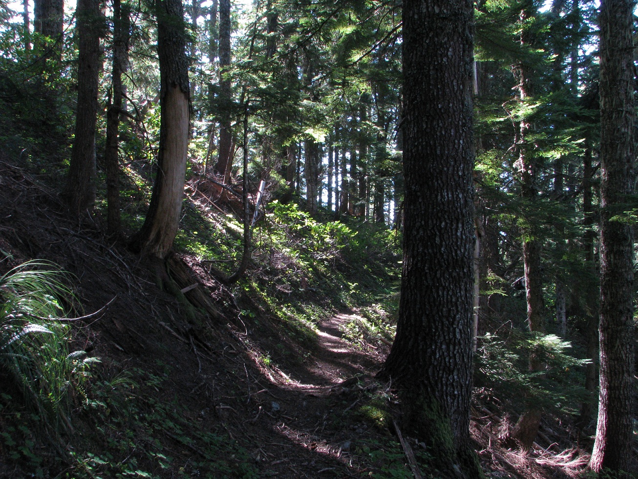
This is in a Wilderness, and is an active trail:
D
Could that be the trail up to Whetstone Mountain?
R
Sorry, you're pretty cold.
Log in to reply.