
What Trail am I am - Fall Edition
D
Don,
That's not the trail that you're seeing in the photo. It's a small streambed which probably only carries water when the snow is melting in early summer. The trail is off to the right, 100 feet or more away.
There are a bunch of other campsites in this area, but this is the one to choose if you're searching for peace (and love and joy, too).
D
My photo's not much of a clue
So maybe some more help is due
Hikers camp here (in season)
For a very good reason
Tho the trail keeps on travelin' through.
D
Doug, is that some jingle or poem out of some literature on the Bull of the Woods?
Don
D
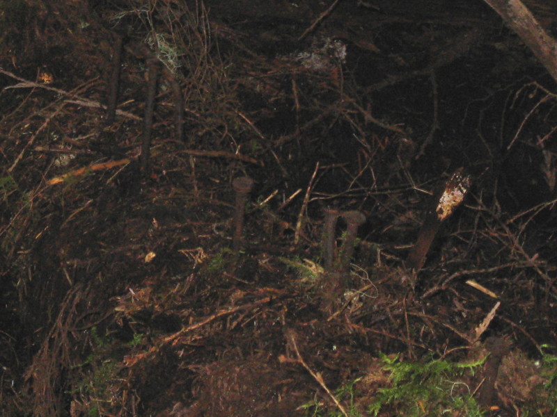 So Doug, the trail is a 100' away from this picture. I can step a 100 feet away from a lot of trails and take pictures and nobody would know where the f* I was but me. Hello! We try to make it so others can figure out where we might be on a TRAIL. I guess I need to post pictures of nails in logs and have you guess what trail I am on? Here's one:
Don
So Doug, the trail is a 100' away from this picture. I can step a 100 feet away from a lot of trails and take pictures and nobody would know where the f* I was but me. Hello! We try to make it so others can figure out where we might be on a TRAIL. I guess I need to post pictures of nails in logs and have you guess what trail I am on? Here's one:
DonD
Okay, Don, I get your message. There's not much there in my photo to help you identify the trail. And I was just trying to have a little fun with my limerick, although it probably didn't help you much. I was trying to hint that the trail takes you to an area where people like to camp which therefore suggests an attraction of some sort. And my next hint would be that maybe the name of the trail includes the name of the "attraction." You got the general location right, it's in the Bull of the Woods.
B
All right, lets begin the process of elimination.....
I'll guess Dickey Creek Trail 553
Bryon
D
Bryon,
It's not Dickey Creek. But there is water involved, which the trail passes by and keeps on going.
K
Doug Firman said My photo's not much of a clue So maybe some more help is due Hikers camp here (in season) For a very good reason Tho the trail keeps on travelin' through.Nice limerick. Don's just jealous that he can't think of limericks to go with his pictures.
K
Donald Presley saidLet me try! Let's see, there are nails in a tree, so the trail name must have something to do with a tree. I'm going to go with Alder. And it looks really damp... so it must be Alder Swamp Trail! Am I right? Kirk
R
I'm pretty sure Kirk is right about the nails - I was on that trail a couple weeks ago, and remember seeing those nails on old rotted bridges across small creeks.
On to the real trail in question - I'm guessing it is the Elk Creek trail, maybe at the old site of the shelter? Where the Mother Lode trail comes in? I know there are lots of areas to camp there, although I can't say I remember seeing a place like what you posted. But it does roughly fit. There are seasonal waterways in that area, and people could hike through to Elk Lake (a major attraction).
D
Rob,
No, it's not the Elk Lake Creek trail.
If you like to swim, this trail will take you to two good places to do that.
D
Maybe some visual clues will help. I don't have a photo of the trail near the campsite in the original photo, but here are a few that are within a half-mile of it.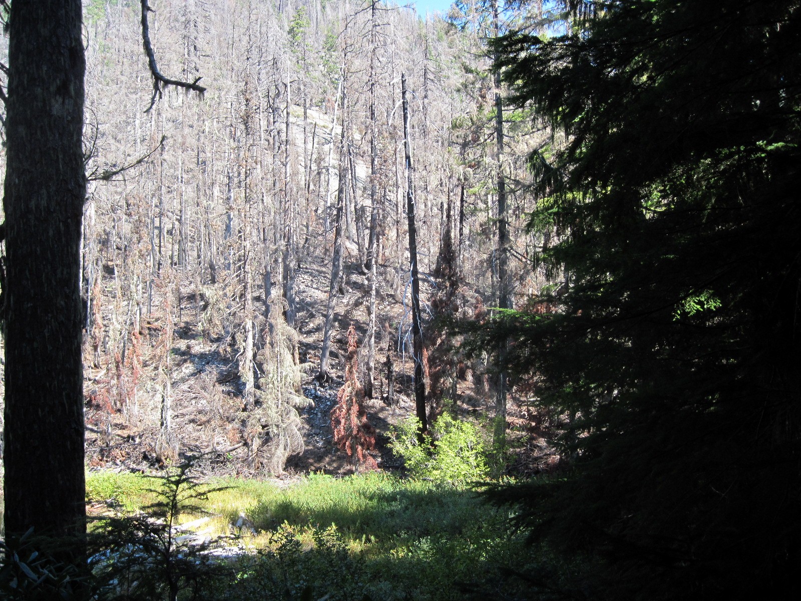 The first is taken from the trail about a quarter-mile east of the campsite.
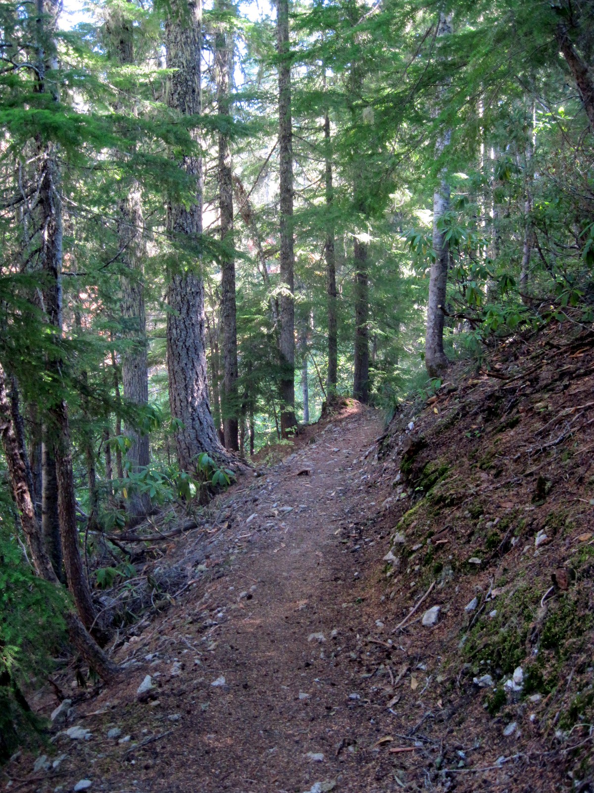 The second photo is of the trail at that same location, facing east. The burned area, which is to the left in this photo, came up to the edge of the trail but did not cross it.
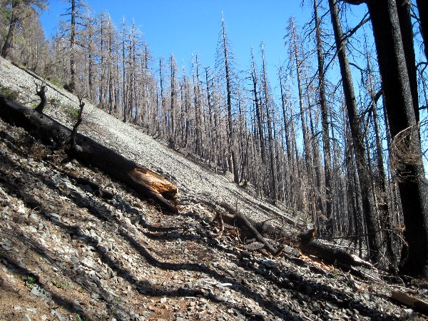 The last photo shows the trail heading east about a half mile from the campsite.
The first is taken from the trail about a quarter-mile east of the campsite.
The second photo is of the trail at that same location, facing east. The burned area, which is to the left in this photo, came up to the edge of the trail but did not cross it.
The last photo shows the trail heading east about a half mile from the campsite. B
Twin Lakes
Bryon
R
Bryon Boyce said Twin LakesI think it is either that or Welcome Lakes, but given the clue about two places to swim, I think you are correct. I haven't been to Twin Lakes since the fire. It looks just as bad as the are around Welcome Lakes. (if that is where those photos were taken)
B
And I don't remember much in the way of river rock near Welcome Lakes. There is West Welcome Lake, but its a bit off the trail. And the small lake next to Welcome Lakes Campground may be unnamed on the maps but is swimable. So either Welcome or Twin could be it.
D
It's the Twin Lakes trail. The campsite in the photo is on the edge of Upper Twin Lake. Your turn, Bryon.
The fire did not reach Upper Twin, although it came darn close. Lower Twin was burned around two-thirds of the shoreline. There are some photos of the area on my Flickr site if you're interested: http://www.flickr.com/photos/19191522@N06/sets/72157631755298438/
B
This picture was taken either from the mystery trail or very close to it.
The trail itself is not on the official list but is well used as it leads to unofficial campsites.
There is a nearby trail that is on the Forest Service maps.
Bryon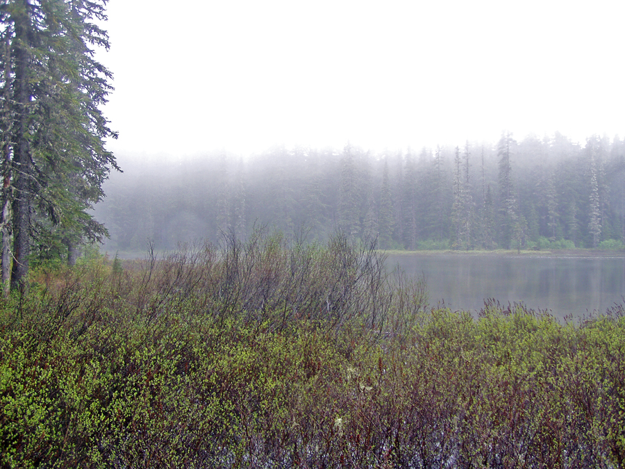
D
I have two candidates.
My second choice will be first: Lower Rock Lake off the Serene Lake Trail.
Don2
K
I was kind of thinking it looked like that area too. I've only been to Shellrock Lake, and it reminds me of that. So that's my guess.
Kirk
B
Both of you are not too many miles off.
Since neither lake nor trail have an official name or number, the first to clearly define/locate it or name any nearby better known landmark wins. It's near somewhere well known to many of you.
Bryon
Log in to reply.