
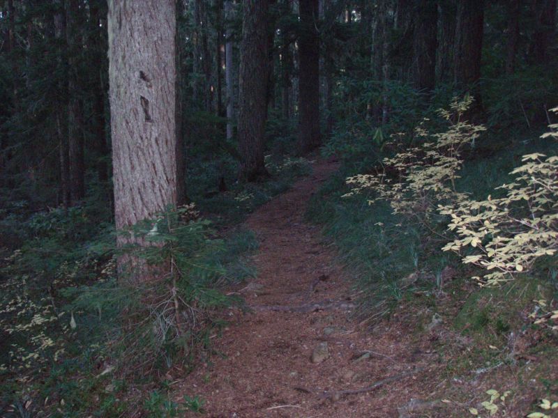
What trail am I on?
D
Kirk Tolstrup said:
Donald Presley said:
South Fork Mountain Trail?
Donald Presley said:
Kirk Tolstrup said:Just to note, the trail in red. Don, Have you snooped along Nohorn Creek yet?South Fork Mountain Trail?
You are correct Kirk, so you will have to post the next photo. We currently only use about a mile of this trail to reach Baty Butte, but segments remain all the way down to Nohorn Creek that didn't get logged or roads built over it. Our district map doesn't even show the Baty Butte Trail. I insert a portion of our district map with some of my scratchings on it, but it hasn't been verified by a GPS yet. Be aware that these abandoned segments hadn't seen any maintenance for 50+ years, basically bushwacking. I have been on most of these segments only once or twice, they are pretty faint. Don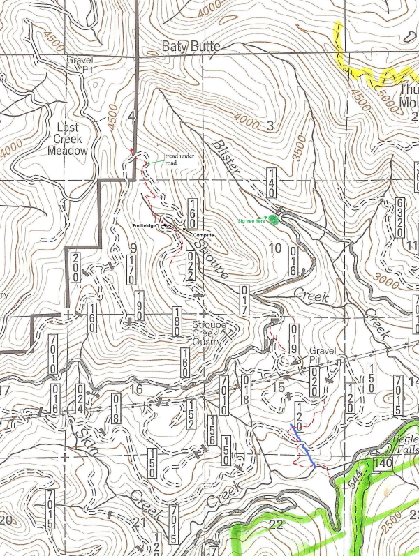
D
Sorry about the map not being very clear, but when you reduce it you loose some clarity. I haven't been up Nohorn yet, but it is on my short list. Have you wandered up that way any?
Don
K
Here's a trail that's not in the Mt. Hood NF. It's only a few miles out of the NF.
K
Don, I forgot to ask if that bridge goes over Stroupe Creek? How old do you think that bridge is?
D
Kirk Tolstrup said:
Kirk, it actually paralells the creek and is probably a 100-200 yards or so below a previous trailhead back in the 60-70's near the 160 spur road crossing of Stroupe Creek. I would think that the footbridge would be at least 50-75 years old and is similiar to others I have seen on other abandoned trails. Don
Don, I forgot to ask if that bridge goes over Stroupe Creek? How old do you think that bridge is?
Kirk, it actually paralells the creek and is probably a 100-200 yards or so below a previous trailhead back in the 60-70's near the 160 spur road crossing of Stroupe Creek. I would think that the footbridge would be at least 50-75 years old and is similiar to others I have seen on other abandoned trails. Don
R
So I'm a little confused. The trail that Don posted is the South Fork Mountain trail? South Fork Mountain (at least the one I know) is significantly north of Baty Butte. Am I missing something?
Please educate me...Or maybe I'm just being slow on a very rainy Saturday morning.
D
Rob Williams said:
The South Fork Mtn Trail formerly went from Estacada to Bagby as mentioned on our website under the Baty Butte Trail. The following image is a portion of 1956 Bagby Hot Springs topo , that I cropped from an image also from our website from the O of U photos, with the trail coming down from Baty Butte and going to Bagby labeled as the South Fork Mtn Trail.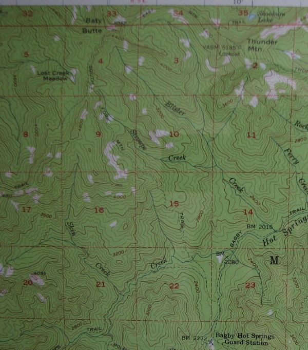 This other image is a cropped one of the one I posted last night that may show my markings of the trail on our current district map a little more clearly.
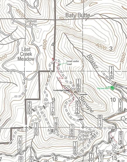
 Don
Don
So I'm a little confused. The trail that Don posted is the South Fork Mountain trail? South Fork Mountain (at least the one I know) is significantly north of Baty Butte. Am I missing something? Please educate me...Or maybe I'm just being slow on a very rainy Saturday morning.
The South Fork Mtn Trail formerly went from Estacada to Bagby as mentioned on our website under the Baty Butte Trail. The following image is a portion of 1956 Bagby Hot Springs topo , that I cropped from an image also from our website from the O of U photos, with the trail coming down from Baty Butte and going to Bagby labeled as the South Fork Mtn Trail.
This other image is a cropped one of the one I posted last night that may show my markings of the trail on our current district map a little more clearly.
DonR
Don, thanks for the clarification. After looking at those 1956 maps, I see the trail clearly. That was a long trail!
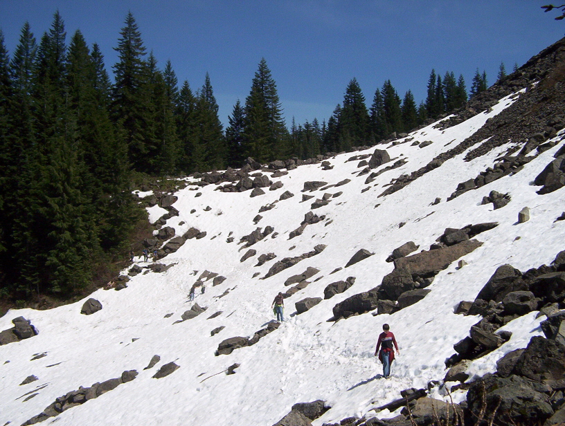
Kirk: Is that the Table Rock trail? It kind of reminds me of the rock field you approach before you get to the basalt wall....
K
Exactly Rob. If it's ever my turn again, I'll try to make it more challenging. Your turn!
D
Donald Presley said:
Isn't there a waterfall nearby the bridge? Don, No, I haven't looked for that end of Nohorn. I have found a part where the trail comes out of the creek towards the divide but was never able to get anything good strung together on account of the very extensive harvest history in the boundary area.
Kirk Tolstrup said:Don, I forgot to ask if that bridge goes over Stroupe Creek? How old do you think that bridge is?
Kirk, it actually paralells the creek and is probably a 100-200 yards or so below a previous trailhead back in the 60-70's near the 160 spur road crossing of Stroupe Creek. I would think that the footbridge would be at least 50-75 years old and is similiar to others I have seen on other abandoned trails. Don
Isn't there a waterfall nearby the bridge? Don, No, I haven't looked for that end of Nohorn. I have found a part where the trail comes out of the creek towards the divide but was never able to get anything good strung together on account of the very extensive harvest history in the boundary area.
D
Donavon
I believe the footbridge just goes over a spring, but there was a waterfall on Stroupe Creek near that area. I need to get back up there next summer and do some more exploring, since the 160 road is to be decomissioned sometime in the not to distant future.
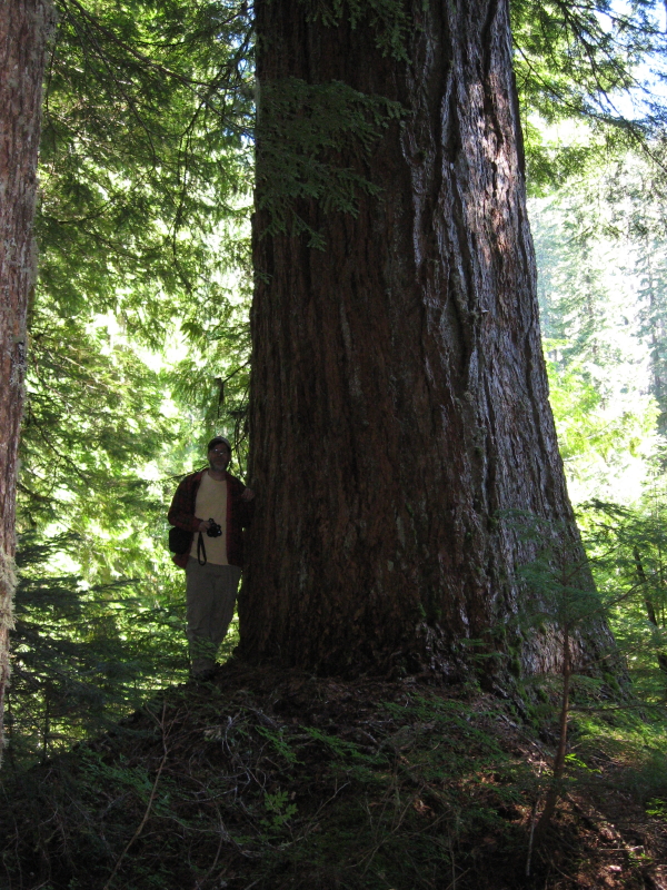
In another note, on that portion of the district map a marked an area near Blister Creek that has a huge tree that I stumbled upon that is bigger than any tree I have seen in our district before. I took a picture of Bob next to it when we did a weekend hiking up by Baty Butte last fall.
Don
D
Nice tree. We ought to restart the biggist tree hunt again.
That looks like it could be bigger at DBH than the MP3 tree.
Back to your map. I did spend a lot of time off that -022 spur looking for tread. It is a nice virgin stand in there so I felt confident. I concluded that there may have been some swithchbacks in the cut above the spur. But that cut will need some more time. There is a lot of water there, as I recall. Hellacious brush.
D.
D
Donovan said:
I thought that it looked bigger then the MP3 tree, that is why I posted the photo. I still haven't measured it yet to confirm it's size. That is the only area that I haven't looked for the trail in yet. I tried to go across that cut above that virgin stand and it seemed like I was 5-10 ft up in the air climbing on brush, it is a mess. Another one to put off til next summer. Don
Nice tree. We ought to restart the biggist tree hunt again. That looks like it could be bigger at DBH than the MP3 tree. Back to your map. I did spend a lot of time off that -022 spur looking for tread. It is a nice virgin stand in there so I felt confident. I concluded that there may have been some swithchbacks in the cut above the spur. But that cut will need some more time. There is a lot of water there, as I recall. Hellacious brush. D.
I thought that it looked bigger then the MP3 tree, that is why I posted the photo. I still haven't measured it yet to confirm it's size. That is the only area that I haven't looked for the trail in yet. I tried to go across that cut above that virgin stand and it seemed like I was 5-10 ft up in the air climbing on brush, it is a mess. Another one to put off til next summer. Don
D
Rob, wasn't it your turn to post a photo for the "What trail am I on" game? We all tend to get busy this time of the year with the holidays and family, myself included.
Has any one been out hiking the last couple of weeks and want to share something? I try to get out most weekends, if nothing else to hike for an hour or two and let my dog run and maybe find a grouse to shoot.
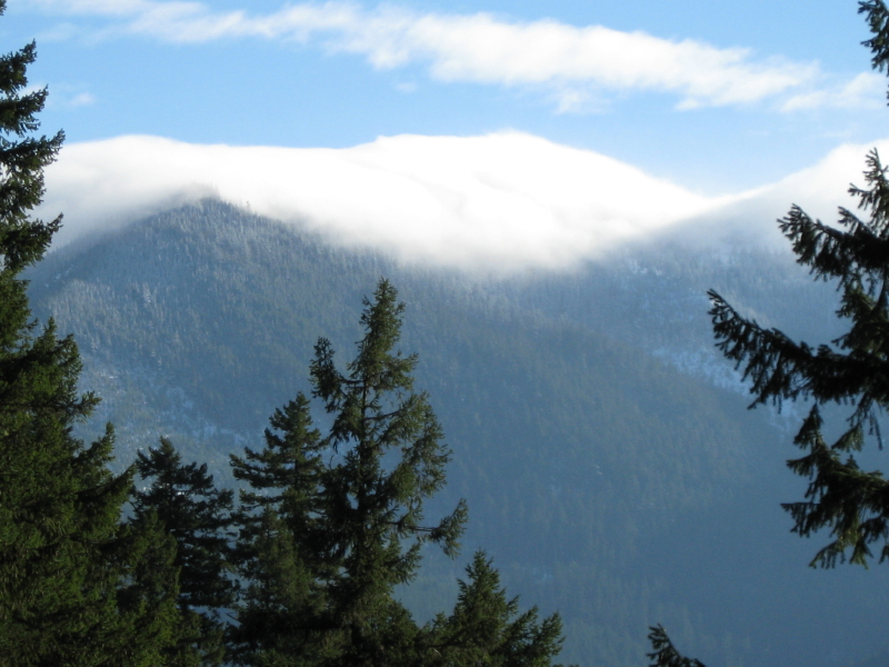
A couple of Sunday's ago I hike up an old abandoned trail near the Austin Hotsprings area. It was one of those rare clear days that happened to coincide with a weekend. There was a skiff of snow at the trailhead and I was wondering how far I could get before the snow got too deep. About half way up out of the canyon you start getting views of nearby mtns between the trees. This one is of cloud capped Burnt Granite.
 The old trail comes out next to a clearcut near the top, but miraculously the tread is spared. The trail hasn't seen much maintenance in the last 50+ years, so there are a lot of logs to climb over.
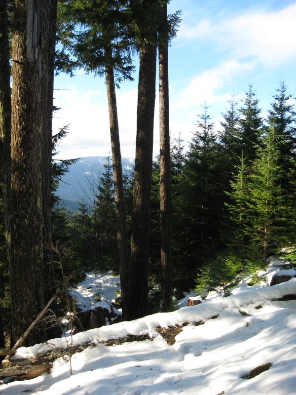 Not wanting to miss dinner at home I decided to turn around and go back down the way I came. The snow was getting over a foot deep out in the clearings and I was tired of post-holeing anyway. This next photo shows the upper trail a few hundred yards below the upper road where the trail comes out.
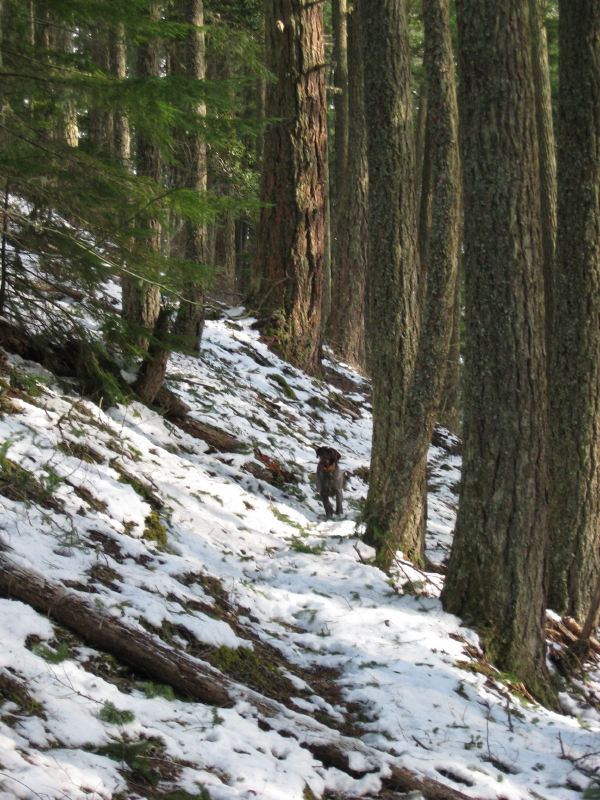 Tell us about one of your adventures.
Don
Tell us about one of your adventures.
Don
The old trail comes out next to a clearcut near the top, but miraculously the tread is spared. The trail hasn't seen much maintenance in the last 50+ years, so there are a lot of logs to climb over.
Not wanting to miss dinner at home I decided to turn around and go back down the way I came. The snow was getting over a foot deep out in the clearings and I was tired of post-holeing anyway. This next photo shows the upper trail a few hundred yards below the upper road where the trail comes out.
Tell us about one of your adventures.
DonR
You are correct, Don. Life has been rather busy for me this week. Thanks for the reminder.
Here is a trail that goes to a nice little destination. I'm not sure of too many clues that wouldn't give it away.
 Unfortunately, the only adventure I've been on recently was to get a Christmas tree a few weeks ago. I'd really like to get out in the woods again. SOON!
Unfortunately, the only adventure I've been on recently was to get a Christmas tree a few weeks ago. I'd really like to get out in the woods again. SOON!K
Does this trail have a number assigned to it? I'm not asking what the number is, just if it has a number. If it does have a number, does the number have a letter suffix?
Is that an arcane enough question for you?
R
Kirk Tolstrup said:
Yes, it has a number and no it doesn't have a suffix on it.
Does this trail have a number assigned to it? I'm not asking what the number is, just if it has a number. If it does have a number, does the number have a letter suffix? Is that an arcane enough question for you?
Yes, it has a number and no it doesn't have a suffix on it.
K
Rob Williams said:
Okay that didn't lead me to any conclusions. How about a clue? What do the digits in the trail number add up to? If it's the Pacific Crest Trail, this clue would give it away.
Yes, it has a number and no it doesn't have a suffix on it.
Okay that didn't lead me to any conclusions. How about a clue? What do the digits in the trail number add up to? If it's the Pacific Crest Trail, this clue would give it away.
D
Rob, is it the Fish Creek Mtn trail up on top where it flattens out before coming to the junction to High Lake?
Don
R
Don, it is not Fish Creek Mtn. OK, a small clue. It is one of the shorter trails in the district and it seems to be a reasonably popular camping spot.
Log in to reply.