
What Trail am I am - Fall Edition
K
Donovan said I have two candidates. My second choice will be first: Lower Rock Lake off the Serene Lake Trail. Don2Well, it looks like we're in the neighborhood. Since we already know what's behind door number two. Pray tell what's behind door number one and see if that gets us any closer. Kirk
D
Well, it looks like we're in the neighborhood. Since we already know what's behind door number two. Pray tell what's behind door number one and see if that gets us any closer.kirk said :
Kirk Kirk, you are barking up the wrong tree! Haven't you had your annual anger management class just recently, or do they have those where you work? Lighten up dude! Don
K
Donald Presley saidWhoa, dude!Kirk, you are barking up the wrong tree! Haven't you had your annual anger management class just recently, or do they have those where you work? Lighten up dude! Don
D
My first guess is Cripple Lake on Trail "X". Past the camps and where the trail leaves the lake to head up to cache meadow.
Don2
B
Donovan said My first guess is Cripple Lake on Trail "X". Past the camps and where the trail leaves the lake to head up to cache meadow. Don2Definitely close enough. The location is actually just before the campsites. This unofficial trail formerly petered out on the slope before reaching Cache Meadows. We had an early fire season 20 or more years ago, followed by heavy summer rains. Fire Crews had poured into Oregon, then had nothing to do as the rains stopped the fires. That was the year Trail X as you call it was grubbed out. I have always assumed it was a bored fire crew that did it, though I don't have absolute proof, just the timing coincidence. Your turn!
D
New info for me on trail X. I figured it wasn't too old on account no blazes.
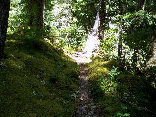
 What trail am I on?
Don2
What trail am I on?
Don2
What trail am I on?
Don2R
I'll take a guess - Dry Ridge at the Grouse Creek crossing?
D
Seems a bit too certain to be a guess Chief.
Because you are correcto!
Don2
R
Well, that creek crossing is one of the only ones I've seen in the district that has two distinct "creeks" you have to cross with dry land in the middle.
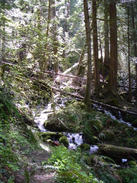
This photo was taken from a current district trail. Where am I?
K
It looks really mossy. Is it the Alder Flat Trail?
R
It is not Alder Flat. You'll need to head south.
K
Okay, I'm going to go big..... Is it Rho Creek? I'm already at home, so if that guess is wrong I don't have anyplace to go. 
B
Another wild guess - if wrong then at least the process of elimination is moved along....
The north fork of Berry Creek, Trail 564 heading North not too far from the cutoff to Hawk Mountain
R
You guys are both wrong, but you are getting closer. You need to go west a bit.
B
Yet another wild attempt at the process of elimination....
Trail 554 heading towards Welcome Lakes
B
Yet another wild attempt at the process of elimination....
Trail 554 heading towards Welcome Lakes
R
You are getting warmer.
B
I'll try Mother Lode 558 trail
Bryon
D
How about Baty Butte or the boundary trail south to Joyce Lake?
Don
R
Bryon: You are getting really close, but you've gone a little bit too far south.
Don: You are too far west and need to come a little farther south.
For those playing along at home, a small hint (if you haven't figured it out already) - this trail is in a wilderness area.
Log in to reply.