
What trail am I on? Spring 2013 edition
D
And don't forget Dry Ridge.
D
What trail am I on?
D
Is that Rho Ridge north of Mount Lowe?
Don
D
I thought it was just south of the summit, but close enough. You win!
D 2
D
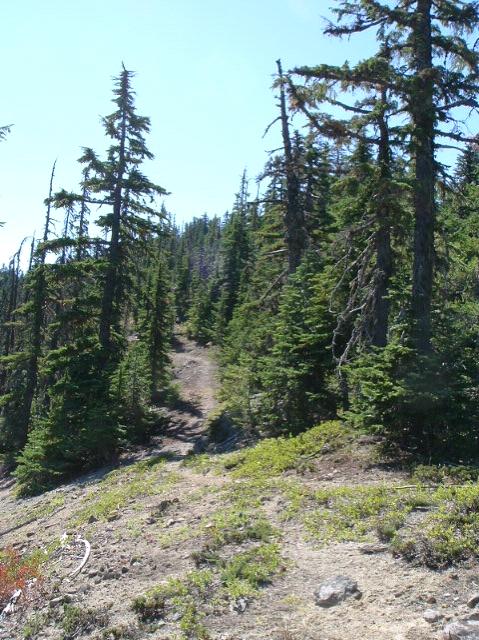
 So it is my turn again! I really don't get out on current trails too often these days. So the only one I could come up with was a abandoned trail a came across a few months ago that I haven't showed anybody yet, so here it is. This is where I first came across this trail, with the cut log and blaze on a tree nearby. The trail was only on a couple of the older maps, so you will need to go back into the 30's-40's to find it. It's in the Upper Clackamas River area above Austin Hot Springs.
Don
So it is my turn again! I really don't get out on current trails too often these days. So the only one I could come up with was a abandoned trail a came across a few months ago that I haven't showed anybody yet, so here it is. This is where I first came across this trail, with the cut log and blaze on a tree nearby. The trail was only on a couple of the older maps, so you will need to go back into the 30's-40's to find it. It's in the Upper Clackamas River area above Austin Hot Springs.
Don
D
Gunna be a little bit tough if you haven't showed it to anybody yet.
But here it goes, looks like moderate elevation, say 3500'?
And, trail's entering a clearcut or a road prism?
D 2
D
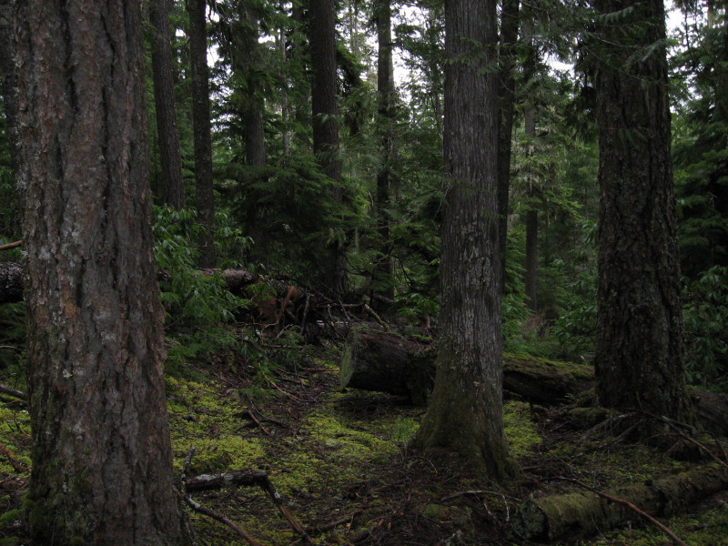
Isn't that the point of it to make it hard to figure out? The trail does go that high and higher according to the old maps, but this location is 7-800 feet lower, more 27-2800' elevation. The photo was taken above a road prism just past a creek on a dead end spur road. I followed the trail for a 100 yards or so, but the bad news looks like it enters into a future thinning area with all the new flagging going on. Isn't it bad enough to wipe out a trail once with logging, but to do it again with a thinning operation on the trees 40-50 years later to seal the end of this trail. I don't know, it was my third attempt to locate this trail when I finally found something and followed it into a proposed thinning area. I thought why bother, except for the fact that nobody has found a segment of this trail so far to prove that it actually existed in the first place, other than a dotted line on an old map from 75 years ago.
Don
D
No takers? This trail is a dotted trail, so not a major route. No clue if it had a number or a name, but I call it by the name of the creek it follows. The maps show it going down to the Clackamas River and crossing to meet the Upper Clackamas River Trail at a junction with another trail that heads East up a prominent butte in the area.
Don
R
Well Don, your clues have confused me (which is not hard to do). I thought you might be referring to Oak Grove Butte, but I don't see any dotted trails that follow a creek that connect to a trail that goes to Oak Grove Butte. Since you said you just found the trail it can't be Switch creek (and switch creek is a dashed trail, not a dotted trail).
I'm going to need some more clues....
K
Somewhere near Granite Creek?
D
The trail is further up the river past Burnt Granite, but if you drive to the current trailhead access for Burnt Granite you drive within 2-3 miles of the mystery trail.
Don
B
Fawn Creek?
D
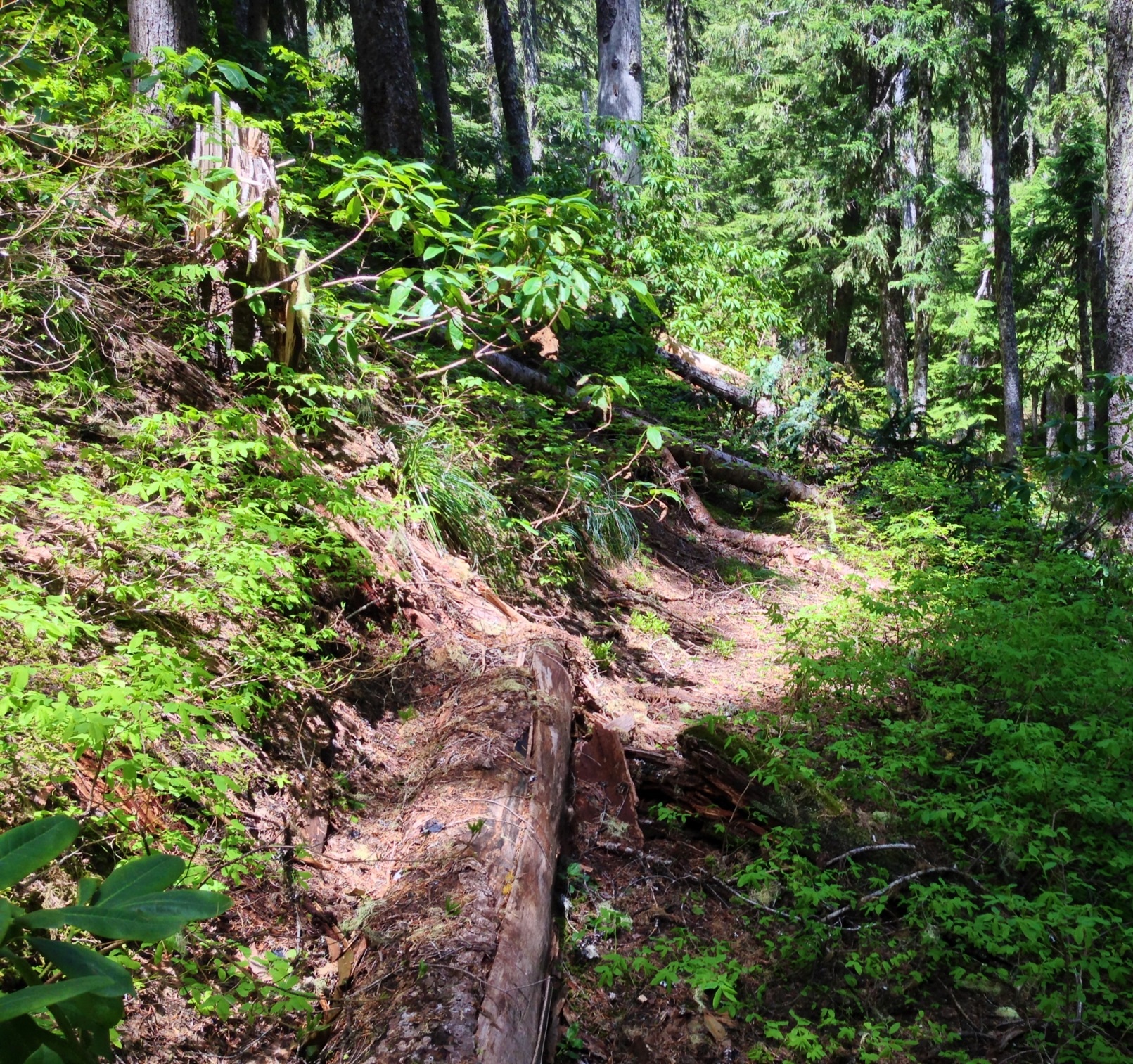
That would be correct. I only found a 1-200 yards segment above the 4671-170 road to the south of Fawn Creek. Below the road was a newer clearcut, so probably not much use looking into any further. I was more interested in locating the eastern portion that goes up Sisi Butte. Your turn to post one. DonBrianEdwards said Fawn Creek?
D
Chuck and I chased that trail up the otherside figuring it would be apparent at that spring, but it was dubious at best. I mean whether we were on tread or imaginary tread. You know how that is. Or game trails/imaginary tread/indian trail type trail.
D 2
B
 Abandoned trail in the district
D
You along Stroupe Creek?
D
Donovan said Chuck and I chased that trail up the otherside figuring it would be apparent at that spring, but it was dubious at best. I mean whether we were on tread or imaginary tread. You know how that is. Or game trails/imaginary tread/indian trail type trail. D 2I think it would be worth another look now that we have a wilderness without trails. Don
B
Yep
D
Just crin' to be sawed out. Nice.
D 2
D
 So I take it, it is my turn to post one? That trail along Stroupe Creek is a portion of the South Fork Mtn Trail that comes from South Fork Mtn and ends at Bagby Hot Springs. A good portion of it from our present trailhead for Baty Butte comes down Stroupe Creek, going through 3 clearcuts before crossing Nohorn Creek on over to Bagby.
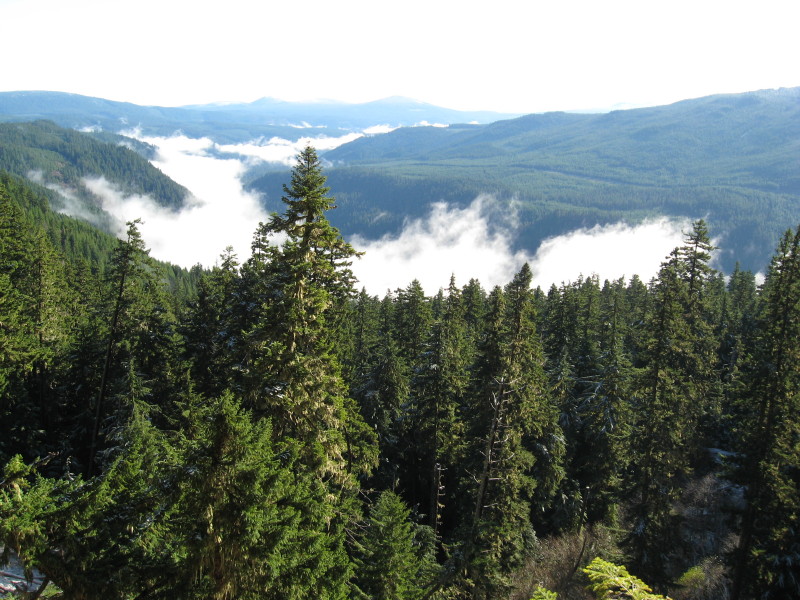
So here is a view from another abandoned trail in our district. Seeing how I spent most of my time tracking down these old gems, most of my pictures are from abandoned trails.
Don
So I take it, it is my turn to post one? That trail along Stroupe Creek is a portion of the South Fork Mtn Trail that comes from South Fork Mtn and ends at Bagby Hot Springs. A good portion of it from our present trailhead for Baty Butte comes down Stroupe Creek, going through 3 clearcuts before crossing Nohorn Creek on over to Bagby.
So here is a view from another abandoned trail in our district. Seeing how I spent most of my time tracking down these old gems, most of my pictures are from abandoned trails.
DonLog in to reply.