
What Trail am I am - Fall Edition
Bryon Boyce said Clue: the trails in this location were not abandoned because of roading or budget cuts. The trail which formerly headed north from the destination of the trail in question, has suffered from a high erosion rate and I've yet to spot it. I've not looked for it since I found out that a trail was once there. You would have several miles of defacto wilderness on that trail once you found it.Might this section of trail be along the alignment of the old South Fork Mountain Trail?
Bryon Boyce said Let me amplify a previous clue - Where in the Clackamas has a trail been dropped by the Forest Service because they no longer own the land part of the trail is on?I have no idea, but I'm really interested to find out.
Robert Koscik said Somewhere in Olallie Country? Olallie Butte?
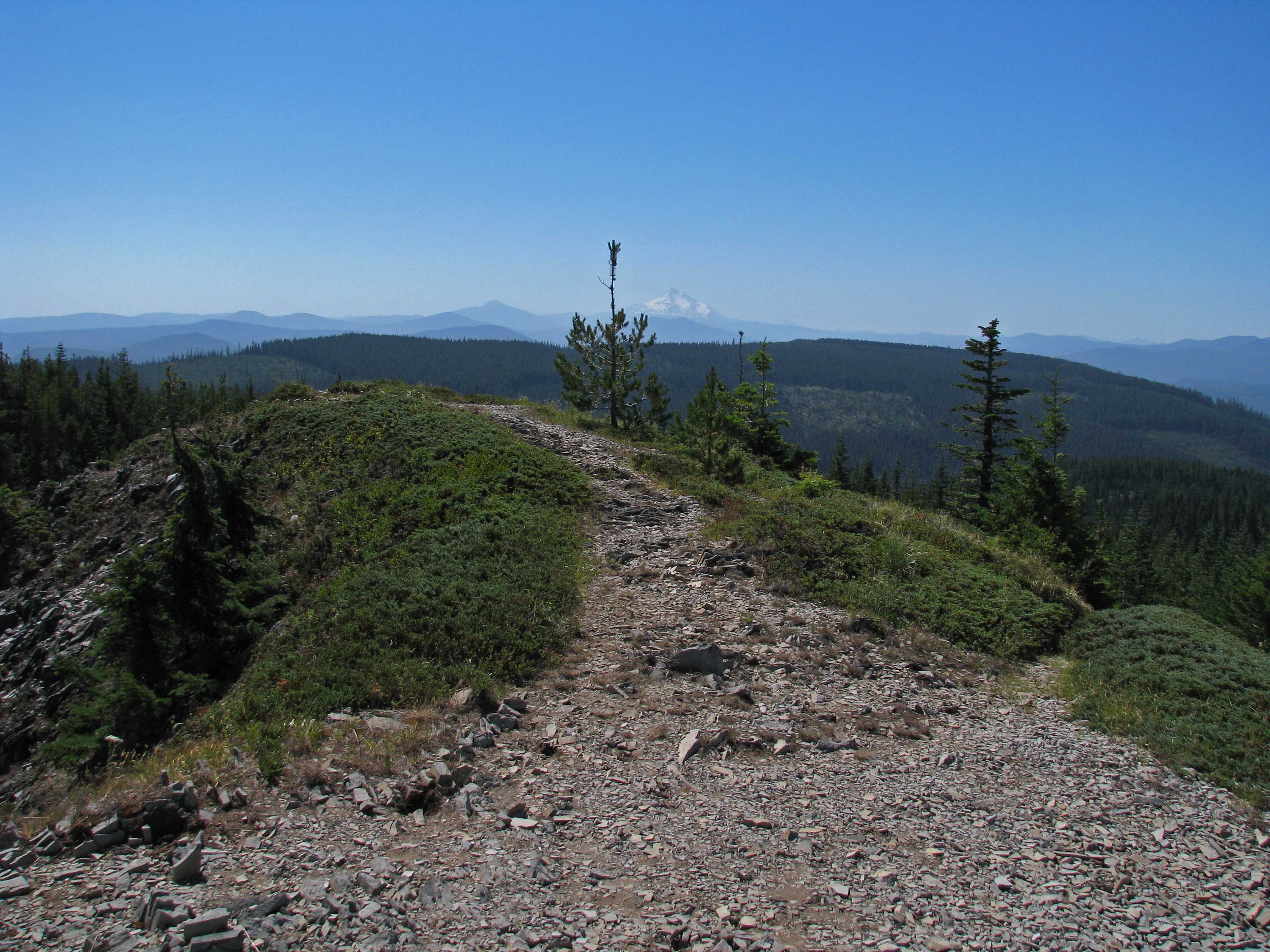
We have a winner! The McQuinn - Handley survey controversy took 101 years to resolve, and in 1972 all parties agreed that the McQuinn line was correct and the Warm Springs Reservation was expanded by 61,360 acres. The Indians had been right all along. At Olallie Butte the trail to the top shifted from 100% Forest Service Ownership (I'm approximating here) to about 1/3. The Warms Springs Tribe agreed in the settlement to allow free access by hikers to Olallie Butte, but not to all other areas shifted to their ownership. The trail has been deteriorating since 1972 - there are sections filling in with basalt ball bearings and with the beetle kill, trees are beginning to fall across the trail. The view from the top is easily one of the best in the Cascades, with dozens of lakes and the rimrock above the Deschutes visible. At 7215' Olallie Butte is the highest spot between Hood and Jeff. Read about the boundary shift here: http://pelton.warmsprings.com/.docs/pg/10208 And really guys that mossy shelf is very obvious as you hike up the Olallie Trail.
"The Indians had been right all along." I believe that will always be subject to debate. Don2
Donovan said If there is a link to specific language that allows access to Olallie Butte Trail we should probably post it here somewhere. I could never get a clear answer on it. Don2Here is a brief description which should be enough for anyone familiar with the area. Get yourself on road 4220 heading south towards Olallie Lake. Park at the powerlines, there is plenty of room. Head onto the powerline road going east. After a short distance take the trail on your right which quickly climbs. It will cross the Pacific Crest Trail at about a 90 degree angle; continue straight, there are no sidetrails past this. It is a continuous but fairly even grade for 4 miles and 2500 ft. gain. The view from the 7215' top can hardly be equaled. I only found this by meeting one of three Estacada (then-) high school girls who crossed the Cascades on horseback from Warm Springs Reservation to Estacada and home. This would have been 1962 or 63. At that moment much of the route was trail. They did use a section of the aforesaid powerline road and informed me that was where to find the trail up Olallie. Back when this was all Forest Service land, a trail went down the main ridge to the south from the top. This trail now ends at a road coming west from the reservation. Be aware the Warm Springs folks consider the area to the south closed, unlike Olallie Butte itself.
I did some googling and don't see any specific reference to hiking on the reservation. There are some pages dealing with fishing, and some lakes are DEFINITELY closed to fishing by non tribal members, but I don't really see anything relating to access to hiking. Maybe it is a "don't ask, don't tell" type of thing? Or maybe since Olallie Butte is in the McQuinn strip (I'm pretty sure that is a true statement), that it is allowed?
I did find the following piece from a hunting/trapping regulations document:
350.220 On–Reservation Hunting – Non–Members: No nonmember shall pursue, shoot at, or kill any wild animals or wild birds at any time within the Warm Springs Reservation except within the McQuinn Strip pursuant to the terms of a cooperative agreement between the Tribesand the Oregon State Game Commission (now the Oregon Fish and Wildlife Commission), dated May 30, 1973, and extending to September 21, 1982, and providing the Oregon Fish and Wildlife Commission with the option to extend the term of the agreement for an additional ten–year period. During the term of said agreement or any extension thereof, non–tribal members may hunt in the McQuinn Strip in conformance with Oregon State hunting regulations.
 I'm pretty sure it's not a wilderness area. This is an abandoned trail.
Bryon Boyce said I haven't looked into this for several years - at one point in time 3 to 5 years ago, they had a page including a map detailing open and closed areas. At that point basically the whole reservation was off limits with a few exceptions like Olallie Butte and the campground at Breitenbush Lake. At some spots on the Western edge of the reservation (near4220) there are still large keep out signs, like at Olallie Meadows and behind Breitenbush Lake and the road heading south to that lake. When I have more time I will see if anything was downloaded about this back then. The import of their website has changed drastically since my previous visits as well. Now its all about tourism. Earlier it was much more about asserting their authority over tribal lands and history. And who knows, maybe they've decided tourism is more important than keeping people out of their reservation. Except those signs are still up.There have been 3-4 trip reports on Ollalie Butte on Portland Hikers, appears to be a popular destination. I think I'll go this summer. http://www.portlandhikers.org/forum/viewtopic.php?f=8&t=13116 This one has a map, if asked, I'm sure the author would send a GPS track for posting in the trail index. http://www.portlandhikers.org/forum/viewtopic.php?f=8&t=9304
Robert Koscik saidI'll make a stab at it.
Log in to reply.