
What Trail am I am - Fall Edition
R
No to both. It's a ways up there.
D
OK then, Squaw Mountain with a trick photo angle to hide the steps?
Don2
R
My guess - Thunder mountain
R
No, you still have to go up higher.
R
Higher in elevation?
B
Schreiner Peak?
Bryon
D
Bob, you can't run away for a weekend and leave us hanging, come on give us a clue. Unless you are away from civilization on one of your VW outings, then it is OK. I am going to get me one of those "tin-top campers" one of these days and join you out there. VW
Don
K
Mount Lowe...
D
Well while we're waiting for Bob, why doesn't someone else give us something trail fantastic to look at?
Don2
R
Sorry, was out "camping" at Armstrong, what a madhouse, even in March.
You guys are off, go north.
K
So we need to look farther north. Farther north than Squaw Mtn.?.... abandoned trail not in a wilderness area?.... Do we need to think outside the box on this one, or are we overlooking something obvious? Was there ever a lookout at this site?
Kirk
B
That looks like the view from High Rock
D
Brian might be on to something. I recall two tops at High Rock.
The ridge in the foreground does look like the ridge that the former 701 trail runs along.
I hope he's right so we can move along.
Don2
B
The clear cuts jogged my memory. Then I found this photo:
http://www.panoramio.com/m/photo/4368139
R
I think Brian is correct as well. I think the trail on the right is the trail from the "parking area" below the old lookout - it looks like there might have been a garage or something in that area a long time ago.
R
High Rock it is!
Man I thought I was being so obvious with my clues.
It's still a trail, isn't it? Even though it's a short one...
B
No current trails go by this Lake, but a couple long-gone trails passed by a small distance away.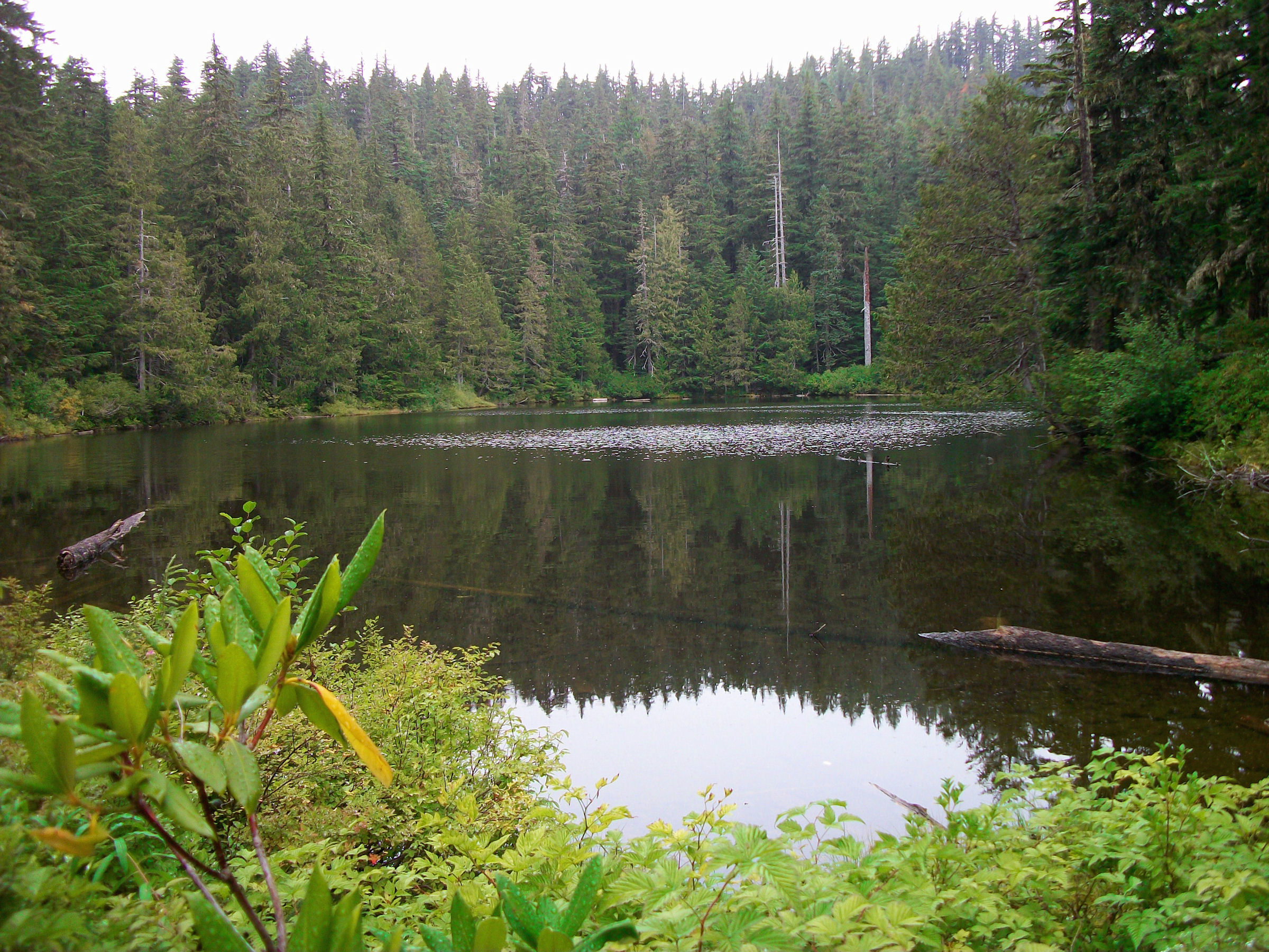
R
I must excuse myself for this one - I know where it is.
But, once this has been answered, I'm curious as to which trails you refer to. The maps I've looked at don't have any trails near this.
B
Rob, I'll admit to not owning any historical maps, but I did just take a look at this lake on some of your new maps (Nice job btw), and the two trails I was thinking of are a bit further up the ridge then I thought. "Nearby" was misleading.
D
An extremely short trail at High Rock.
I have scouted around for a water trail down to the spring but it was inconclusive.
On the new "what trail", was this taken perchance from a very near a road?
Don2
Log in to reply.