
What trail am I on?
R
Donovan said:
Plaza Lake?A little farther south...
K
Would it be accurate to say it's about 28 miles from Plaza Lake?
R
As the crow flies? I'd say that is probably pretty close....
K
Is that Jude Lake?
R
I believe it is. It is just before you get to Russ Lake, but that appears to be the back side of Jude Lake. There is also a side trail that goes up to the camp sites at Jude Lake.
Your turn to post a photo!
Things are so quiet here, I feel like I'm talking to myself.....
K
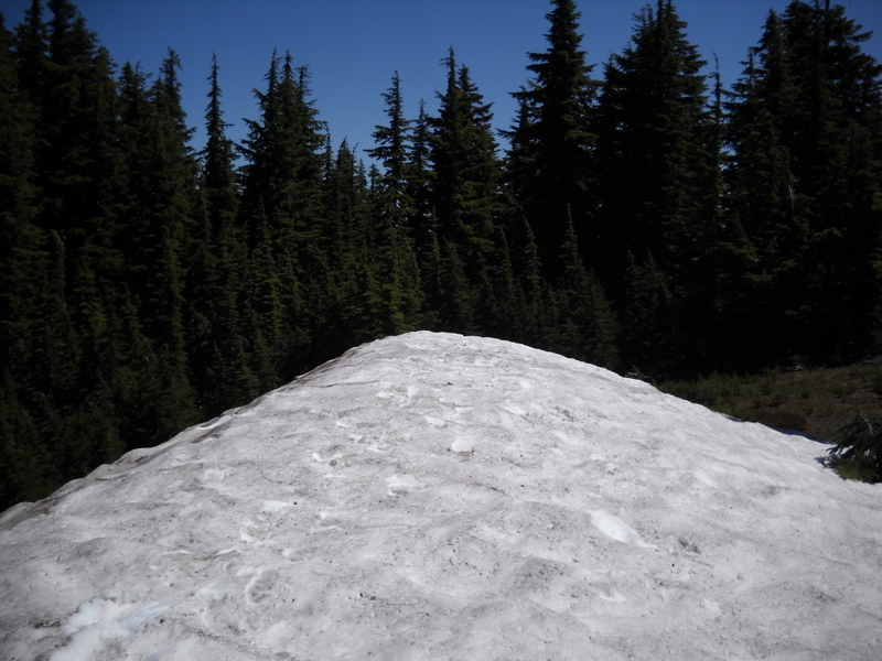
Okay, here's a picture. Hopefully it's not too easy.
D
Kirk, isn't that the glacier that is forming in the Olallie Lakes Scenic Area the past few years near a way trail to an old lookout site?
K
Yes Don, that photo was taken in the Olallie area. But that snowbank isn't a glacier. It was melted away in September, about a month after the photo was taken. Where the snowbank had been, the flowers were just beginning to bloom, a little later than the other flowers in the neighborhood.
I think you know where this photo was taken... go ahead, tell us.
D
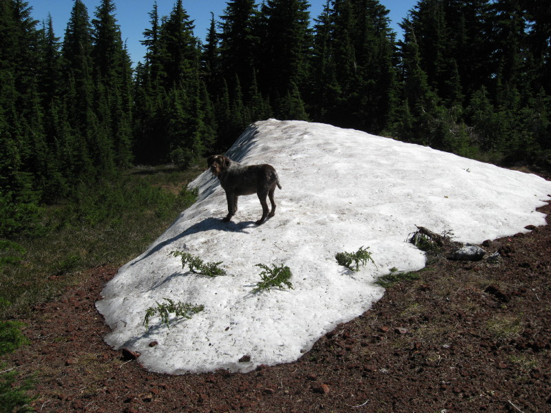
That would be the Ruddy Hill Trail.
It seems everytime I am up there the snow mound is there. I was there in the middle of August this year when I was clearing trails in the area.
R
When we did our pyramid butte trip in September, it had all melted. Amazing how fast it can melt....I'm guessing there is snow up there again, though. The bare ground didn't last too long!
D
We are suppose to have another heavy snow pack again this winter, so that snow mound or drift will be building back up again soon. It is kind of neat that it takes on pretty much the same shape every year.
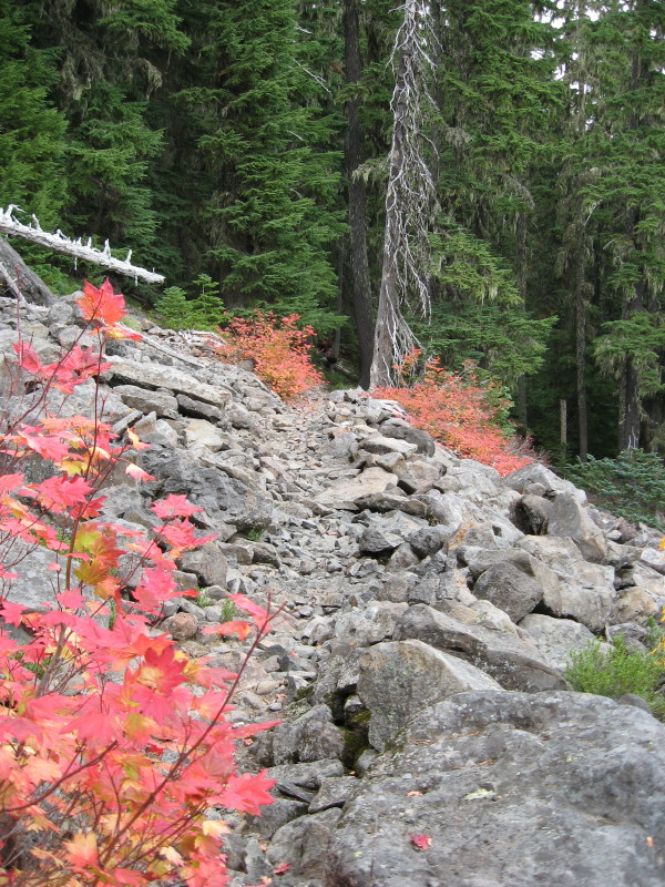
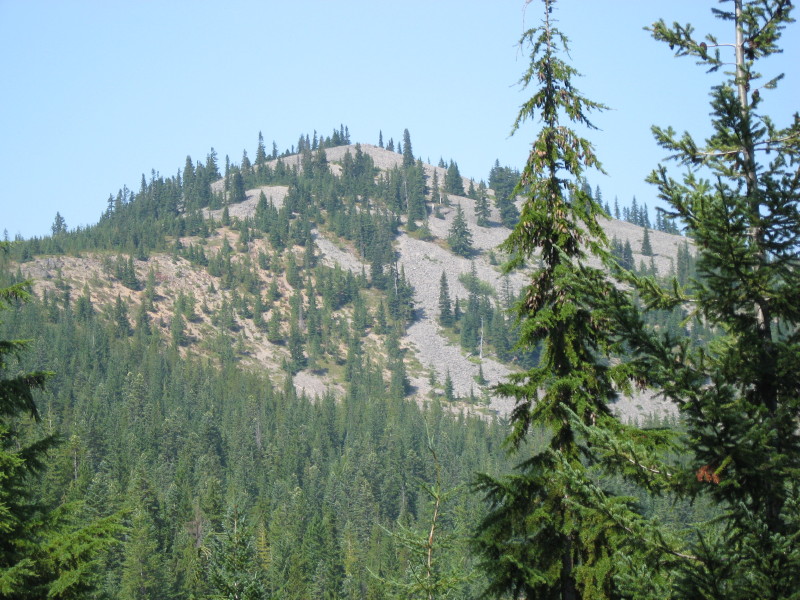
Here is a photo of a current trail in our district. What trail am I on?
R
Well, you didn't give any hints, but that looks vaguely familiar - kind of like that rock slide on the Burnt Granite trail.
I can't believe how quiet this board has been....Where is everyone? Sometimes I feel like I'm talking to myself around here!
D
Rob Williams said:
Well, you didn't give any hints, but that looks vaguely familiar - kind of like that rock slide on the Burnt Granite trail. I can't believe how quiet this board has been....Where is everyone? Sometimes I feel like I'm talking to myself around here!Same with some other boards. My wife thinks people are migrating to Facebook. As for the trail, Corral Springs? I hope I'm wrong because I have no recent pictures. D.
D
We have winner! Rob, you are correct, it is the Burnt Granite Trail. That is the problem with posting a lot of these photos, for you and Kirk were there with me. I guess I might have to go back to posting photos from some of our abandoned trails.
Rob, it is your turn to post a photo.
R
I don't know if I have another photo, unless I repeat a trail. I'll go combing through the archives for something.
R
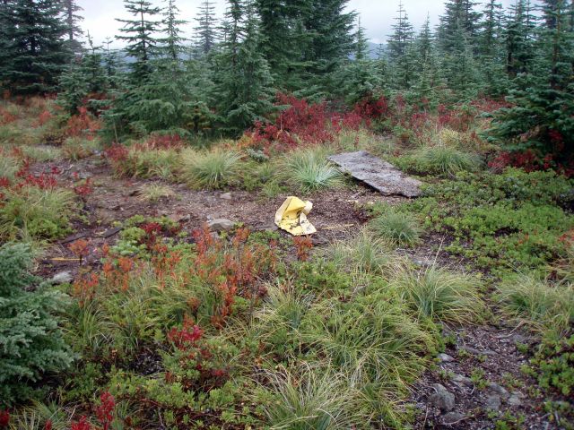
OK, here is a photo I took a few years ago. I'm not sure it is exactly on the trail, but it should be near it. It is an old helicopter landing spot. What trail is it on (or near)?
D
Would that be out by the view point on Mount Mitchell, for the plywood looks familiar?
R
Donald Presley said:
Would that be out by the view point on Mount Mitchell, for the plywood looks familiar?You would be correct!
D
I was out there in September clearing trail, so my memory was fresh. The piece of plywood is still there, but the yellow item is gone. I believe someone mentioned that they hauled out that piece of junk (or hysterical artifact) out prior to my visit.
OK, here is a photo taken from an abandoned trail in our district to make things a little harder, I hope, to figure out where I was at.
D
I forgot to give a hint last night for this trail. That butte in the background and the trail are both in one of the new wilderness areas.
Log in to reply.