
What trail am I on?
D
After looking at the maps that are available on this website, I noticed that this trail does not exist. I can't remember exactly how I knew there was a trail at this place, whether it was a word of mouth or from one of the 360 degree photos from this butte, but this trail does go for a mile or so down towards the namesake of this wilderness area.
K
Is that butte one of the Signal Buttes?
D
Kirk Tolstrup said:
Is that butte one of the Signal Buttes?That would be correct Kirk. It was a bit drier this time then when you and Rob and I hiked out to the Signal Buttes last year.
D
Is this from the trail down the east side?
I showed that to a couple guys. Can't remember who. Followed into a pine barren and lost it, but is is clearly visible being constructed after the burns.
Someone told me part of it also went on up as it was a water route for men sitting the butte in fire season.
I don't think that trail was ever finished.
D.
D
Your are right Donavon. Bob and I were out there this summer and stumbled onto it. Fairly easy to follow until you get down into the flat and it just disappears. There was tread heading up the ridge to the butte, I followed it for a few hundred yards before turning around. Makes since that it was probably a water trail, the headwaters of the Roaring River is suppose to start somewhere down in the draw.
Seeing how you located what trail I was on, do you have a photo to share? Or we can open it up to whoever wants to post a photo and get the ball rolling again.
D
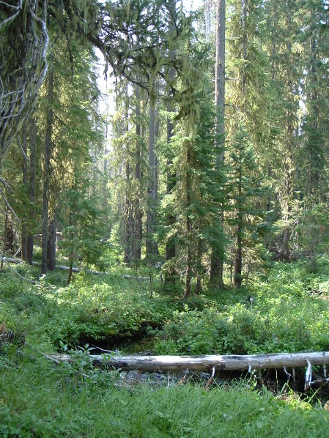 The trail crosses this creek near the rez.
D.
The trail crosses this creek near the rez.
D.R
It doesn't ring any bells, and I've hiked a lot of those trails recently (near the reservation). I'm just going to make a wild guess and say the PCT. Maybe north end?
Rob
D
Norther than where you were.
T
I'll guess Hawk Mountain -- though I've never been up there before (it's on my list!).
Tom
R
Is it a current trail, an abandoned trail or ???
D
It is an abandoned trail.
Clue/puzzle:
Streams in the area are year round, but run dry.
D.
R
The old 38 map shows a trail that crosses lemiti creek, just east of lemiti butte. It looks like a way trail but I do not know its name.
D
Well that's basically it. But you need a name.
D.
R
I'll just take a shot in the dark - based on your previous clue - the dry creek trail?
P
Donovan said:
Well that's basically it. But you need a name. D.From the 1961 USGS 15' Brietenbush topo the Skyline Trail runs through just east of Lemiti Butte. Looks like a couple of other abandoned trails in the area, with names like Boundary and Driveway. --Paul
D
Skyline Trail.
D.
D
Donovan said:
Skyline Trail. D.So Paul and Rob are both winners! Your turns! Runway I believe is Sheep Runway. It's interesting to follow, a wide swath.
P
Donovan said:

Donovan said:Donovan, how much tread is left on this segment of the Skyline Trail? I have one I've been saving up, this photo was taken near an abandoned trail that is either in or out of the district depending on how you view things - surrounded by 3 named mountains, where is it?:Skyline Trail. D.So Paul and Rob are both winners! Your turns! Runway I believe is Sheep Runway. It's interesting to follow, a wide swath.
K
Paul Turner said:
I have one I've been saving up, this photo was taken near an abandoned trail that is either in or out of the district depending on how you view things – surrounded by 3 named mountains, where is it?:To narrow it down a bit….. "in or out" Is this in the Eagle Creek drainage?
P
Kirk Tolstrup said:
Paul Turner said:Nope, go south...I have one I"ve been saving up, this photo was taken near an abandoned trail that is either in or out of the district depending on how you view things – surrounded by 3 named mountains, where is it?:To narrow it down a bit….. "in or out" Is this in the Eagle Creek drainage?
Log in to reply.