
What trail am I on?
D
I'll be more specific. You are on the view point trail off the Rimrock trail, Mitchell Point as it were, with Lake Harriet unseen below?
Donovan
B
Yes, this is the Mount Mitchell Viewpoint Spur Trail. A surprisingly little visited spot.
So now its your turn.
D
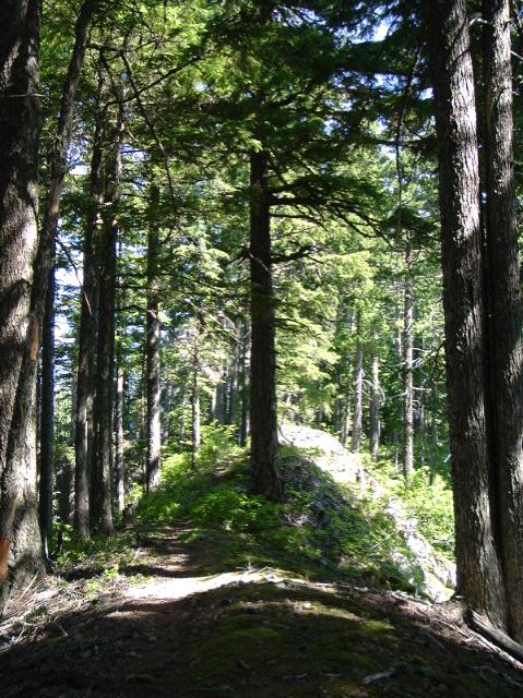 This is a system trail. We just came up through a Hemlock stand.
Donovan
This is a system trail. We just came up through a Hemlock stand.
DonovanR
Is that the Fish Creek Mountain trail? Looks kind of like the "old" trail after heading up from the decomissioned roads.
D
Yep. That's it. You are up next!
Donovan
R
OK, this is on a lesser used trail. It is in a wilderness area.
D
Never been there but I think I have heard about it. From a maintenance perspective.
Donovan
D
Is it the Schreiner Trail #555 out towards Lake Lenore or beyond?
R
Donald Presley said:
Nope, but you are in the right general area....And the right wilderness.
Is it the Schreiner Trail #555 out towards Lake Lenore or beyond?
Nope, but you are in the right general area....And the right wilderness.
D
How about the Dickey Creek Trail #553 near Big Slide Lake?
R
You have to go a little farther south.
B
West lake trail
R
Farther West....
B
I'm guessing its 554 - overlooking Moher Lode Creek.
D
Is this the site of the Battle Ax snow slides?
Donovan
R
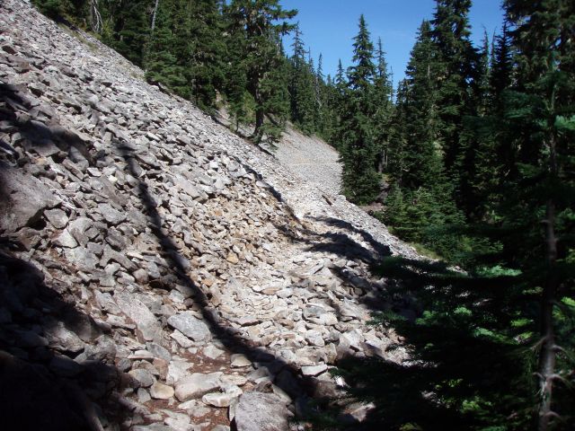
OK, I'm going to give one more hint that should give it away.....This picture was taken on one end of the trail which isn't very well used. The other end of the trail is VERY well used.
B
Bull of the Woods Trail 550.
R
OK, one last hint. It is a north/south trail, and this was taken on the little used southern part of the trail. The northern end of the trail is heavily used.
D
The Bagby Trail 544?
Donovan
R
Donovan said:
Bingo! This was taken on the very south end of the trail, a little north of Elk Lake. It is a pretty long rockslide. I'm thinking this area of the trail is where the picture was taken. You can see the long rock area in that topo map.
The Bagby Trail 544? Donovan
Bingo! This was taken on the very south end of the trail, a little north of Elk Lake. It is a pretty long rockslide. I'm thinking this area of the trail is where the picture was taken. You can see the long rock area in that topo map.
Log in to reply.