
What Trail am I am - Fall Edition
D
Well then, how about the Serene Lake Trail in the Roaring River wilderness?
R
Not that one either! But better.
D
Would that be the Cripple Creek Trail?
Don
D
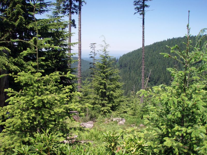
Bob, are you about to walk out to a commanding view over many small ponds?
D
R
Maybe...whatzit to you, kid?
They're not quite ponds, not sure what I'd call them. Marshlets?
D
I hear they used to call them lakes! Marshlets? Is that like bogs? Anyway, you are not in a wilderness area. You need to check your map dude.
Don
R
If no one else is going to guess, I will. I'm thinking that is the Old Baldy trail, very near where you can overlook the Squaw/Tumala lakes basin, where all the "marshlets" (what I would call bogs) are.
R
Yeah yeah I'm lucky I know where I am right now. I sure thought that was wilderness.
But that is the place. Onward!
R
I guess it was my turn to post a photo.....Tardy as I am, here it is.
 This was taken from an officially abandoned, but still maintained trail in the district. It is not in a wilderness area.
What trail was it taken from?
This was taken from an officially abandoned, but still maintained trail in the district. It is not in a wilderness area.
What trail was it taken from?
This was taken from an officially abandoned, but still maintained trail in the district. It is not in a wilderness area.
What trail was it taken from?D
Would this trail be one that has a lot of white flowers along it's path in the springtime, more so down lower than higher on it's course?
Don
R
Donald Presley said Would this trail be one that has a lot of white flowers along it's path in the springtime, more so down lower than higher on it's course?That would be correct. Name that trail and you too can be a winner!
D
That must be the White Iris Trail 502-A.
Don
R
Donald Presley said That must be the White Iris Trail 502-A.You are correct! That is very near the area that threw me twice - a large log went down right at the spot where the trail took a sharp turn west, and I continued along over the tree, losing the trail. If you continue down the tree around the root ball, you can see where the trail continues. Your turn to post a photo!
D
 With all of my hiking this summer done pretty much on abandoned trails, thats where all of my photos are from. I will have to bar Rob and Kirk from playing this one since they were with me last weekend when I took this photo from this trail. Like I said, it is from an abandoned trail and not in a wilderness area.
Don
With all of my hiking this summer done pretty much on abandoned trails, thats where all of my photos are from. I will have to bar Rob and Kirk from playing this one since they were with me last weekend when I took this photo from this trail. Like I said, it is from an abandoned trail and not in a wilderness area.
DonR
That is too funny - I was going to post the exact same photo, but changed my mind.....
Neat place!
D
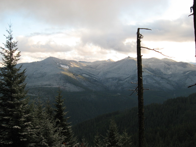
That is a real nice view from where ever that is.
I see the snows are on their way.
Dono
D
We were around 4000' and it was spitting snow on us most of the time we were on this trail last Saturday. This abandoned trail hadn't seen use in quite a while, probably since nearby roads were put in.
Don
D
Don, can you think of some clever hints to help this along? Seems like if the only guys who have been on this trail in the last 50 years aren't eligible to guess, then this game is going to be going nowhere fast. Maybe you could you tell us what direction it is to the snow-covered hills, or some nearby landmark (or perhaps one that you passed as you approached the trail), what river that is in the drainage below, or at least which major road you were last on before you headed up into the higher elevations (FR 46, 57, 63...??). Something, anything! I'm curious to know where this is and what trail you've been exploring, but I have no idea. All I can say is that the mountains in the distance are probably not a wilderness area, given the clearcuts. Other than that, I'm not familiar with the view.
D
The major peaks you are looking at are Burnt Granite on the left and Granite Peaks on the right and the upper Clackamas River is in the valley below. That should get you looking in the right direction.
Don
D
Well, that helps. Is it the trail on the south side of Oak Grove Butte?
Log in to reply.