
What trail am I on? - Part 2
Kinda looks like Monon Lake Trail.
Donovan
Donovan said:Kinda looks like Monon Lake Trail.
Donovan
You need to head north.
Rob Williams said:
It is in the Olallie Lake area.
Is it along the Red Lake Trail #719 ?
Donald Presley said:Rob Williams said:
It is in the Olallie Lake area.
Is it along the Red Lake Trail #719 ?
Don:
You win! It was actually not far from the Olallie trailhead that the trail passed this small pond. It was one of the few areas where the trail actually went around the water than right through it. Most of the other shallow water bodies the trail actually went right through, and you had to either get wet, or go around the side of the water.
Rob Williams said:You win! It was actually not far from the Olallie trailhead that the trail passed this small pond. It was one of the few areas where the trail actually went around the water than right through it. Most of the other shallow water bodies the trail actually went right through, and you had to either get wet, or go around the side of the water.
I am running out of photos in which to post for this game, but I have a few left which were taken of trees along trails with a little history to them. So here is one for you ponder over.
This picture of a benchmark painted on the side of a tree is located on an old abandoned trail that ended up being cover up by a road that is now itself abandoned. (Donavon I know that you know where this, so can you hold off posting for awhile to give others a chance.)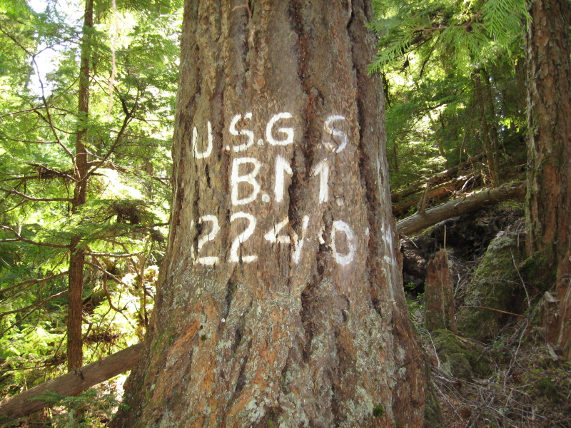
Donald Presley said:
I am running out of photos in which to post for this game, but I have a few left which were taken of trees along trails with a little history to them. So here is one for you ponder over.
This picture of a benchmark painted on the side of a tree is located on an old abandoned trail that ended up being cover up by a road that is now itself abandoned. (Donavon I know that you know where this, so can you hold off posting for awhile to give others a chance.)
Very cool! I'd love to know where this is, but without some clues (other than it was an abandoned trail that was replaced by a road which was abandoned), I don't have the faintest idea where it might be. Is that marking a bench mark? (by the B.M. on it)
Rob Williams said:Very cool! I'd love to know where this is, but without some clues (other than it was an abandoned trail that was replaced by a road which was abandoned), I don't have the faintest idea where it might be. Is that marking a bench mark? (by the B.M. on it)
It shows up on the '38 and '46 maps for sure and maybe a few others, but not on any recent maps. It is near a small creek less than a half mile off of the main road that goes to the southern part of the district.
OK, I'll make a few guesses here and base my answer on them.
- The road is road 63
- The creek is Russ creek
Rob Williams said:OK, I'll make a few guesses here and base my answer on them.
On the '38 map there shows a trail that runs close to Russ Creek, which ran over to Rho Ridge.
- The road is road 63
- The creek is Russ creek
Wrong road, wrong creek. You might look more to the east.
OK, so looking East on the 38 map, I saw something that looked familiar. On the map, there is a marking BM 2240, which is the same marking as the tree. This was near Cabin Creek, off what is now the 46 road.
Is that a little closer?
Rob Williams said:OK, so looking East on the 38 map, I saw something that looked familiar. On the map, there is a marking BM 2240, which is the same marking as the tree. This was near Cabin Creek, off what is now the 46 road.
Is that a little closer?
That is the correct benchmark, it just so happens to be a tree. You were fast to find that one. I will have to show you that one when we are in the area sometime.
So I guess it is your turn to post something.
OK, it took me long enough, but I think I've found a new picture. I'm getting low on pictures as well.....
This is on a current district trail and is not in a wilderness are (I don't think)
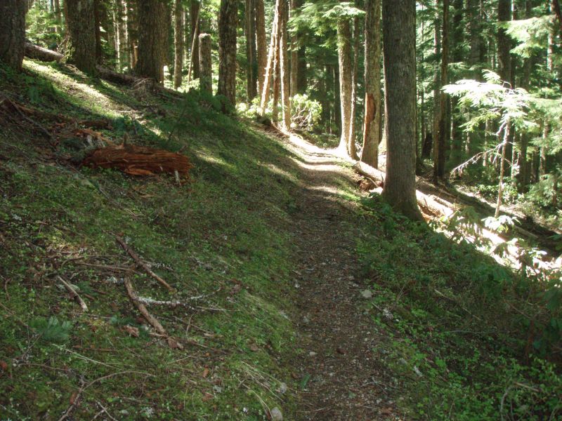
Rob Williams said:OK, it took me long enough, but I think I've found a new picture. I'm getting low on pictures as well.....
This is on a current district trail and is not in a wilderness are (I don't think)

Isn't that the Fanton Trail? I think this photo has been posted before.
Well, I must have.....You got it too quick. I'll have to look some more. Chalk it up to too much work and school.....
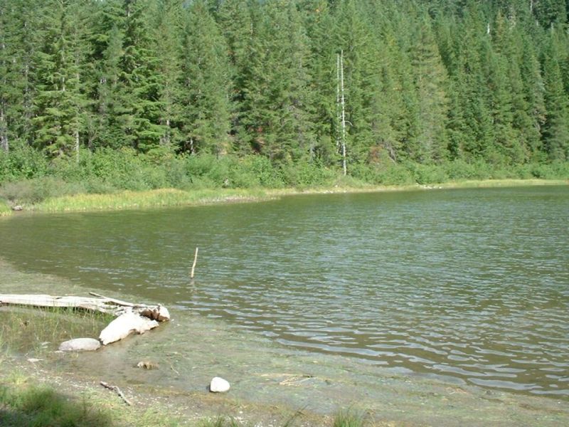
OK, new photo. This is a current district trail. Not sure if it is in one of the new wilderness areas or not.
Rob Williams said:Well, I must have.....You got it too quick. I'll have to look some more. Chalk it up to too much work and school.....
OK, new photo. This is a current district trail. Not sure if it is in one of the new wilderness areas or not.
Is this the destination of the trail. or is it just a lake you pass along the way?
Rob Williams said:It is kind of both. The trail continues on after the lake but it is probably where most people stop.
Is the trail in the Olallie Lake Scenic Area?
Log in to reply.