
What trail am I on - Part 3
D
Rob Williams said:
You are close. Try looking a little further to the north.
Donald Presley said:Rob Williams said: That little knob down in the bottom of the canyon that is directly below Mt Jefferson is Austin Point. If you were to draw a line from Mt Jefferson through Austin Point and on up further into our district that line will cross the ridge that this trail is on. I know that Mt Jefferson isn't on our district map, but is about 2 miles due south of Jefferson Park, which is on our map. So just line it up with the edge of the paper our map is printed on and it is close enough to work. That line will intersect the Clackamas River at Lazy Bend on Hwy 224 if you followed it all the way up.
Fish Creek Mountain?
You are close. Try looking a little further to the north.
R
Donald Presley said:
Whale Head?
Fish Creek Mountain?
You are close. Try looking a little further to the north.
Whale Head?
D
Rob Williams said:
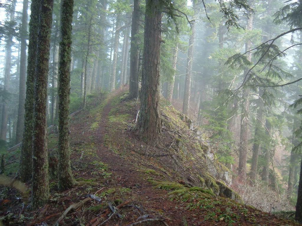
You are correct Rob. The photo was taken from the south slope of Whale Head going into a saddle north of Fish Creek Mtn. That particular area was logged and road built rather heavy and has since been decomissioned to help restore it. Where the trail was at that spot is anybody's guess, but it had to go through that saddle according to the old maps. I don't know if the trail had a number, for I have never seen one for that old abandoned trail. It started at Pup Crrek down on the Clackamas River, came over Whale Head and onto Fish Creek Mtn and south towards Thunder Mtn. Your turn to post a photo.
Whale Head?
You are correct Rob. The photo was taken from the south slope of Whale Head going into a saddle north of Fish Creek Mtn. That particular area was logged and road built rather heavy and has since been decomissioned to help restore it. Where the trail was at that spot is anybody's guess, but it had to go through that saddle according to the old maps. I don't know if the trail had a number, for I have never seen one for that old abandoned trail. It started at Pup Crrek down on the Clackamas River, came over Whale Head and onto Fish Creek Mtn and south towards Thunder Mtn. Your turn to post a photo.
R
Rob Williams said:
OK, a little bit more of a hint. This picture was taken at the end of this trail, near where the old lookout was.
Doug Firman said:Is that the trail that follows a bit of road near the top of Squaw Mountain?
A little too far north, but you are thinking correctly. It is a very similar looking spot.
OK, a little bit more of a hint. This picture was taken at the end of this trail, near where the old lookout was.
R
Rob Williams said:
Nobody has any guesses? Maybe the "What trail am I on?" is getting a little old.....
Doug Firman said:Is that the trail that follows a bit of road near the top of Squaw Mountain?
A little too far north, but you are thinking correctly. It is a very similar looking spot.
OK, a little bit more of a hint. This picture was taken at the end of this trail, near where the old lookout was.
Nobody has any guesses? Maybe the "What trail am I on?" is getting a little old.....
R
Mt. Lowe?
R
A little too far East....Another hint. The section of trail that takes you to this point is unmaintained. The first part of the trail is a maintained trail and relatively well traveled.
R
It's not S. Fork Mtn is it? That kind of looks like the spur road heading up.
R
We have a winner!!!! You may post a photo if you have any available....
R
See that is what threw me...I thought it was a trail you photographed. That, and the parallel "what trail is it" with Don! Ok then.
R
Well, it is technically at the end of the trail......Or at least that was my recollection. It was a while ago I was there.
R
D
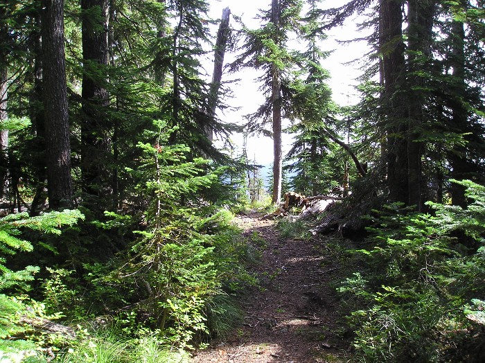
Is this the trail to Fish Creek Mountain?
R
It is! I thought it would be too easy, it's pretty distinctive. Often foggy up there too.
I have more mysterious photos, but they're at home. Next time.
D
This trail is located north of the previous trail that Bob posted. It's a listed FS trail, but probably lightly used.
R
518 Dry Ridge?
D
Robert Koscik said:
No, too far west.
518 Dry Ridge?
No, too far west.
R
Grouse Point?
D
Rob Williams said:
Nope. Still a bit too far west and north. But not too awfully far.
Grouse Point?
Nope. Still a bit too far west and north. But not too awfully far.
D
Doug, is that the Rimrock trail looking out at the road at the west trail head?
Log in to reply.