
What trail am I on?
D
I should have said it will go all the way to the Frazier Road once the middle 1-2 mile section is once again located.
D
Rob Williams said:
If that is the trail I think it is, it looks a lot sunnier and drier than the last time I saw it!Are you thinking about the time we waded through a river during a rainstorm and slushed our way back up 2000 feet. Then you would be right.
D
Let's hope it's not a future Missing Persons trail.
D.
R
Donald Presley said:
Are you thinking about the time we waded through a river during a rainstorm and slushed our way back up 2000 feet. Then you would be right.I actually forgot about wading through the river, but I certainly do remember the rain and the slog uphill that seemed to never end. I'm not sure I've ever been wetter. Well, maybe the Signal Buttes day.... OK, I'll guess - it must be the infamous Cougar Creek trail.
D
Rob, you are correct, it was on Cougar Creek Trail about 2 switchbacks down from the Abbot Road. Never made it out there this year, bummer! Have to wait for the snowmelt next spring for now.
Your turn to post a photo.
R
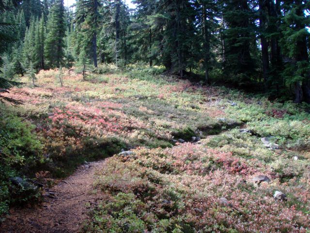
OK, here is a photo from a district trail. I'm not exactly sure which trail it was taken from - it is one of two - I will give credit for either trail name. I just like the photo:
D
Are we at about 4600 to 4800 feet?
R
I think it is a little higher - more like 5600' probably.
D
Would that be on the PCT by any chance?
R
Donald Presley said:
Would that be on the PCT by any chance?That would be one of the trails. I'm not sure if this was taken on the PCT or on a segment of the Skyline trail. It was near Pyramid Butte - there is a short section of Skyline trail in that area. I posted a photo of an old sign a while ago that was taken near where this photo was taken. That was too easy... Your turn.
D
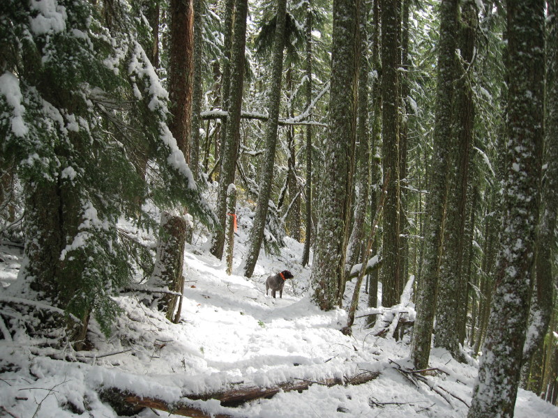
Here is a photo of a trail fresh from today's hike. I couldn't waste a sunny day, knowing that next week looks to be mostly wet, so I ran to the mountains and enjoyed the early snowfall in the mountains of the Clackamas. From the tracks in the snow, it looked like someone had beat me to the fresh snow, at least half way up the trail. Probably a late season deer hunter, for his tracks wandered around looking down into draws. Anyway from what I saw the deer were up the trail a little higher and even laying down in the tread on several occasions.
This is an abandoned trail in our district.
K
Well I'll take a guess. Is it the lower part of the Cripple Creek trail, between the river and the pipeline road?
D
Kirk it isn't the Cripple Creek Trail, but it does start at the river and goes up.
R
That post just doesn't look familiar to me. Got any hints or clues?
K
Donald Presley said:
Kirk it isn't the Cripple Creek Trail, but it does start at the river and goes up.Upriver from Cripple Creek or downriver?
D
Kirk, it is 10-12 miles up river from Cripple Creek.
Rob, this trail probably dropped out of service in the 50's when roads started to be built in the area.
K
Donald Presley said:
Kirk, it is 10-12 miles up river from Cripple Creek. Rob, this trail probably dropped out of service in the 50's when roads started to be built in the area.Somewhere around Switch Creek?
D
That would be correct Kirk. Almost as much snow as last winter when we where up there. The road up the Clackamas was mostly just wet, but there were a couple of icey spots in the shade of the canyon. This warm rain we have been having will probably be melting most of that snow that I was in on Sunday up on the trail.
D
I should have said," I missed you up on the trail', for it is a neat trail to hike with the snow. Your turn to post a photo taken from a trail in our district.
R
I've been up that trail a couple of times with you, but I don't ever remember seeing that post? Where is it?
Log in to reply.