
What trail am I on?
K
Donald Presley said:
Kirk, is that picture taken from the Rho Ridge Trail. I know that there were a lot of insulators on that trail?Yes Don, it is the Rho Ridge Trail - somewhere between Hawk Mtn. and Mt. Lowe. I thought I had taken more pictures of the insulators when we were out that way in September, but I only had pictures of two trees on my camera. Next time I'm on that trail I'm going to get a picture of the brown/white insulator I saw. Your turn.Don
D
Rho Ridge was that 12 miler we hiked last summer. I think I like the northend section of that trail better, Graham Pass north to Mt Lowe and beyond, for you can actually see some views from that end. I didn't take much for photos on that hike either, so I will have to get back out there again.
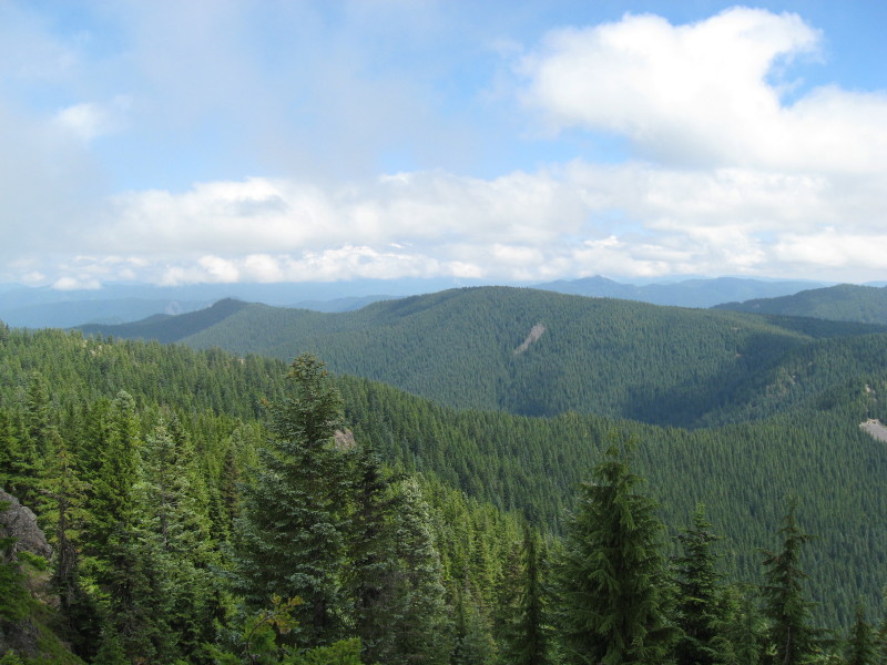
So here is a photo from a current district trail I hiked this summer:
K
Is that Olallie Butte in the distance?
D
Kirk Tolstrup said:
Is that Olallie Butte in the distance?No, but most of what you are viewing in the background is in a neighboring district.
D
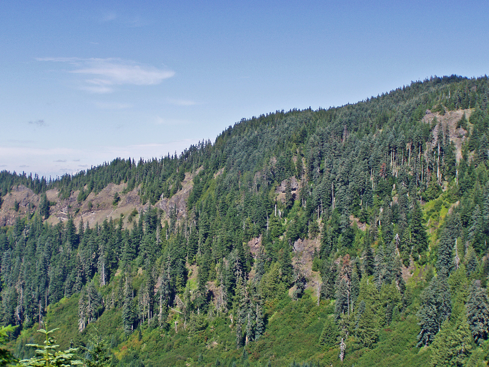
Not much response on this one! So here is another clue: The clouds cover a prominent mountain in our neck of the woods.
Don
D
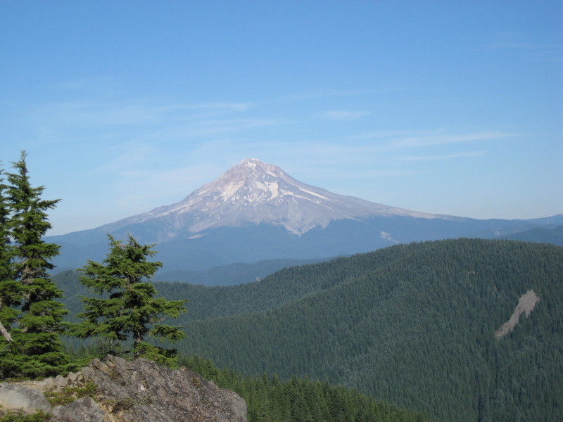
No takers! Here is a view from the same spot on a clear day, albeit zoomed in a little, the rockslide on the ridge is clearly recognizable.
D
Are you on Squaw Mountain?
D.
D
Donovan said:
Are you on Squaw Mountain? D.Bingo! We have a winner. I figured once I posted a clear view from the old lookout site on Tumala Mtn (Squaw Mtn) that it would be obvious to those who had been there. Your turn to post a photo. Don
D
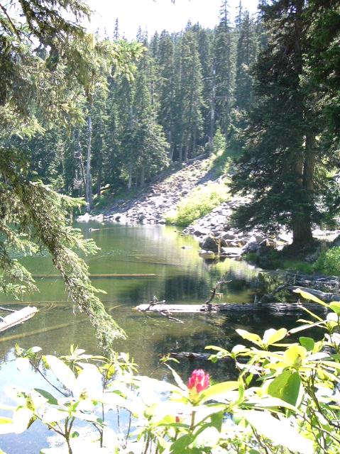 OK then. Here you go.
Donovan
OK then. Here you go.
DonovanR
That looks like high like from the backside.
D
I guess that was too easy.
You are up!
D
R
The tree by the base of the rockslide was the giveaway....Along with the rhodies.
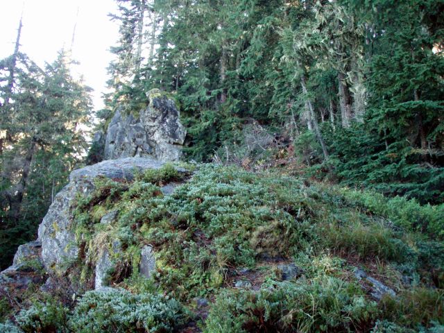
OK, here is an interesting rock formation on a current district trail. It is in a wilderness area.
D
Good one Rob! That rocky outcrop isn't jogging my memory. Would the trail in question be in the Bull of the Woods by chance?
Don
R
It would be in Bull of the Woods.
B
Would that be 550 - the trail to Bull itself?
R
That would be the one....
Your turn to post a photo
P.S. - Sorry for the brief interruption of the website. Things have been corrected now....
B
Someone among you may have seen this view before, but its a little out of the way and only a few will have. It is from on or near a long-abandoned once-official trail, which can be found on older maps.
 This trail to the south connects to another more recently abandoned trail, which further south has a goodly section which has been reopened only by volunteer workers, some of whom may be reading this.
This trail to the south connects to another more recently abandoned trail, which further south has a goodly section which has been reopened only by volunteer workers, some of whom may be reading this.R
Well, that view doesn't ring a bell with me, but your description sure has me intrigued. I'm interested to find out where this mystery trail is!
D
Kinda reminds me of Bracket Mountain over Lost Creek. Would be on the Old South Fork Trail.
That's my guess.
D.
B
That is kinda an excellent guess - what this means is you get to post the next poser!
This trail branches off of the June Lake - Baty Butte trail not long before it begins switchbacking onto Baty Butte itself. It was easy to see maybe 10-15 years back but now is obscure from lack of use. Some of the tread is still clearly visible once you head downhill to the north. I have followed it a ways down the Lost Creek headwall, but once you reach Lost Creek Meadows it's lost in the lush wetlands growth.
Log in to reply.