
What trail am I on?
R
So how long ago was that picture taken? I've only been to Baty Butte (itself) once. I've taken the Baty Butte trail south a couple of times. I'll have to scour some of the older maps to see where you are referring to.
Very cool!
K
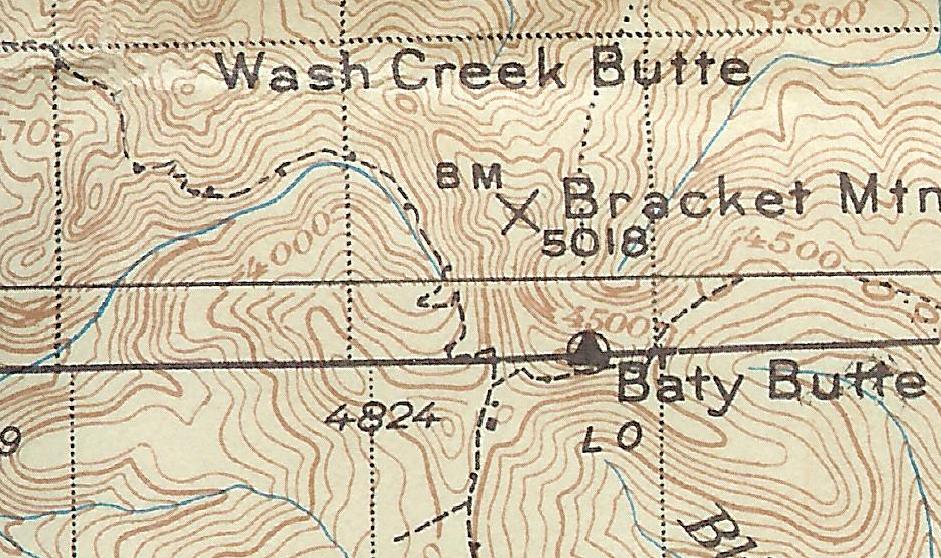
Here's a snippet from the '38 map. Maybe this is it:
D
 Here's another one for you all. What trail am I on?
D.
Here's another one for you all. What trail am I on?
D.D
That looks like "The Sounds of Two Rivers Trail" up on that flat bench with Burnt Granite in the background through the trees.
Don
B
That picture was taken August 31, 2007.
The snippet from the '38 map does show the trail well. It also shows what looks like a cabin and perhaps outhouse near the trail junction, which I have never noticed evidence for, but also never knew to look for it. It also shows a lookout on top of Baty Butte, and the only evidence I've seen for that is the phone wire coming from the north.
I've tried following the trail down the Lost Creek Headwall, but once you reach Lost Creek Meadows it disappears in the lush wetlands growth. Perhaps the trail north from the bottom of the canyon could be located.
D
Yes Don you are right Sounds of Two Rivers bench camp(?), but I am not sure that's BG in the distance, but rather simply high ground across the canyon. Tail of Whale maybe.
There is a distinct location at Baty Guard Station. The stove top remains in the fire pit. A rudimentary spring. A potty. And it seem to me there may have been a rudimentary shed for the horse.
In the 80s Lost Creek was stripped by the BLM. The slash burned so hot the soil was fried and eroded so heavily that the trail was obliterated. This info is from a relative who ride horse from Dodge to Bagby in the 70s. They tried it again but the logging spoiled the day. There are a few ribbons of timber where the trail has been found according to a friend along the bottom. I have looked hard for the switchbacks shown climbing the wall northbound from the saddle above. No trace. But from there north to South Fork Mountain there is much of it follow. It crosses the road many times. At Miners Butte it runs quite a ways below the road.
The Junction with the High Camp Trail is in a saddle but all cleared off ground.
Some older maps show the trail over Bracket Mountain. Several I know have scouted around up there but there is nothing definitive. It may have been faint anyway.
D.
D
Yeah I was mistaken about the background mountains, I guess I thought I was up on the Switch Creek trail. Both the Sounds and Switch Creek trails follow a ridge up out of the canyon and have a flat bench part way up.
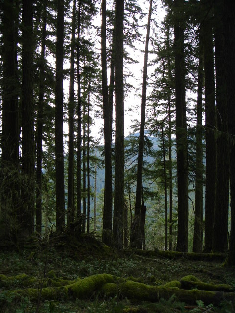
I have got to get some more photos of trails in our district, for I think I have exhausted my supply. I hope this photo of a current district trail isn't too easy:
K
That view looks a little familiar. Except, I think it was covered with snow when I saw it and I was with you and Rob. Have I been here with you when it was covered with snow? On second thought, I think I'm wrong because the shadows seem to be wrong.
R
I'm thinking that is the Fish Creek Mountain trail, on the old (original) part of the trail partway up. I remember a hillside meadow like in the photo.
D
Kirk Tolstrup said:
That view looks a little familiar. Except, I think it was covered with snow when I saw it and I was with you and Rob. Have I been here with you when it was covered with snow? On second thought, I think I'm wrong because the shadows seem to be wrong.I have never hiked this section of trail in the snow before, because you usually can't get to the trailhead in the winter. I usually get up there in May or June, and there is usually some snowdrifts up on top but not in the section of trail the photo was taken from. It was beautiful up the Clackamas today, no fog from the NorthFork reservoir upriver, but there were some icey spots in the canyon past Three Lynx that you had to pay attention to. It was a great day to get out in the woods. Don
D
Rob Williams said:
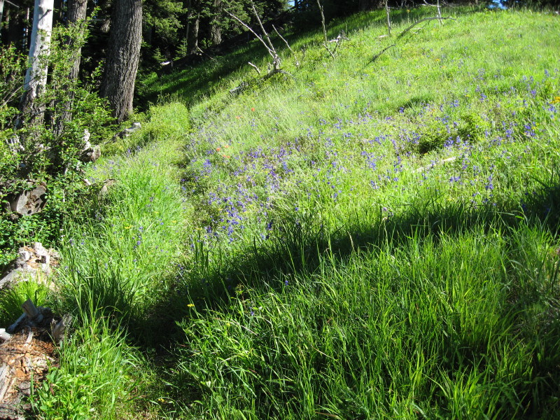
I'm thinking that is the Fish Creek Mountain trail, on the old (original) part of the trail partway up. I remember a hillside meadow like in the photo.You are correct Rob, it is the Fish Creek Mtn trail. That hillside meadow is one of my favorite spots to stop for a break and look at all the wildflowers that are always there. So it is your turn to post a photo.
R
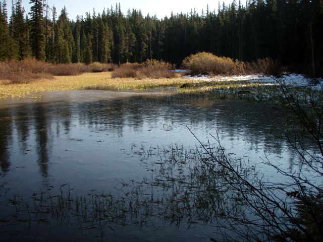
Well, I'm running out of good photos to post that aren't dupes, but here goes one.
K
I'll guess.... Cottonwood Meadows?
R
Good guess, but no. This is a wetlands area along a trail, but not the highlight of the trip.
D
Half way in to Cache Meadows?
D.
D
So this trail is in one of the new wilderness areas and has a pond or small lake next to it, but the main feature along the trail is something else.
I would have to say that that body of water looks like the one along the beginning of the Rimrock trail.
Don
R
Donald Presley said:
So this trail is in one of the new wilderness areas and has a pond or small lake next to it, but the main feature along the trail is something else. I would have to say that that body of water looks like the one along the beginning of the Rimrock trail. DonWe have a winner! The main feature on the Rimrock trail is the overlook - to me it is one of the most spectacular spots in the district, maybe only surpassed by Pyramid Butte.
D
Here is a photo of a trail junction on a current district trail that is in one of the new wilderness areas: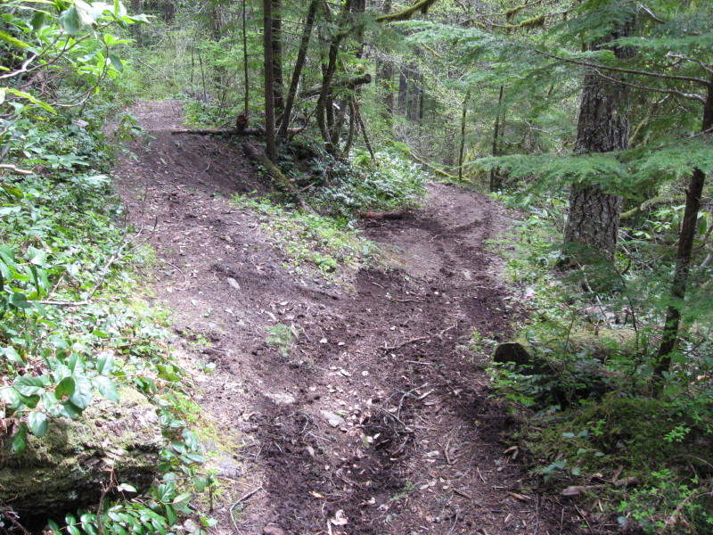
D
Nice.
D.
D
I don't know if you could makeout the tracks in the photo posted, but a motorcycle and a quad came through a few minutes ahead of us when we were hiking on this trail in a new wilderness area. Ignorance of the fact, that you can't use ATV's in a wilderness area is no excuse. The laws have changed in the forest, if it is not posted for ATV use, stay off the trail. I know it might take some time to get all the needed signs up and the ATV users to change their ways, but hopefully the damage to our trails will finally come to an end from this type of abuse.
Don
Log in to reply.