
What trail am I on?
R
I was going to let someone else make a guess, but since there hasn't been any posting, I'm going to guess that is the Huxley Lake trail. I haven't been up there in a couple of years, but that looks like the racetrack that the ATVs have made in that area. It is a shame, especially around Huxley Lake.
D
Huxley Lake trail it is. The ATV track this last spring seemed to be to ride down the 4611 road and come back the Huxley Lake trail and onto the Winslow Pit trail or whatever name that trail has, and back to the 4611 road. There was some clearing of the trail to Huxley Lake, but it wasn't finished and we decided not to cut it out either, in hopes of detering ATV's using the trail.
Your turn to post one.
D
A severe wind storm is what that trail needs.
D.
D
Why is it, some trails get all the attention of this age, while others are overcomed with rhodies and vine maple? I for one don't blame the trail, but those seekers who need to hike on them. Get out there and see nature and exercise that body we all have. I am in my mid 50's, but strive to get out almost every weekend. I am jealous of those retired folk who can hike any day of the week, for I must reserve myself to the weekend.
Don
R
I don't know the answer to your question, Don. I too and jealous of those who are retired that can go hiking any day of the week. I look forward to the day when I will be able to do that. I know I will be doing that today. Haven't quite decided where I will be going, but I will be breaking in my new pair of hiking boots that Santa brought me.
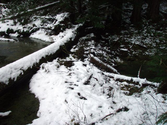
Since I guessed the last photo, here is another one. It is just off a current district trail. Hopefully it isn't too easy.
D
Sorry about that late night, holiday cheer induced ramble I posted. I was lamenting the fact that I wouldn't be going hiking today because of a change in plans.
Is that a picture of a beaver dam across a creek?
R
Yes, that is a beaver dam across a creek. I have a feeling you know where the photo was taken....I did go hiking today and will post about it in a different thread.
R
Well, no one has guessed, so either it isn't as easy as I thought, or no one wants to guess since they have no photos to post.....
Another clue - it is a very short trail and well used.
K
Is this trail in a "flat" area?
R
Yes
D
Does this trail have a lot of water crossings?
K
Okay, I'll guess the Alder Flat Trail #574.
R
Kirk Tolstrup said:
Okay, I'll guess the Alder Flat Trail #574.You would be correct!
K
Here's a picture from a trail with expansive views. Maybe there are a lot of these markers around? I don't know.
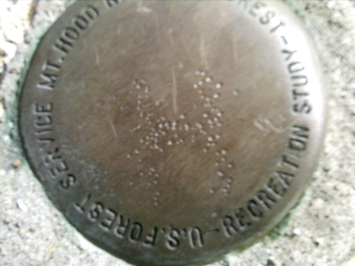 Sorry about the poor focus. What can I say, I'm not a good photographer.
Sorry about the poor focus. What can I say, I'm not a good photographer.D
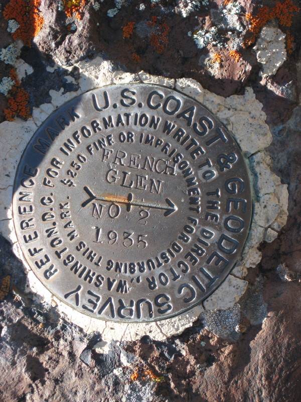
Kirk, I can't say I have seen one those markers before put in by the FS. It must be a boundary marker. Is the trail in question perhaps on an wilderness boundary? It doesn't look like they even stamped it like is usually done on section markers by the USGS or an earlier marker I found out by French Glen in SE Oregon by the US Coast & Geoditic Survey:
K
The trail is in a wilderness, and this marker is about 2000', as the crow flies, from the wilderness boundary. I wish my picture would have turned out as sharp as yours.
R
Is this marker on a peak of a former lookout?
K
Yes I believe there was a LO located there at one time. It appears that the LO used to be outside of the wilderness area before it was a wilderness area. (How's that for an arcane clue?)
D
Would the wilderness area be the Roaring River Wilderness?
K
No not that one. The location of this LO used to be just outside what used to be called a primitive area in the '30s. Now it is just inside the wilderness area.
Log in to reply.