
What trail am I on?
R
I'm not sure, but I think it was taken in the evening.
D
Rob, I am seeing burnt trees on the rocky ridge, is this in the Bull of the Woods?
R
Donald Presley said:
Rob, I am seeing burnt trees on the rocky ridge, is this in the Bull of the Woods?Yes
R
OK, no guesses yet, so another clue. This was taken from a lake in the Bull of the Woods wilderness.
D
I will make a guess, because it doesn't look familiar to me. How about the Welcome Lakes Trail.
P
Rob Williams said:
OK, no guesses yet, so another clue. This was taken from a lake in the Bull of the Woods wilderness.Here's a guess, photo was taken from Big Slide Lake off the Dickey Creek Trail looking up at Big Slide Mtn. –Paul
R
Paul Turner said:
Here"s a guess, photo was taken from Big Slide Lake off the Dickey Creek Trail looking up at Big Slide Mtn.We have a winner! Nice Pull! Your turn to post a photo....
P
This one is a gimme for somebody. This photo is from my 1st hike of 2012 done New Year's Day and is from a trail in a new wilderness area. What trail am I on?

D
Would that be on the "Mile Post 3 trail" that goes up to the Rimrock trail?
P
Donald Presley said:
Would that be on the "Mile Post 3 trail" that goes up to the Rimrock trail?Yes indeed, you may proceed... --Paul
D
Paul, how was the trail? I haven't been on that one so far this year. That was some of Eric's handiwork in that logcut.
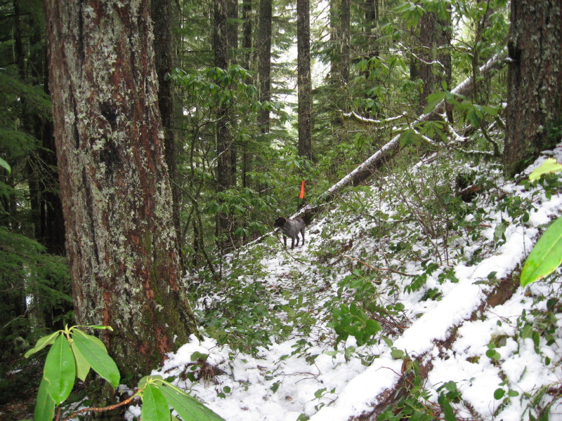
Here is a photo of a fairly new found lost segment of a current district trail that isn't in a wilderness area:
P
Donald Presley said:
Paul, how was the trail? I haven't been on that one so far this year. That was some of Eric's handiwork in that logcut. [...]The trail is in good shape, I seem to recall a smaller stem or 2 on trail near the top. --Paul
D
Paul Turner said:
The trail is in good shape, I seem to recall a smaller stem or 2 on trail near the top. –PaulThanks for the info Paul, I thought Eric had cutout the big tree that had come down. Well seeing how there have been no quesses on the new photo, I will give another hint. This trail was one of the routes of the Skyline Trail.
D
Kinda looks like the new query climbs rather dramatically out of a major canyon?
D
D
Yeah, it does and it is on one of those unnamed creeks that is totally wrong on our district map and every map that I have seen, even Google or any current topo. That is why this trail segment was so hard to find in the first place. I suppose this creek could have been on where our current map shows it maybe 60 years ago, but doesn't anybody ever check this s*%$ out before they print it. Hello!
Don
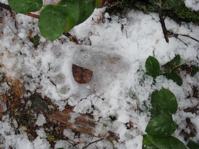
Here is another photo from the same area, but looking down at the trail. I think maybe a small Yeti or baby Bigfoot or just a bear or a wide footed juvenile Portland jogger in those new "toosey socks".
R
Don:
Is this new found segment in a rocky, old burned area?
D
Rob Williams said:
Don: Is this new found segment in a rocky, old burned area? What type of rock are you thinking of?
R
Some really hard type of rock, maybe?
K
The suspense is killing me. Spit it out already!
D
OK, OK! The lower segment of the Burnt Granite Trail from Big Bottom up to the 4650 130 spur road. Hadn't finished looking for the last piece above the 130 road to the trailhead, because the snow has pushed me back down river.
Rob, your turn to post one.
Don
Log in to reply.