
What trail am I on?
D
I think you are on Fish Creek Mountain a short ways before the summit.
D.
B
Rhododendron Ridge it is. It formerly was part of the Pacific Crest Trail, so was once famous; it was abandoned by the Forest Service for some years following extensive roading 0f the area; now it has some signage and is an official trail. But very few folks seem to use it.
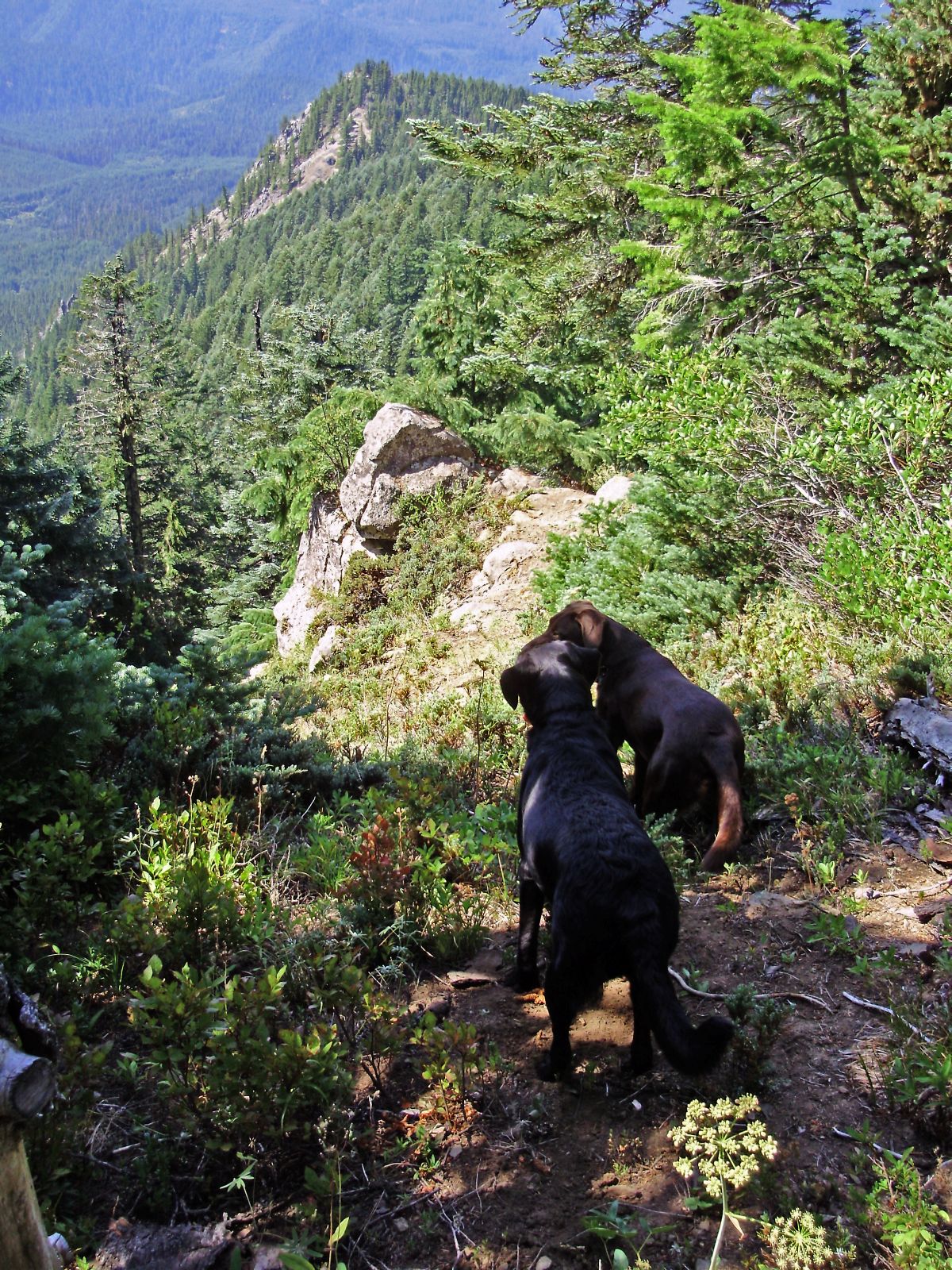
The location is a little ways south of Mount Lowe to the right of the trail as you head south. It is hard to tell from the trail that its worth the few steps over. Actually my dogs found this viewpoint; when I first got there they were still taking it all in.
Bryon
D
 I just hiked the whole length of the Rho Ridge Trail last fall with Rob and Kirk. I had been on several portions of the the trail in the past, mostly Mount Lowe and Hawk Mtn, but had never done the whole trail until last fall. There were logs to climb over, but there seemed to be less than 30, if I remember right. Will have to get that cutout next year.
The clues I got out of your photo was that slide scar on the ridge above the Dickey Creek trailhead and of course the powerline track going over the far ridge.
Now I have got to look for something to post, that's the hard part.
This one might work, it is a current trail in a new wilderness:
I just hiked the whole length of the Rho Ridge Trail last fall with Rob and Kirk. I had been on several portions of the the trail in the past, mostly Mount Lowe and Hawk Mtn, but had never done the whole trail until last fall. There were logs to climb over, but there seemed to be less than 30, if I remember right. Will have to get that cutout next year.
The clues I got out of your photo was that slide scar on the ridge above the Dickey Creek trailhead and of course the powerline track going over the far ridge.
Now I have got to look for something to post, that's the hard part.
This one might work, it is a current trail in a new wilderness:M
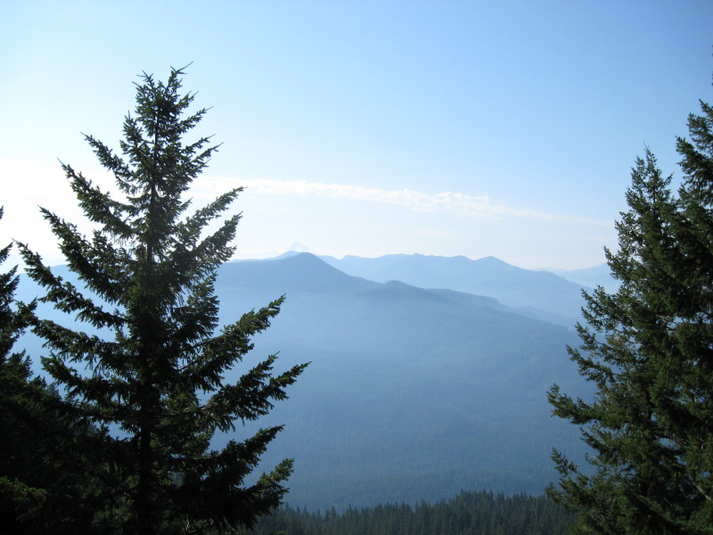
Is that a look out to Mount Jefferson from the Mount Mitchell Trail?
D
Matt Reeder said
Is that a look out to Mount Jefferson from the Mount Mitchell Trail?It is from the Rimrock Trail with Oak Grove Butte blocking most of Mt Jefferson in the background with smoke from the Bull of the Woods fires last fall. So you are correct. Your turn to post. Don
M
Donald Presley said

Matt Reeder saidYou know, I only got that because I went up there last fall during all the fires. I took a guess because it looked so similar to my photos from that day. You guys will probably get this really fast, but what the hey...you'll guess everything else I have too within a day or two.Is that a look out to Mount Jefferson from the Mount Mitchell Trail?It is from the Rimrock Trail with Oak Grove Butte blocking most of Mt Jefferson in the background with smoke from the Bull of the Woods fires last fall. So you are correct. Your turn to post. Don
B
Pretty generic, could be any of several high elevation sidehill trails, but I will guess its on the one from Baty Butte to June Lake.
Bryon
D
I also think Baty Butte, but not towards Joyce Lake, but rather on the east side of the butte, dropping down to the ridge towards Skookum.
D.
M
Donovan said
I also think Baty Butte, but not towards Joyce Lake, but rather on the east side of the butte, dropping down to the ridge towards Skookum. D.We have a winner.Your turn! Also: how are the roads to the other Baty Butte trailheads? I've only been there via Skookum Lake and would love to hike the trail from the other end.
R
Matt Reeder said
Also: how are the roads to the other Baty Butte trailheads? I've only been there via Skookum Lake and would love to hike the trail from the other end.We were there last year (I think it was last year) and the 7010 road was washed out at Blister Creek. They were working on fixing it, but I don't know what the status is. The washout was not on the FS website. Other than the washout, the roads are pretty good. There is one partial washout you need to be careful of on 7010, but most of the road is in exceptionally good shape. The 160 spur is in GREAT shape. It doesn't really seem like a spur road....
D
Rob Williams said
The other end can be reached by heading up the Molalla River instead. DMatt Reeder saidAlso: how are the roads to the other Baty Butte trailheads? I've only been there via Skookum Lake and would love to hike the trail from the other end.We were there last year (I think it was last year) and the 7010 road was washed out at Blister Creek. They were working on fixing it, but I don't know what the status is. The washout was not on the FS website. Other than the washout, the roads are pretty good. There is one partial washout you need to be careful of on 7010, but most of the road is in exceptionally good shape. The 160 spur is in GREAT shape. It doesn't really seem like a spur road....
R
Donovan said The other end can be reached by heading up the Molalla River instead. DWe thought about going around that way, but it is a LONG drive.....But in retrospect, it would have probably been shorter than what we did.
B
The distance up the Molalla isn't all that much further, and the road is either paved or good gravel to the trailhead. And you start hiking at around 4200 which is a benefit.
There is a good section of abandoned trail on the way to Thunder Mountain or Skookum Lake if you do not want to follow the former road. This trail and the road can make a loop for a day hike.
On the Molalla Forest Road continue past the Table Rock turnoff to where the blocked Lost Creek Road comes in and take the right over the creek and look for a Y intersection on the left. Keep on the main route; it tops out at 4500 and drops from there to the trailhead. It is not marked and difficult to spot; look for a broad spot in the road giving room for maybe 3 cars to park on the left. Trail is on the right.
Bryon
R
I didn't state that very well. It isn't a long drive if that is your destination, but if you are on road 7010, find out it is washed out, and want to drive all the way over to the Molalla side, THAT is a long drive.
M
Thanks guys! I have this on my summer wishlist now. It looks like a great trail. I really liked the section I got to hike.
R
Donovan, when are you going to post a new photo? I'm curious to see what you might dig up.....
D
Rob Williams said Donovan, when are you going to post a new photo? I'm curious to see what you might dig up.....What? it's my turn? Oh. I'll see what I can find.
D
 OK here you go.
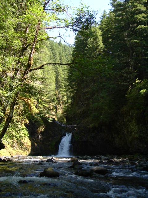
What trail was I on ?
D
OK here you go.
What trail was I on ?
DR
Hmmmm, that kind of looks like the south fork. Is this on a current trail or an abandoned trail, or off trail?
D
It's slightly upstream of a current trail crossing.
D.
Log in to reply.