
What Trail am I am - Fall Edition
D
Some clue D. I was thinking that is was the Alder Flat Trail before the plaque, but now I am not sure. You say Riverside, maybe? I need to get out for a walk this weekend and the snow level is suppose to come down to 2000', so those trails maybe good prospects for an outing anyway. I said walk and not a hike, for these trails are basically flat with little elevation gain, but will get you next to the Clackamas River. When the snows really come down low, these trails can be a delight on showshoes when the conditions are right and you can get there.
Don
R
So where does that leave this clue? No one has posted anything in a while? Did anyone go take a look at the Riverside and/or Alder flat trails to see if they could reproduce it?
Just curious....The silence is deafening!
D
Like I said, it was in my file of Riverside pictures, but it pends verification.
D.
R
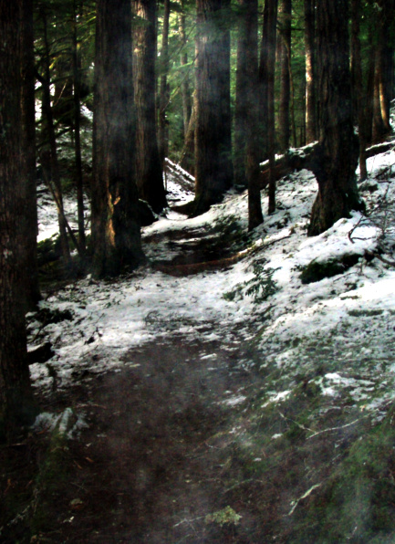
Well, no one seemed to want to go check this out, and I really wanted to get out in the woods today, so I went and validated where this is. I'm very sure Donovan's notes were correct. I think my photo was taken just about where his was (within a few feet, anyway). You can see the downed log on the right (under the snow) and the large downed log in the background on the right. The photo was taken on the Riverside trail near where the Boy Scout bridge used to be (more on that in a moment) Here is my photo - please excuse the "smoky" effect - I'm not sure what it was from - maybe my breath or something, but this was the photo most like the one Donovan posted:
 So, the next thing in the boy scout bridge over tag creek. I thought it was over Tag creek, and looked back at the last time I hiked Riverside (2008) and I found this photo of that bridge - at that time the handrails were coming off:
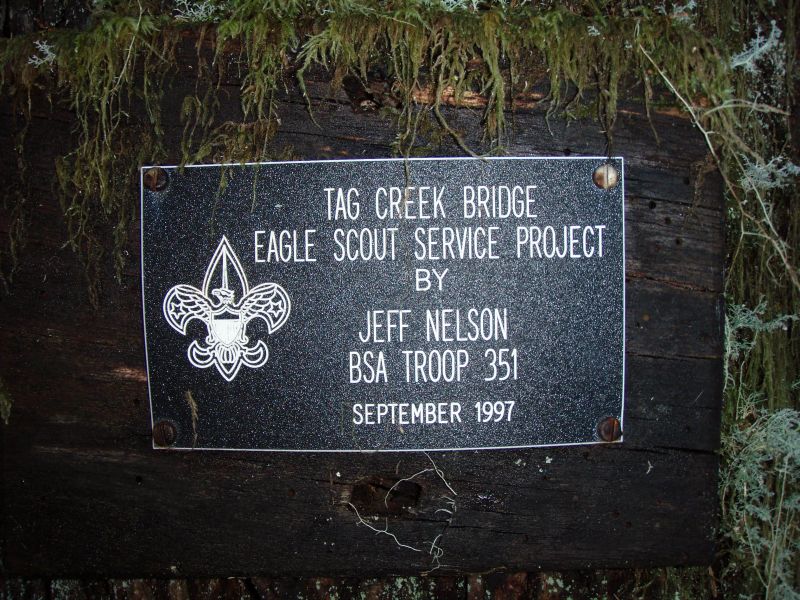
 Here is the nameplate that identified it as a Boy Scout Eagle Project that was lying on the ground on one end of the bridge (the wood had rotted and fallen off a tree).
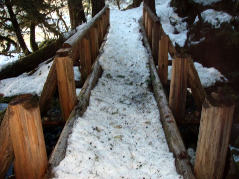
 Here is the "new" bridge - I could see remnants of the old bridge in the creek:
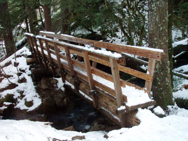 I think it is kind of sad that old Boy Scout bridge was replaced. I'm a bit surprised it lasted less than 15 years - it looked to be pretty stout to me.
So, the next thing in the boy scout bridge over tag creek. I thought it was over Tag creek, and looked back at the last time I hiked Riverside (2008) and I found this photo of that bridge - at that time the handrails were coming off:
Here is the nameplate that identified it as a Boy Scout Eagle Project that was lying on the ground on one end of the bridge (the wood had rotted and fallen off a tree).
Here is the "new" bridge - I could see remnants of the old bridge in the creek:
I think it is kind of sad that old Boy Scout bridge was replaced. I'm a bit surprised it lasted less than 15 years - it looked to be pretty stout to me.
D
Thanks Rob for checking that trail out. I was going to go up the river tomorrow and was thinking of doing the Riverside Trail to see if that was the trail in question, but now I can go somewhere else. I will probably go on an abandoned trail so that I can climb out of canyon and Murphy can play in the snow.
How deep was the snow? I was thinking of throwing in my snowshoes or crosscountry skis just in case I would get a chance to use them. This will probably be my last hike for awhile, so I thought I would make the most of it.
Don
D
Sweet! You found the spot!
The boy scout bridge. I am sad to see the work we did fixing the rail so quickly discarded. It was fun to peel the cedar and make a near perfect match.
At that time they were on a bridge kick. Didn't do any we really needed like Salmon River or Roaring River. It may have been a spend it or loose it (the money) situation. And an easy project close to a road.
So that makes you the winner I believe. And you know what that means.
D
R
Alder Flat had almost no snow (just a dusting in places - most of it was bare). Riverside was anything from bare to 4-6" or so in spots - but those were usually in more open areas. The road was single track to the Riverside trailhead, but you can pull over in something with high clearance (and 4WD). The snow on the road and at the trailhead was probably 10" or so. Maybe not quite that deep, but it was deep enough.....
I'll go find a photo to post now.
R
OK, I found a photo. This photo was taken while standing in the middle of a current district trail. It is near (but not in) a wilderness area (I don't think).
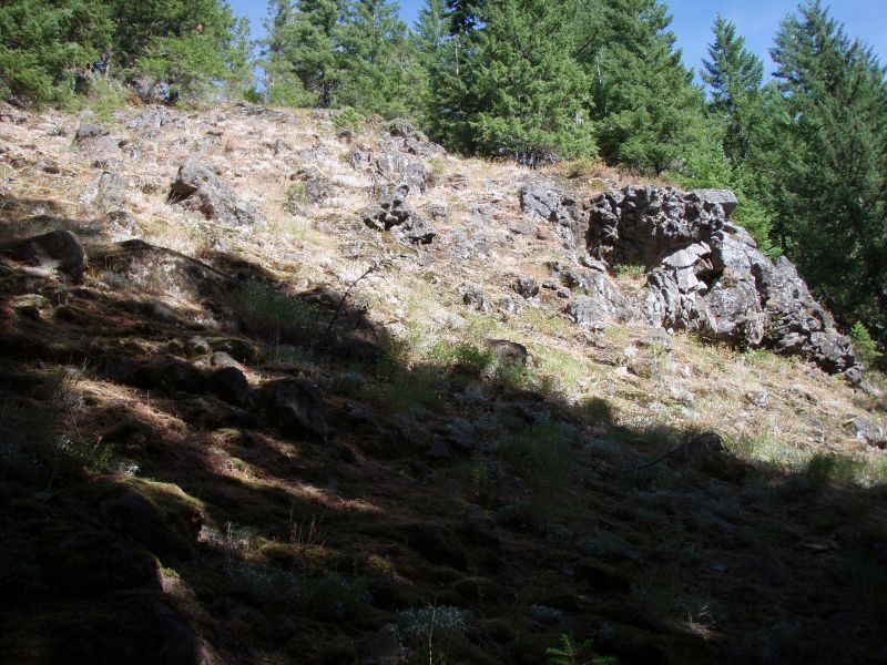 What trail was I standing on when I took this photo?
What trail was I standing on when I took this photo?D
Kinda hate to guess 'cuz I am short on pictures in case I win, but here it goes:
Just short of summit South Fork Mountain from Memaloose Lake?
D
R
You are too far south. I took a good look at the map, and I was (partially mistaken). Part of this trail in indeed in a wilderness area, however the part where this was taken is not in a wilderness area (I'm pretty sure - how is that for conviction?)
R
Nobody wants to guess?
D
How about Name Change Mountain?
D
R
Donovan said How about Name Change Mountain?Well that isn't the name of a trail.....But I'm pretty sure you know where this is - so what is the trail near name change mountain?
D
I suppose it is between Squaw Mtn and Twin Springs?
I do recall rock outcrops with occasional interesting flora but this doesn't completely look the same.
D.
R
Donovan said I suppose it is between Squaw Mtn and Twin Springs? I do recall rock outcrops with occasional interesting flora but this doesn't completely look the same.You are correct! It was taken on the east end of the Old Baldy trail which I don't believe is in a wilderness area. You may post another photo, or maybe it is time to give the "what trail am I on" a rest for a while. Based on the lack of responses, it seems the interest doesn't seem to be too high....
R
It's winter and all the bears are hibernating. Woods? Too cold and wet I'm going back to sleep.
We camped at Pot Creek for the Solstice, tons of wet snow. Come on spring! Bleu skies seem like a distant dream...6 more months until the high country?!!?! Bah.
R
What better time to review maps, make plans for the upcoming nice weather and review places other people might not have seen before?
I think wintertime is the BEST time to do stuff like this...
FYI, I went up to the gorge on the 1st and explored the old log flume in WA across from Hood River. An interesting piece of history. If you are interested, you should go soon - the flume is very quickly being reclaimed by nature. I want to go back when there is no snow and do a little more exploration.
R
Allow me to put one up, step aside nothing to see here...well except for the photo.
This is in a wilderness area I'm pretty sure at least.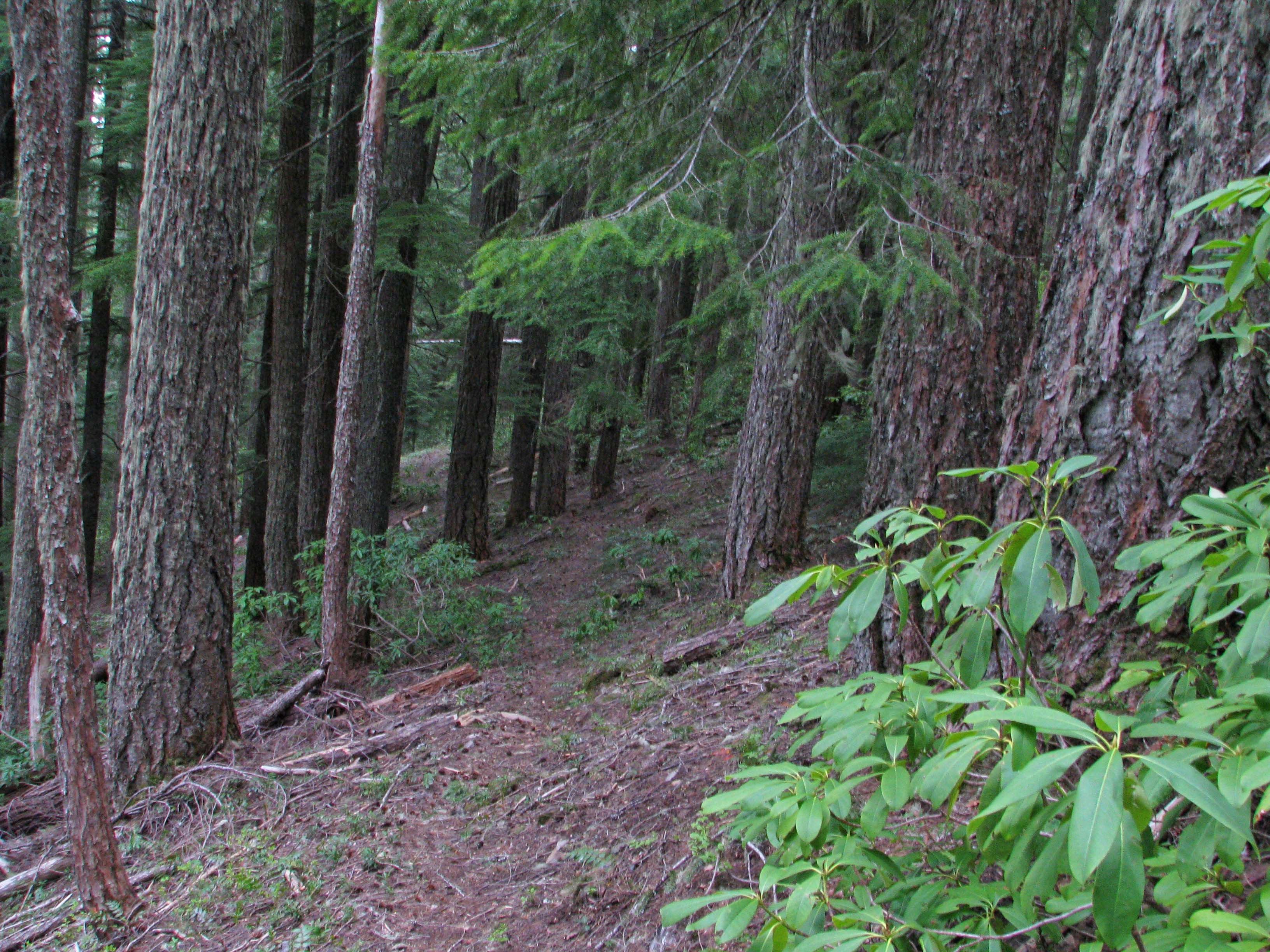
D
Bob, would that be the lower end of the Cottonwood Meadows Trail? I know it kind of looks like that and it is in a wilderness area now.
Don
R
It is...boy you sure don't mess around. YOUR turn.
Log in to reply.