
What trail am I on?
K
If you're a student of latin etymology and binomial names, that will help you decipher the tenuous clue. I can't give you a clue to the genus because that would make it way too easy.
R
OK, apparently everyone is stumped. Another clue - this is a semi-official trail (part of the trail appears on some maps but not others). It is listed on the trailadvocate.org trail pages, however.
K
I don't think we've reached twenty clues yet. But in that vein, here's another clue: The name of the trail doesn't contain an animal or a mineral.
R
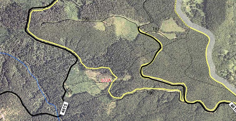
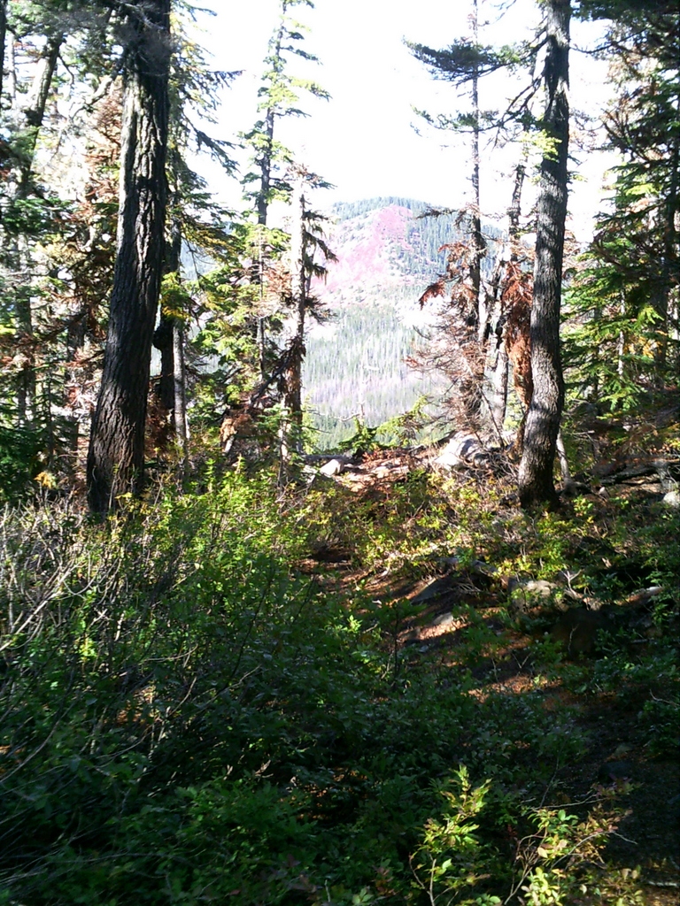
Well, it seems interest in this trail has slipped, so I'll give everyone the answer. This photo was taken on the White Iris (502-A) trail right where it meets the 4614 road. The un-named creek flows under the road at that point and the trail continues on the other side.
If anyone would like to post a new "what trail am I on" photo, please feel free to do so. Personally, I really like seeing photos from district trails. Many time I see things I never saw when hiking the trail. Even better when it is an undiscovered (to me) trail.
D
I thought that is a new widerness. So confusing.
D.
R
Maybe it is. I can't keep all of the wilderness areas straight! I just looked at the wilderness maps here on the site, and if I am reading them correctly, the beginning of White Iris is in the Eagle Creek Wilderness area, but before it hits the 4615 road, it exits the wilderness. But you are correct, the portion where it crosses the 4614 road is part of the wilderness area.
I didn't realize that area was wilderness....I've added the Eagle Creek wilderness map to the site here.
K
It's kind of tricky whether to call it wilderness or not. If I remember correctly, we were pretty close to the road when that picture was taken. How far do you have to be from the road before you would consider yourself in the wilderness area?
R
If I'm reading the map correctly, I think the trail exits the wilderness about the place where that large tree is (where we lost the trail). The crossing at 4614 looks like it is in the wilderness, which sounds really weird - there is a road running through the middle of a wilderness area? And a paved road at that? Am I mis-reading the map? Does it look like the 4614 road is a sliver of "non wilderness" area right in the middle of the wilderness?
K
Yeah, I've noticed that with the expansions of the wilderness areas that there will be an existing road that's left as an access sometimes. For example the road into Frazier Turnaround, and the road to Grouse Point trailhead.
D
I think you guys need to enjoy those roads while you can. They may be waiting on new additional funding to rip them. A long wait hopefully.
One good thing about those in close wildernesses, is that they might be more likely to dowse the fires when flames and smoke are visible from Portland, hence perhaps to keep the roads.
D.
B
If anyone would like to post a new "what trail am I on" photo, please feel free to do so.OK, here goes! This longish trail now sees little traffic, but was once a main hoof and foot route. Bryon
K
Well, I'll take a stab at it. Is it Rho Ridge?
D
The powers that be were really grasping for land when the new wilderness additions were made into law. Clearcuts, paved and gravel roads are not wilderness attributes, but that didn't stop them from added the areas to the wilderness system. Maybe the roads will be decommissioned, but the clearcuts will take 100's of years to dissolve into the woodwork.
I believe about 2/3 of the White Iris trail is in the new wilderness addition to the Salmon-Huckleberry Wilderness, just that bottom end is out in the clearcut with the big blowdown trees you have to climb over is out of the boundary.
Won't it be nice to have a new district map with the wilderness boundaries marked on it. What do think, maybe 5 more years before they issue a new map. While on vacation within the last month I stopped by the Forest Service office in Lakeview, Oregon and bought their most current map, a 1995 edition. 17 years old is current. Our 2002 edition map of our district, being 10 years old, isn't looking bad in comparison. I bet they are waiting until they decommission all of those roads so that won't have to draw them on the new map. I know I am off subject, but hey you gotta vent.
Bryon would that new trail listed be the Rho Ridge Trail?
D
I guess Kirk beat me to the punchline by 3 minutes while I was venting. That does look like Rho Ridge.
Don
B
kirk said Well, I'll take a stab at it. Is it Rho Ridge?Yes - and the award is....your turn to post! Bryon
K
K
I tried to upload the picture, but it doesn't seem to have worked. I was using Firefox, this time I'll try Chrome.
K
I guess I need a tutorial.  This picture uploading doesn't seem to be working no matter what browser I use.
  HELP ME!
K
Okay, after Rob's tender ministration, it should work this time.
 Yay! It worked this time.
Yay! It worked this time.R
kirk said Okay, after Rob's ministration, it should work this time.If anyone is interested in the resolution - After some research, I found an irritating "feature" of the forum. Apparently it is case sensitive on the extensions that it will allow. It was setup to allow images with jpg, jpeg, gif and png extensions, which is all of the typical image (photo) types. What I didn't know is that if the file had an uppercase extension (.JPG, JPEG, .GIF, .PNG), it would get rejected as an invalid file type. I added the uppercase extensions as valid file types so we shouldn't run into that issue again, but if anyone tries to add a .Jpg or .jPg or .jpG file, you will get an "invalid file type" error when uploading. Now, back to the "what trail am I on" game.....
Log in to reply.