
What trail am I on?
K
Donald Presley said This looks to be in the area of the current fire closure south of Olallie? DonYou are correct! Not to be a stickler or anything, can you tell us which of the many trails south of Olallie it is? And you'll get an extra gold star if you can guess which trail junctions this segment is between.
D
How about on the PCT between Horseshoe Lake and Gibson Lake trails?
This is totally a guess, for I haven't been there.
Don
K
Donald Presley said How about on the PCT between Horseshoe Lake and Gibson Lake trails? This is totally a guess, for I haven't been there. DonRight trail, wrong segment, you won't see a vista like this on that segment of trail. You'll need to think primitively to get the correct segment of trail.
B
My turn for a wild stab at it - between the two forks of 740 that go to Pyramid Butte
Bryon
K
Bryon Boyce said My turn for a wild stab at it - between the two forks of 740 that go to Pyramid Butte BryonExactly! I didn't know the Pyramid Butte loop had a number designation. Is it on one of the older maps? Your turn!
B
I found it on Green Trails and also on Accuterra on my iPhone.
Again, I've never made it to Pyramid Butte though its been on my list but looks like it'll be next year with the fire closures.
Your two junctions clue narrowed it down and I used Google Earth to find terrain that matched your picture. Bingo!
Very busy today so I'll post a new picture tomorrow.
Bryon
B
I'm assuming someone has hiked along this district trail and will get this one right away.
If not, there will be clues.
Bryon
D
That looks like the Cottonwood Meadows Trail 705?
Don
D
Horseshoe Saddle.
D.
B
It may look like Cottonwood Meadows Trail, but its some miles away.
I had to look up the Horseshoe Saddle Trail, as I've never been there. Looks like one I'll have to try once the fires are gone. The picture on the trail guide has very similar huckleberry fall color, but is even more miles from the trail in question.
The trail is between these two guesses.
The trail at this point is approaching a lake. The lake is nearly 4200 ft.
I've always assumed this was a maintained trail, as its in better shape than many that are. However, it does not show on Green Trails, the USFS maps for 1993 or 1987, though it is on the 1946 but without a number. It also does not show up on Accuterra which is unusual as it includes many abandoned trails. So I'm afraid this is another abandoned, no longer official trail lost to roading that was already present in the 1946 map.
Bryon
D
That wouldn't be near Summit Lake, would it? I have been on one abandoned trail near the lake heading south towards Warms Springs Meadow, but I know there are others in the area that I haven't been on.
Don
B
Donald Presley said That wouldn't be near Summit Lake, would it? I have been on one abandoned trail near the lake heading south towards Warms Springs Meadow, but I know there are others in the area that I haven't been on. DonThat would be near Summit Lake, wouldn't it! You win. Looking at the 1935 MHNF map, I see 7 north-south trails within 5 miles east and west of Summit Lake. The one in question went to Warm Springs Meadows and on south into the Olallie Highlands. Bryon
D
Someone still needs to follow that one out to the road. It gets thin on top and dies in a cut.
Meanwhile, I think you boys need to go find Dry Spring and see what's in the vicinity trail wise. I have never had the opportunity. Take pictures.
I have looked hard for trail from Summit heading east to Dry Spring but couldn't find it.
D
D
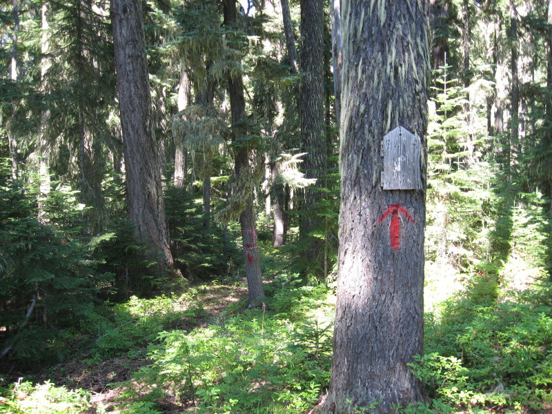
I hope to get out to the Pinheads and Summit Lake area next week and do some exploring when I am on vacation looking for versions of the Skyline Trail as well as others. Here is photo of an abandoned trail I recently located as some other people have found also painting the blazes in red paint. The pink and black flagging is from the FS archaeologist who is also trying to locate some of the old trails. Don
D
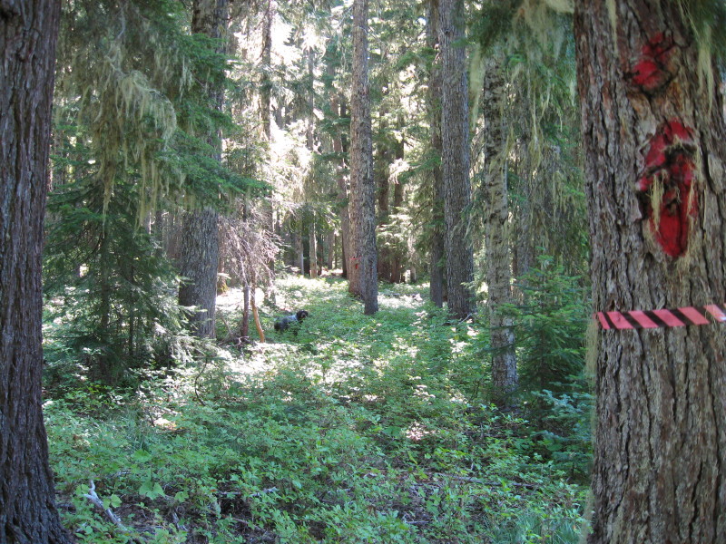
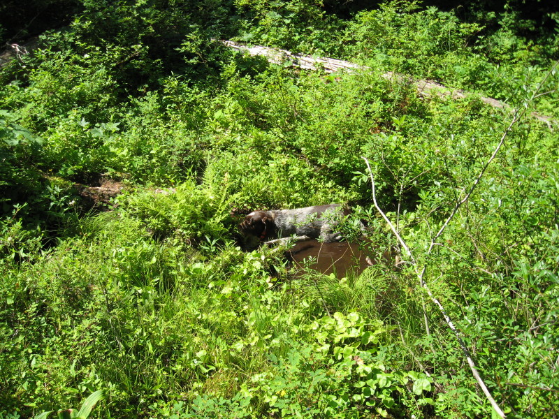
Here are a couple of more photos of the abandoned trail. Most of the trail down to the Clackamas River got logged, but I am sure there are more segments like this one, which is only about 200 yards long, still exist out there. The trail goes by a spring, who's name would give the trail's name away, so I am not mentioning it here. Murphy, my ever present companion out in the woods, likes finding those springs or small creeks out there in the summer time to cool off in.
Don
D
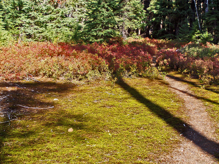
How are the Huckleberries doing anyhow?
Nice spring. Much flow?
That red is at the beginning of Rho Creek too.
D.
R
Wow, I go away for a couple of days to camp with my daughter, and all sorts of old trails are popping up!
The huckleberries are starting to get ripe in a few places. We were on the Rimrock trail and a few spots had bushes with berries - the ones that did had nice ripe berries. YUM!
D
The huckleberries are starting to ripen. I was eating some from the bushes near the spring in the photo. I haven't been to some of my usual berry picking spots yet. The ones that I have seen, seem to be hit and miss. Some areas with fully ripe ones, while in other areas they are small and green or non-existant.
The trail in question starts out around 2200 feet at the Clackamas River and reaches 4200 feet in the area of the spring.
Don
B
This seems to be the off-year for huckleberries, they are both late and scarce.I havn't seen an area yet with a good crop.  Bryon
Bryon
R
Bryon Boyce said This seems to be the off-year for huckleberries, they are both late and scarce.I havn't seen an area yet with a good crop.I thought last year was MUCH worse, as we had such a late spring and lots of late snowfall.
Log in to reply.