
What trail am I on?
P
Donald Presley said:
Very close...
Would that be the Burnt Granite Trail #595 ?
Very close...
P
Donovan said:
That is Mount Mitchel in the center, and on the far right are 2 bumps, is one of them Signal Buttes and the other High Rock? Now that you mention it I might have stepped off the trail a few feet. Not sure about the last one, not on my map anyway... --Paul
Are we looking at Mt Mitchell center, Signal Buttes to the right, and are you on a trail? And McLaughlin Blvd does not run to the top of it?
That is Mount Mitchel in the center, and on the far right are 2 bumps, is one of them Signal Buttes and the other High Rock? Now that you mention it I might have stepped off the trail a few feet. Not sure about the last one, not on my map anyway... --Paul
B
The old lower elevation trail from Burnt Granite to Rhododendron Meadows and Fadeaway Springs
P
Bryon Boyce said:
No but interesting, I see that trail on the 1938 map, is there anything left of it? --Paul
The old lower elevation trail from Burnt Granite to Rhododendron Meadows and Fadeaway Springs
No but interesting, I see that trail on the 1938 map, is there anything left of it? --Paul
B
Road 4670 may have covered a little of it, and logging probably eliminated more.
But for the most part judging from the 1946 Mount Hood National Forest map the roads avoided the old trail. A couple of spur road may be close to or on its route.
Trail 569, Rhododendron Creek, still exists, which the old trail connected to.
If this trail could be recovered, it would form a loop with the Rhododendron Ridge trail, connecting to the south near Graham Pass and looping north on Burnt Granite.
So is your trail the extension of Rhododendron Ridge trail northward of Mount Lowe near Granite Peaks?
P
Bryon Boyce said:
Indeed, it is. Some great views in there just before the end of the trail. Rho Ridge could use some loops - the one you suggest would be a nice one. On this old USGS topo http://www.robshikingdiary.com/oldmaps/15-Topo-BreitenbushHotSprings-1961-Green/IMG_7873.JPG is mention of the Lowe Creek Trail and the Hunter Creek trail both of which intersect Rho Creek - I wonder if the Lowe Creek trail mentioned on the USGS map is part of the one you mention. --Paul
Road 4670 may have covered a little of it, and logging probably eliminated more. But for the most part judging from the 1946 Mount Hood National Forest map the roads avoided the old trail. A couple of spur road may be close to or on its route. Trail 569, Rhododendron Creek, still exists, which the old trail connected to. If this trail could be recovered, it would form a loop with the Rhododendron Ridge trail, connecting to the south near Graham Pass and looping north on Burnt Granite. So is your trail the extension of Rhododendron Ridge trail northward of Mount Lowe near Granite Peaks?
Indeed, it is. Some great views in there just before the end of the trail. Rho Ridge could use some loops - the one you suggest would be a nice one. On this old USGS topo http://www.robshikingdiary.com/oldmaps/15-Topo-BreitenbushHotSprings-1961-Green/IMG_7873.JPG is mention of the Lowe Creek Trail and the Hunter Creek trail both of which intersect Rho Creek - I wonder if the Lowe Creek trail mentioned on the USGS map is part of the one you mention. --Paul
D
It sounds like you guys are talking about the Tumble Creek Trail.
I have been on two ends of it. The north end is off the Burnt Granite Trail in the small timber before the switchbacks descending. There may be a cairn, I can't remember. But that goes down to Tarzan Springs (meadow and bog), crosses the spur and doubles back just before the barricade.
The other end is a well marked junction above Tumble Creek on the Rho Creek Trail. I have been up that to a Pine flat on thin soils where I couldn't follow it. It does appear that there may be some sections of the trail to find. If you do, flag and share. With the planned (done?) road closures in the area, the Tumble Creek Trail would be a nice locate. You boyz need to go find it. But maybe not right now as it's crawling with hunters.
Just below the north side summit of Mt Lowe on a switchback corner, the old Lowe Creek Trail heads down, an easy follow, to the road at the Mt Lowe repeater spur junction. It is followable below the spur and then crosses the main road near that distinctive point visible on the drive up.
D.
B
Yes the Lowe Creek Trail is the one I was describing. It follows Lowe
Creek before heading over to Rhododendron Creek. Hunter Creek Trail
seems to be a southerly extension of the Lowe Creek Trail. On my 1946
map it loops around south of Hawk Mountain thru Cachebox Meadows to
Round Lake. Another lost trail with potential but roads seem very close
to much of it.There also seems to be a trail to Hawk Mountain from the
west probably to the south side.
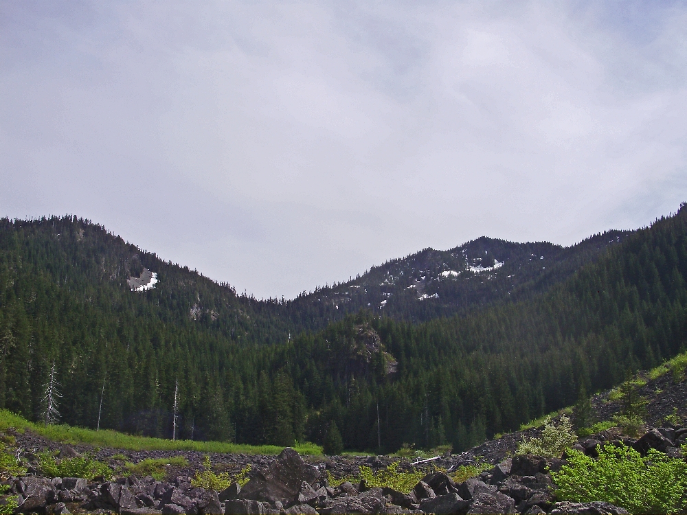
Here is the next one. This is taken from a spot off-trail with
the abandoned trail in the far end of the grassy meadow. This is in a
wilderness. There is a current trail in this valley. Name the valley!
R
Very interesting....We were on that trail to Tarzan springs today (the tumble creek trail)....Off the Burnt Granite trail. I think there might have been a cairn, but it is a very apparent trail junction. The trail down to Tarzan Springs is in even better shape than the Burnt Granite trail.
B
Donovan said:
Sounds like Tumble Creek Trail and Lowe Creek Trail are one and the same. Your description of the north end sounds identical. So does the south end. Different names for the same thing. It does sound like it would be worthwhile following and tagging the route. Perhaps this side of this thread should be moved to a new post. Edit: Actually reviewing different newer maps shows them separate, and older maps they seem the same
It sounds like you guys are talking about the Tumble Creek Trail. D.
Sounds like Tumble Creek Trail and Lowe Creek Trail are one and the same. Your description of the north end sounds identical. So does the south end. Different names for the same thing. It does sound like it would be worthwhile following and tagging the route. Perhaps this side of this thread should be moved to a new post. Edit: Actually reviewing different newer maps shows them separate, and older maps they seem the same
P
Bryon Boyce said:
I don't really know as I've never been there but I've seen photos that makes me think this is Pansy Basin. In either case I need to get out that way. --Paul
[...] Here is the next one. This is taken from a spot off-trail with the abandoned trail in the far end of the grassy meadow. This is in a wilderness. There is a current trail in this valley. Name the valley!
I don't really know as I've never been there but I've seen photos that makes me think this is Pansy Basin. In either case I need to get out that way. --Paul
B
Since I guessed the last one by process of elimination without ever being there, you win!
Its your turn to post.
Pansy Basin has much to offer. The current official trail, the abandoned trail, off-trail routes, hidden waterfalls and campsites, a huge landslide and the disappearing stream which reappears as the lake perched on large boulders shown below. It only appears when groundwater is high, like this year.
The current closure of Bull of the Woods Wilderness is keeping me from finding the lake hidden near the knife-edged tip of western wall of this valley.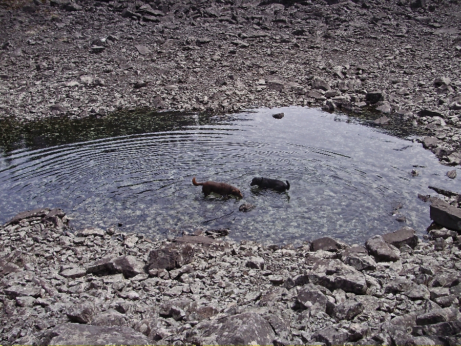
R
So where does this abandoned trail go?
B
I havn't found where it comes out at the trailhead, it simply disappears. So going offtrail is the way to find it at least at first. It traverses on the east side downhill from the current trail, crosses Pansy Meadows, and goes steeply up the west side to a lake above the old horse camp which is above Pansy Lake. A six foot thick fir fell right down the trail in 1996 above the camp, hiding the trail. Past that it passes the old mining shaft, goes up and down majorly, and eventually zig zags up the south headwall. It was the original trail hooking Bagby to Bull through Pansy Basin.
I tried once to follow this trail north from the Pansy Basin Trailhead, but lost it in clearcuts. Its downhill from the blocked off road at least at first.
P
Bryon Boyce said:
The picture I referred to was from this trip report on Portland Hikers: http://www.portlandhikers.org/forum/viewtopic.php?f=10&t=5231&start=0&st=0&sk=t&sd=a I've been wanting to get out that way for a while. There may be some stuff in there that might help you efforts. Here's a photo - what trail, now in wilderness, did I use to arrive at this view?
Since I guessed the last one by process of elimination without ever being there, you win! Its your turn to post. Pansy Basin has much to offer. The current official trail, the abandoned trail, off-trail routes, hidden waterfalls and campsites, a huge landslide and the disappearing stream which reappears as the lake perched on large boulders shown below. It only appears when groundwater is high, like this year. The current closure of Bull of the Woods Wilderness is keeping me from finding the lake hidden near the knife-edged tip of western wall of this valley.
The picture I referred to was from this trip report on Portland Hikers: http://www.portlandhikers.org/forum/viewtopic.php?f=10&t=5231&start=0&st=0&sk=t&sd=a I've been wanting to get out that way for a while. There may be some stuff in there that might help you efforts. Here's a photo - what trail, now in wilderness, did I use to arrive at this view?
D
It looks to me that your looking into the Roaring River from the Shining Lake Trail #510 in the new Roaring River Wilderness. You are looking down river towards Plaza Creek that comes in from the right. The flat bench below you that is above the river is due west of the confluence of Cougar Creek with the Roaring River.
Don
P
Donald Presley said:
Don, You have the correct Wilderness and the RR canyon is in there... --Paul
It looks to me that your looking into the Roaring River from the Shining Lake Trail #510 in the new Roaring River Wilderness. You are looking down river towards Plaza Creek that comes in from the right. The flat bench below you that is above the river is due west of the confluence of Cougar Creek with the Roaring River. Don
Don, You have the correct Wilderness and the RR canyon is in there... --Paul
D
Looks to me as if you are just off Grouse Point Trail near Dry Ridge junction. There is a small rock field there. One of the few places to get a view.
D.
P
Donovan said:
[ edit ... The trail is right but I'm a little further along the trail in the direction of the Serene Lake cutoff. This location has a name (I can't think of a decently obscure enough hint as this practically gives it away).] Actually, on second thought you are correct, the Grouse Point Trail is how I got to this point which is, I believe, Grouse Point. We have a winner... –Paul
Looks to me as if you are just off Grouse Point Trail near Dry Ridge junction. There is a small rock field there. One of the few places to get a view. D.
[ edit ... The trail is right but I'm a little further along the trail in the direction of the Serene Lake cutoff. This location has a name (I can't think of a decently obscure enough hint as this practically gives it away).] Actually, on second thought you are correct, the Grouse Point Trail is how I got to this point which is, I believe, Grouse Point. We have a winner... –Paul
D
The elusive Grouse Point. Beside the trail is a site where there was a cabin I am told. An old road leads into there. A clearing remains.
Also, there is a parallel trail in the 510 junction vicinity. Didn't run high like the current trail to the helipad.
I always concluded that Grouse Point was grown in with Rhododendrons. Which are pretty much impenetrable.
If you are up there again, maybe you could flag the point you jog off the trail to get to the Point.
D
Log in to reply.