
What trail am I on? Spring 2013 edition
D
Old Baldy Trail near Twin Springs Campground.
Don
K
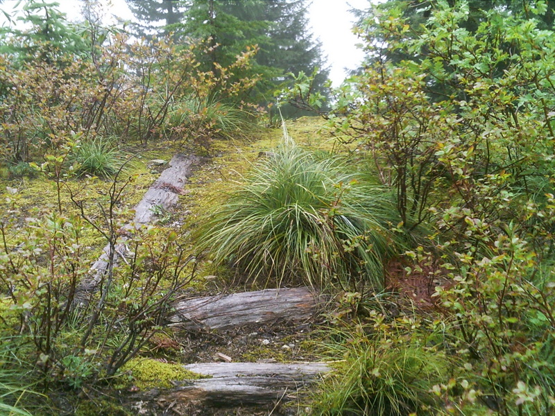
Yes Don, it is the Old Baldy Trail. You're a few miles off on the exact location. I was just a little northwest of the junction with the Eagle Creek Trail. There were some old timbers arranged in a triangular pattern in this small clearing. Maybe they were a visual reference for an aerial survey? 
D
I believe that was also a helipad.
Somewhere I have a district map from the 60s that shows helipads.
I know of three others. Two on or near Rimrock Trail and one on the Baty/Joyce Lake divide trail.
Don2
K
Donovan said I believe that was also a helipad. Somewhere I have a district map from the 60s that shows helipads. I know of three others. Two on or near Rimrock Trail and one on the Baty/Joyce Lake divide trail. Don2If I remember correctly, we were fairly close to the road. So that would make sense for access purposes to the helipad. Here's a picture of the timbers:
 Rob has a better picture that shows the triangular layout.
R
I had forgotten about that....I was thinking your photo was on the Baty Butte Trail.
Here is the photo that Kirk is referring to:

D
The pads were there long before the road.
I think they landed men in before dropping them from the sky.
Now here's a trivia question (and I don't know the answer).
Did we ever have any beacons in the District for guiding commercial aviation.
Don2
R
D
You guys might start hunting for what were called "Fire Maps". I found one at Oregon City that was quite interesting. I think they were for the patrols.
Don2
B
Fire maps were multipurpose documents which indeed were used by early post-lookout fire patrols. They were used for many purposes however. They showed anything that may be of use in firefighting. Trails, roads, clearcuts, proposed clearcuts and any sort of landmark.
At that time they commonly dug out large basins below culverts to provide water sources for fire trucks. The one just downstream from the Pansy Lake trailhead is a good example. These were marked on fire maps
They were intended to give the folks on the ground enough information to accurately describe the location of any fire. And the location of water sources and any road or trail to provide access to the fire.
If you find any they are valuable resources that were never sold to the public.
Bryon
R
Those fire maps sound pretty cool, although I have no idea where I would find one. Sounds like a treasure trove of historical info about the forest!
Any suggestions on where to find one?
D
There is a barely funded museum overlooking the river. I found one to look at there. Maybe two. 1945. About ten years ago. I don't know if it is still there or not.
I think I saw some at U of O map room.
Don
B
Donovan said There is a barely funded museum overlooking the river. I found one to look at there. Maybe two. 1945. About ten years ago. I don't know if it is still there or not.That would be the Museum of the Oregon Territory. Since its close to me I'll go ask today. Other than that ask old probably retired forest service types. Unfortunately we could never find the one that one relative was known to have while alive. Someone active in the service might still have one as well. Maybe this discussion could use its own thread. Bryon
D
kirk said Yes Don, it is the Old Baldy Trail. You're a few miles off on the exact location. I was just a little northwest of the junction with the Eagle Creek Trail. There were some old timbers arranged in a triangular pattern in this small clearing. Maybe they were a visual reference for an aerial survey?So I take it, it is my turn to post a photo or are we into exact locations or GPS coordinates inorder to be right. I know you guys are off on a tangent on these "Fire Maps" , but that is all good, so start a new string or thread and be on with it. We are on the "What Trail am I on?" thread. So here is one:
B
I did some transmogrification on that picture and I still do not recognize it. You can see some more details that might help someone who actually has been there.
Bryon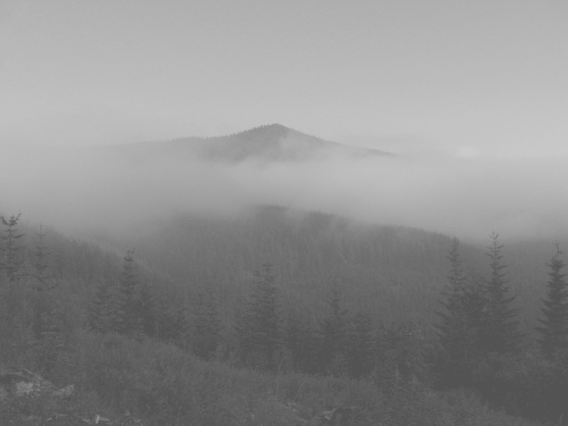
D
I should have mentioned that it is a current trail and is not in a wilderness area., and that I stepped off the trail to get a clear view of the mountain.
Don
K
Well, I don't know what trail you're on. Is that Fish Creek Mountain up there?
D
kirk said Well, I don't know what trail you're on. Is that Fish Creek Mountain up there?You will need to go further north for it is not Fish Creek Mtn we are looking at in the photo. Don
D
Fanton Trail?
Don2
D
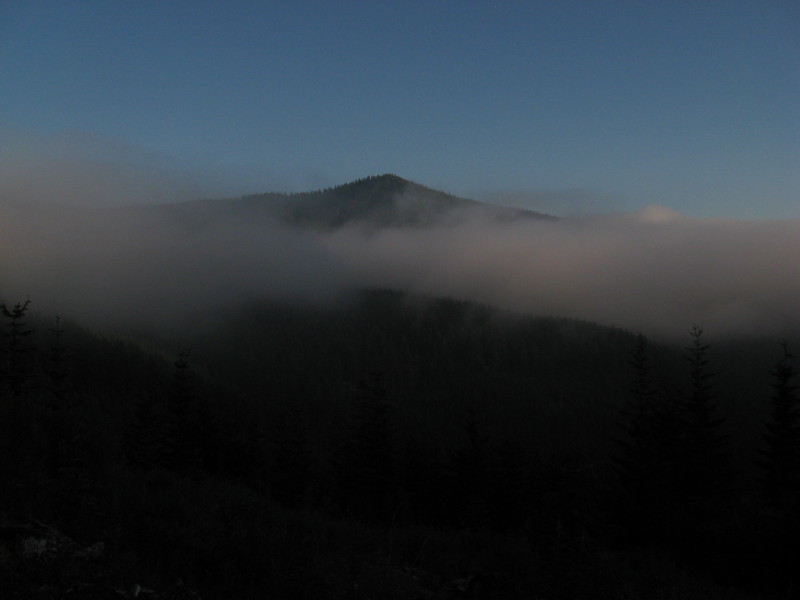
Donovan said Fanton Trail? Don2That would be correct Donavon. The Fanton Trail has several road crossings and this photo was taken from near the last or uppermost one before it ties in to the Old Baldy Trail. This area is also a place I have used several times to campout when working on nearby trails. That moutain surrounded in fog is Tumala Mtn (Squaw Mtn). Your turn to post one. Don
D
I thought there was something familiar about that mountain top. Here is my photo of the same view in daylight. A good spot for huckleberries at that landing, at least that year.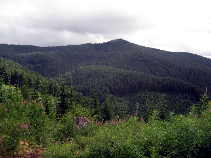
Log in to reply.