
Cougar Creek Trail
I thought I would experiment a bit on how to include pictures in a post. Here are a couple of pictures from the exploratory trip Don Presley and I took down the Cougar Creek Trail a couple weeks ago:
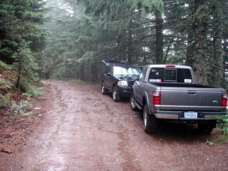
The "trailhead"
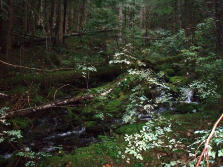
An un-named creek along the trail
If you click on the pictures, they will popup in a window in a larger size.
Rob Williams said:I thought I would experiment a bit on how to include pictures in a post. Here are a couple of pictures from the exploratory trip Don Presley and I took down the Cougar Creek Trail a couple weeks ago:
The "trailhead"
An un-named creek along the trail


Very cool!
Nice to be able to add photos.
Is that on 4610 near Twin Springs (RIP)? It looks so wide there. Must be pretty close to the landslide.
Robert Koscik said:Nice to be able to add photos.
Is that on 4610 near Twin Springs (RIP)? It looks so wide there. Must be pretty close to the landslide.
Check out the document that tells how to add photos to postings.
The picture is deceiving. The road is VERY narrow. I'm not sure how much farther to the landslide, but it can't be too far. That is the farthest I've ever gone down that road. It took a LONG time.....It is past Twin Springs. That was the first time I've ever seen Twin Springs, or at least what it used to be. Looks like you can still walk in, though. Boy, did they create a tank trap there, though.....
Donald Presley said:

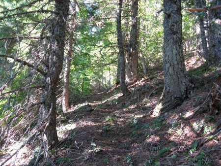
This a view of the Cougar Creek trail near the 4610 road. This an old abandoned way trail that bisects the new Roaring River Wilderness.The trail so far hasn't been located in it's full length, only a couple of miles in from each end.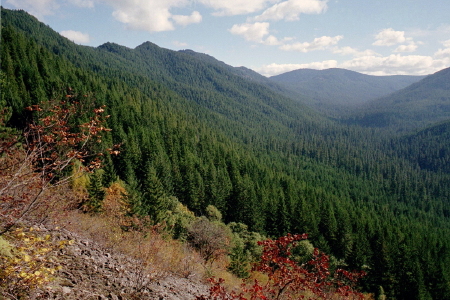
This view is taken about half way down to the Roaring River where the trail comes out near a rockfield, giving an awesome view looking up towards Hambone Springs.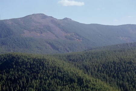
This is another view from the same spot as the last photo, but looking across the Roaring River up towards the Signal Buttes. The other end of the trail comes off the side of Signal Buttes and follows the Cougar Creek canyon part way down before climbing over the ridge in the foreground.
Other photos to come as the location of the trail progresses.
Log in to reply.