
South Fork Clackamas logjam is no more!
D
Sometime in the last week the logjam on the South Fork of the Clackamas was washed away. I, as well as alot of other people have been using the logjam to get across the South Fork to explore the old OC Waterworks that are in the canyon as well as several waterfalls. It will make doing a loop hike almost impossible as many of us have done in the past. I failed to take a photo as I was driving down 224 because it was pouring down rain this afternoon. I did manage to get a morning hike in before the rain started to come down.
Don
D
That will make things more interesting. I guess the Christian Camp trail will be the ticket in high water.
It would be interesting to see the South Fork series of falls in this weather.
The tweaker tunnel route; is that spur decommed? Across from the first borrow pit.
D.
D
Donovan said:
Yeah, I need to hike that one again someday. I have only been down it once, but it wasn't on my agenda today. There was alot of water up on the Collawash from what I saw at the viewpoint. They trenched in about 100 yards or so. It looks like hell, and is a pain to hike through. Don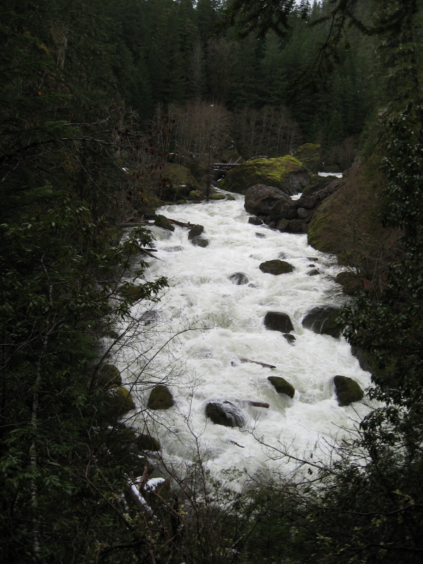
That will make things more interesting. I guess the Christian Camp trail will be the ticket in high water. It would be interesting to see the South Fork series of falls in this weather. The tweaker tunnel route; is that spur decommed? Across from the first borrow pit. D.
Yeah, I need to hike that one again someday. I have only been down it once, but it wasn't on my agenda today. There was alot of water up on the Collawash from what I saw at the viewpoint. They trenched in about 100 yards or so. It looks like hell, and is a pain to hike through. Don
K
How long had the logjam been there? About a week ago we were driving by there and I was thinking that a good heavy rain would wash that natural bridge away.
D
Speaking of natural bridge, has anyone been able to get a decent photo of the "eye hole" in Big Cliff?
D.
R
Donovan said:
Like this?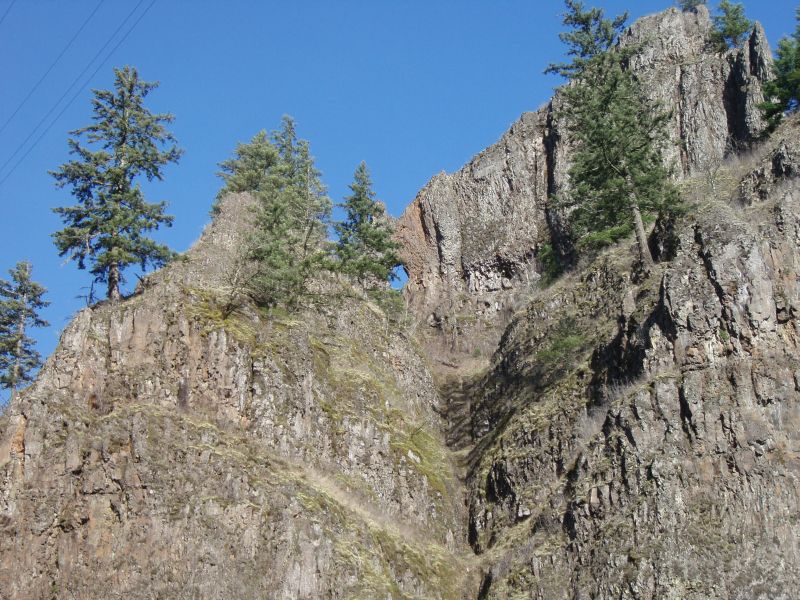 That sure is a bummer about the logjam.....Although it was getting so jammed, it was only a matter of time.
Speaking of natural bridge, has anyone been able to get a decent photo of the "eye hole" in Big Cliff? D.
Like this?
That sure is a bummer about the logjam.....Although it was getting so jammed, it was only a matter of time.R
Don is that the view from Alder Swamp?
D
Rob, that would be correct. A lot of water coming down the river. I did a hike out there yesterday a little over half way through. It started to sprinkle, so I headed back to my rig and got there before it started to really pour. I think the deepest snow I came across was about 8 inches.
Don
D
Kirk Tolstrup said:
Kirk, It seems like 2 or 3 winters ago it was just one big log across the mouth and then it has been collecting more and more logs as they came down the South Fork. The last picture I took of the logjam was back in January on one of severals trips I took over it this year. Don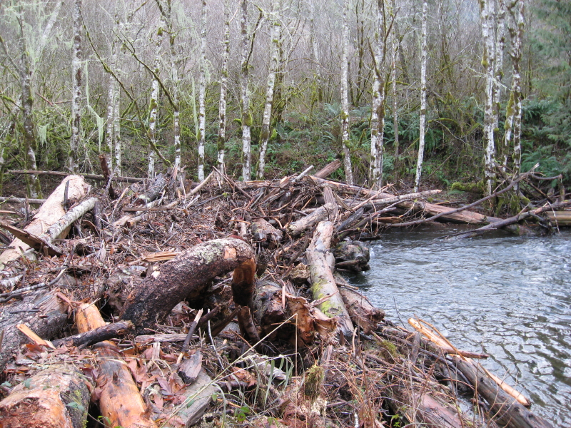
How long had the logjam been there? About a week ago we were driving by there and I was thinking that a good heavy rain would wash that natural bridge away.
Kirk, It seems like 2 or 3 winters ago it was just one big log across the mouth and then it has been collecting more and more logs as they came down the South Fork. The last picture I took of the logjam was back in January on one of severals trips I took over it this year. Don
K
Donovan said:
Is the Christian Camp trail the one that takes off from the pipeline and goes up the west side of the gorge? If the tweaker tunnel is the one with all the garbage, then yes, that spur has a few deep trenches across it. The gun enthusiasts have been taking interesting things like toilets to the trenches and using their weapons to destroy them. The funny thing is, they don't seem to find their targets worth taking home after they've had their fun.
That will make things more interesting. I guess the Christian Camp trail will be the ticket in high water. It would be interesting to see the South Fork series of falls in this weather. The tweaker tunnel route; is that spur decommed? Across from the first borrow pit. D.
Is the Christian Camp trail the one that takes off from the pipeline and goes up the west side of the gorge? If the tweaker tunnel is the one with all the garbage, then yes, that spur has a few deep trenches across it. The gun enthusiasts have been taking interesting things like toilets to the trenches and using their weapons to destroy them. The funny thing is, they don't seem to find their targets worth taking home after they've had their fun.
R
Kirk:
I think the Christian Camp trail is that one that went up the hill when we hiked down the river a ways. We didn't go very far up the trail, though.
K
So coming from the east side should be possible still, but instead of going across the logjam you'd have to start at the end of the spur above the Memaloose tunnel and then if you cross the pipeline bridge you could get to the tunnels on the other side of the South Fork? The "trail" from the end of the spur seems like it might be worse going down to the creek than coming back up because it's so steep.
R
Kirk Tolstrup said:
That would be the other possibility. That was actually the way I was going to go until Don and Charles showed me the better way. Either that, or wading the river, but that wouldn't be too easy until September or so. The other option is the "Christian Camp" trail, which is pretty rough I think, but should be doable after some more exploration.
So coming from the east side should be possible still, but instead of going across the logjam you'd have to start at the end of the spur above the Memaloose tunnel and then if you cross the pipeline bridge you could get to the tunnels on the other side of the South Fork? The "trail" from the end of the spur seems like it might be worse going down to the creek than coming back up because it's so steep.
That would be the other possibility. That was actually the way I was going to go until Don and Charles showed me the better way. Either that, or wading the river, but that wouldn't be too easy until September or so. The other option is the "Christian Camp" trail, which is pretty rough I think, but should be doable after some more exploration.
Log in to reply.