
What trail am I on? Winter 2011
K
I thought I'd start a new thread for the new year. The previous one was getting long.
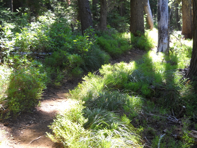
Here's a picture of a trail. It's not in a wilderness area.
D
Kirk, is that trail in the Olallie Lakes area?
K
Donald Presley said:
Yes Don, it is. I tried to post a picture without too many clues. Alas, you are too good. There are many trails in that area. Which trail is it?
Kirk, is that trail in the Olallie Lakes area?
Yes Don, it is. I tried to post a picture without too many clues. Alas, you are too good. There are many trails in that area. Which trail is it?
R
I'll take a wild guess - The east end of the Red Lake Trail?
D
I am also making a guess, for it is really a nondescriptive photo, not unlike some of those that I have posted in the past. Is it the Olallie Lake Trail #731?
K
Don, you have guessed correctly. Now it's your turn.
D
Here is a photo taken from the view at the end of the trail. It is a current disrict trail, and isn't in a wilderness area.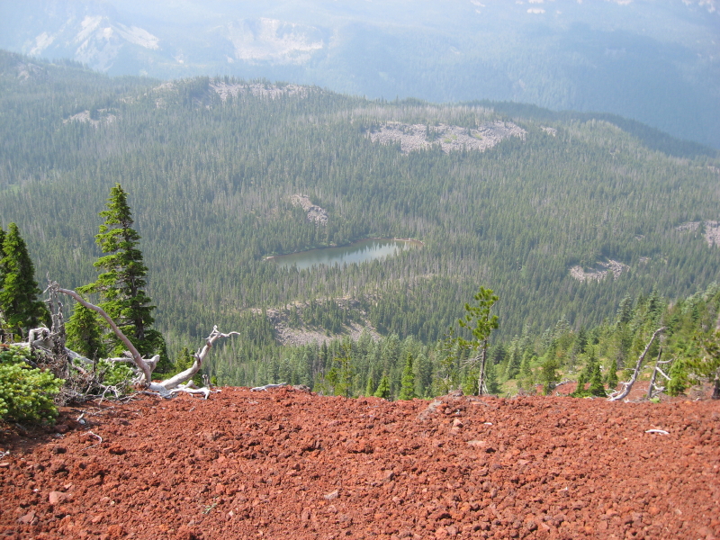
K
Is that Spinning Lake down there?
R
Kirk Tolstrup said:
I'm sure it is, for that is most definitely the Ruddy Hill trail. The red cinders are a dead giveaway.... Interesting little old phone box at the summit.
Is that Spinning Lake down there?
I'm sure it is, for that is most definitely the Ruddy Hill trail. The red cinders are a dead giveaway.... Interesting little old phone box at the summit.
D
Rob you are correct, it is the Ruddy Hill Trail. I was afraid it would be too easy, but I was having a hard time finding a photo to post. So it is your turn to post something.
R
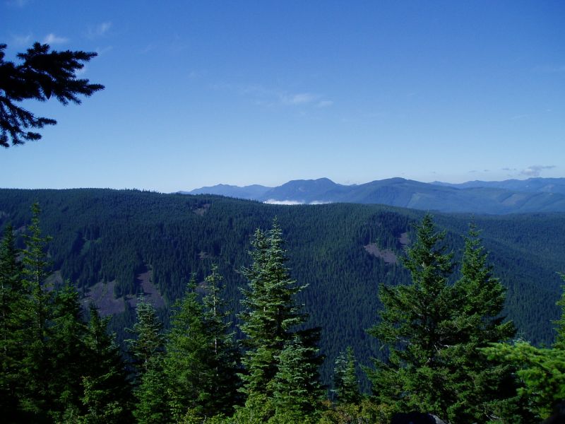
Here is a view from an old lookout site:
D
Rob, to me, that looks like Mount Mitchell from the south. So I would say that the photo was taken from Oak Grove Butte. But I have a problem with that because I don't remember you saying that you had been up there before. Anyhow that is my guess.
R
Donald Presley said:
It was not taken from the top of Oak Grove Butte. I should have said it was taken from an existing official trail that is in a new wilderness area. I'm not sure what the peak is, but I don't think it is Oak Grove Butte. This trail is farther north.
Rob, to me, that looks like Mount Mitchell from the south. So I would say that the photo was taken from Oak Grove Butte. But I have a problem with that because I don't remember you saying that you had been up there before. Anyhow that is my guess.
It was not taken from the top of Oak Grove Butte. I should have said it was taken from an existing official trail that is in a new wilderness area. I'm not sure what the peak is, but I don't think it is Oak Grove Butte. This trail is farther north.
D
Just a guess here. Is that the lookout site on the Shining Lake trail?
R
You are correct, Doug. It was taken several years ago, but it was somewhere at the end of the Shining Lake Trail where the old lookout was (along Indian Ridge). Your turn!
D
Here's one to fit the season. It's a district trail, not in a wilderness area.

R
Doug:
Is that the beginning of the trail or somewhere on the trail?
D
It's either the beginning or the end. I'm not sure which. I guess it depends on where you started.
R
I'll just take a wild guess and say it is the Rho Ridge trail. That picture doesn't ring any bells with me. At first I thought it might one of the short trails into one of the small lakes, but the ones I've been to don't look quite like that. Maybe the snow is what it throwing me….
D
That looks like the Cottonwood Meadows Trail #705 as it starts at the 5830 road and heads down towards the meadow.
Log in to reply.