
Anyone been on 517 from 4612 this year?
B
Hey group, was wondering if anyone's been on the 517 from 4611 down to the river, and then up the other side to Grouse Point recently. My main curiosity is about the trail going uphill from the river to Grouse point. The goal is to see Perrywinkle falls, and then head up towards grouse point to the view near 518, then return.
T.I.A.
R
I was on it about 3 years ago. My recollection was that it is pretty faint on the far side of the river - I remember we lost the trail for a while on the way up the hill. It is pretty steep on both sides as well, but maybe things have improved in the last 3 years (I kind of doubt it - that section doesn't get much traffic).
D
About 8 years ago, tthe FS hired a contractor to saw out the other side from the river to Dry Ridge . About halfway up the hill, which is punishing by the way, they bypassed a switch back and followed the elk trail up the spine of the ridge instead.
From Dry Ridge to 518, the trail is little maintained and walks a Rhododendron thicket.
The good view is from the old helipad, just before the trail starts down to Cache Meadows.
There is no water beyond the spring on the way out of the river bottom. The kerosene can spring.
Let us know how it goes!
D
B
Thanks guys. Rob was this trail part of your death march with Paul you told me about? I never did get the details.
Another question, how far is it on 4611 from the end of the gravel to the beginning of the 517..? I also just realized the title of my first post is wrong..
P
BrianEdwards said Thanks guys. Rob was this trail part of your death march with Paul you told me about? I never did get the details. Another question, how far is it on 4611 from the end of the gravel to the beginning of the 517..? I also just realized the title of my first post is wrong..Hey Brian, Answering for Rob, yes, the 517 was our exit out the RR at the end of a long day. I did a trip report on a hike in the area a while back and posted to Portland Hikers - there's a map at the end with my GPS track that might provide some useful info. There is a GPX file available from the most excellent Trail Advocate's Trail Guide for the 517 entry. The TH for the #517 off the 4611 used to be signed. At the end of this month I'm going to be going up Dry Ridge and down the 517 to do some maintenance - return on Sounds. --Paul
R
It was a death march for me - just another day in the woods for Paul - Don't know how he does it. I remember coming up the 517 on the other side of Roaring River - I was huffing and puffing and Paul wasn't getting enough of a workout, so he brought his hand saw and was sawing out logs across the trail "to get more of an upper body workout" as I recall. My upper body was getting enough of a workout!  I looked back at my GPS track from that day, and Topofusion says it was 20.26 miles and 5200' of elevation. I just remember it took me a week to recover from that hike! It was quite an epic hike!
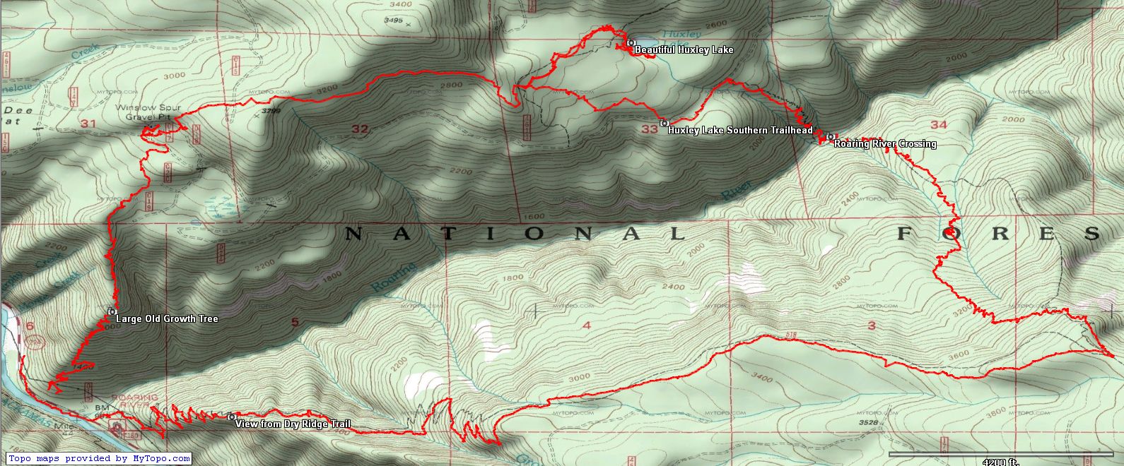
Here is a shot of the track we did:
I looked back at my GPS track from that day, and Topofusion says it was 20.26 miles and 5200' of elevation. I just remember it took me a week to recover from that hike! It was quite an epic hike!
Here is a shot of the track we did:
P
Yesterday I did the loop up Dry Ridge and down the 517 to the RR and back up the other side to the 4611 and exit via Sounds - the purpose being to saw out whatever I could on that lonely segment of the 517 from the Dry Ridge intersection down to the RR - I'm making this an annual affair as the 517 to RR needs some friends. On the way there I note that Dry Ridge really took a hit this year as there were 5-6 obstructions above the 3000' level that will need professional treatment plus several smaller ones - I did a couple but my goal for the day was the 517.
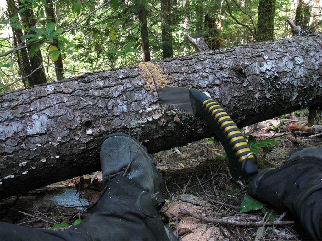
The Silky Sugoi is one fine saw, still as sharp as the day I got it.
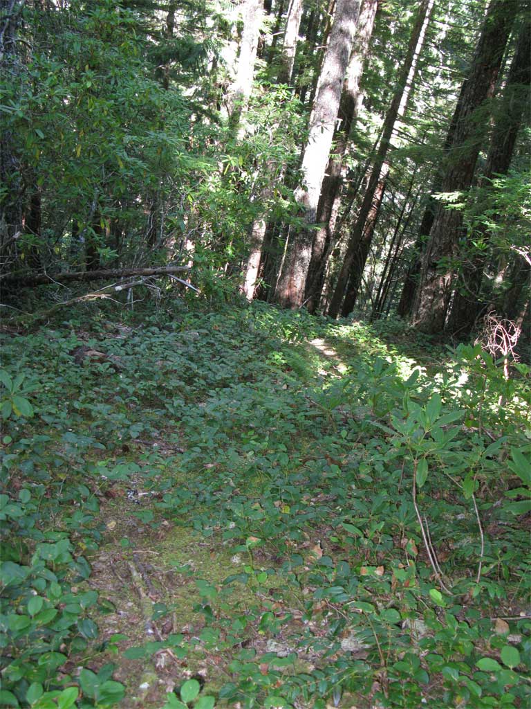
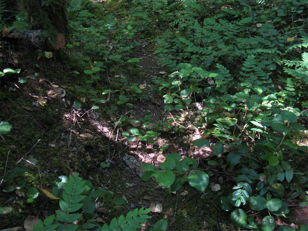
 The problem with the 517 is not so much trees on the trail but oxalis and salal obscuring the tread.
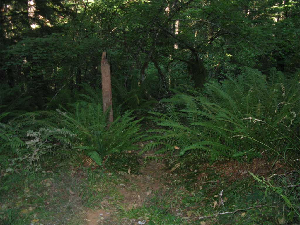
 Seems like from last year there were one or 2 new large trees on the trail I could not do and I left 4-5 that I could do but ran out of time - at any rate I was satisfied with what I accomplished. A before and after:
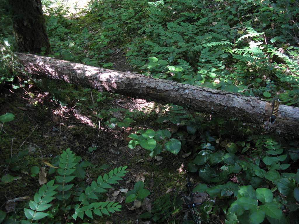
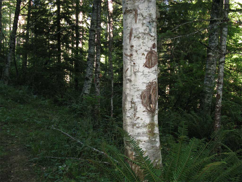
 Going out the other side to the 4611, there are no signs to mark the trail. Just the old post, some flagging, and blaze on an alder tree which at one time held a nice sign - the vandals have been busy with all the signs that used to be along the 4611 after the wilderness designation. The 521 looked like it gets lots of ATV traffic.
Here's the post:
Going out the other side to the 4611, there are no signs to mark the trail. Just the old post, some flagging, and blaze on an alder tree which at one time held a nice sign - the vandals have been busy with all the signs that used to be along the 4611 after the wilderness designation. The 521 looked like it gets lots of ATV traffic.
Here's the post:
 Here's the blazed alder
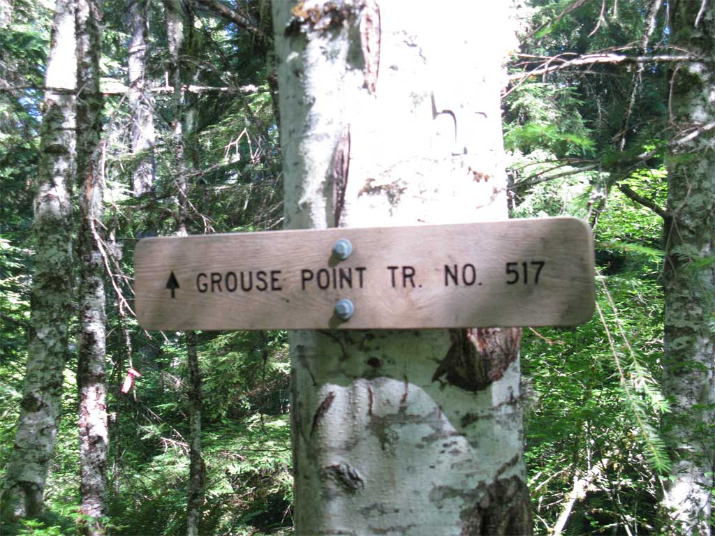
 And here is the sign that used to be on the blazed alder tree - this photo is from last year's visit:
 All things considered, Sounds trail is in good shape - only a couple of problems, one at the south end of that grove of mature timber where a large log is across the trail and one spot further down where a large snag folded up on the trail.
A great day, around 15 miles, 4500' cumulative elevation gain, 8.5 hours
All things considered, Sounds trail is in good shape - only a couple of problems, one at the south end of that grove of mature timber where a large log is across the trail and one spot further down where a large snag folded up on the trail.
A great day, around 15 miles, 4500' cumulative elevation gain, 8.5 hours
The problem with the 517 is not so much trees on the trail but oxalis and salal obscuring the tread.
Seems like from last year there were one or 2 new large trees on the trail I could not do and I left 4-5 that I could do but ran out of time - at any rate I was satisfied with what I accomplished. A before and after:
Going out the other side to the 4611, there are no signs to mark the trail. Just the old post, some flagging, and blaze on an alder tree which at one time held a nice sign - the vandals have been busy with all the signs that used to be along the 4611 after the wilderness designation. The 521 looked like it gets lots of ATV traffic.
Here's the post:
Here's the blazed alder
And here is the sign that used to be on the blazed alder tree - this photo is from last year's visit:
All things considered, Sounds trail is in good shape - only a couple of problems, one at the south end of that grove of mature timber where a large log is across the trail and one spot further down where a large snag folded up on the trail.
A great day, around 15 miles, 4500' cumulative elevation gain, 8.5 hoursR
Paul
This was essentially a reversal of the route we took, eliminating the side trip to Huxley Lake, right? Thank you for taking care of this section of trail - it doesn't get many visitors in that area. I think the trail is a little more visible earlier or later in the season (when the underbrush hasn't leafed out so much).
I was up the sounds trail last fall and it seemed in pretty good shape.
Why do people have to steal those signs? I just don't understand it....
D
Thank you Paul.
You get an additional stripe and an eagle feather.
Glad to hear Sounds is still useful.
Reversing the loop seems like a good idea.
D
P
Thanks guys, it was a good workout, I owe more than I can repay.
Reversing the route from when Rob and I went up there had a couple of benefits, I felt my vehicle was safer next to the campers at Roaring River camp and (obviously) the hike up north on the 517 from RR did not have the elevation gain as on the 517 from RR to Dry Ridge - still, it was a long walk on the 4611 back to Sounds.
--Paul
Log in to reply.