
Old Lookout Photos
R
Stumbled across this interesting website that has old panoramic photos from all the lookouts in the Mt Hood NF:
http://iamwho.com/cdv2/westOr/mthood/forest/forest.htm
And another page that shows some info about CCC activity in the Mt Hood NF:
http://www.nps.gov/history/history/online_books/ccc/ccc/chap14.htm
D
Too bad the images are so small, 300 x 700.
But now that they appear Public Domain, we should host our images some where for those who like to see the details.
Don2
R
Ask and ye shall receive:
http://www.trailadvocate.org/images/LookoutPanororamaPhotos/
On a related note, while looking at some of these photos, I noticed that there was a box on Frazier Mountain that looks like one of the old phone boxes. Does anyone know if it is still there? (like the one on Ruddy Hill)
D
That's much better. The fun is in the details.
That box looked a bit wobbly then. I have never bee to that point and I was told it's growed in but it would be interesting to find.
I have seen the wire corridor crossing somewhere along that old road part of Grouse Pt East end.
Don2
P
Thanks for posting these Rob, I see I now have a new hobby, going out and trying to duplicate these panoramas to see how they look now.
--Paul
D
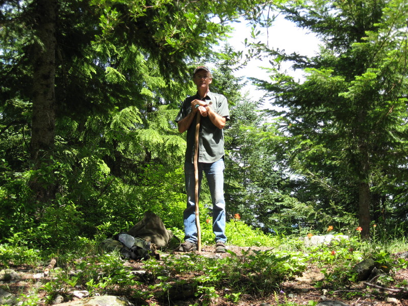 Paul I hope your are bringing a tall ladder or plan to climb a nearby tree or bring your chainsaw, for most of these sites have grown in with trees. They clearcut these sites for a reason, so that they could see firstly for firewatch and secondly for firewood. Some sites I hear have been improved through the years, but most are overgrown with trees. Been to Old Baldy lately? I guess this photo could have be posted under the Great Volunteer Moments, but I will use it here instead.
Don
Paul I hope your are bringing a tall ladder or plan to climb a nearby tree or bring your chainsaw, for most of these sites have grown in with trees. They clearcut these sites for a reason, so that they could see firstly for firewatch and secondly for firewood. Some sites I hear have been improved through the years, but most are overgrown with trees. Been to Old Baldy lately? I guess this photo could have be posted under the Great Volunteer Moments, but I will use it here instead.
Don
P
Don,
Ha! I've been there on Old Baldy and no, it would not be high on my list of spots to visit for a panorama. Interesting to me how several of the lookout photos show all the trees cut down like you mention - sometimes I wish old lookouts locations could be maintained for the views. Tumala Mtn is one I'll visit for this purpose - Tumala Meadow in the lookout photo looks like a bomb crater. Salmon Butte and Signal Buttes will be interesting and I've never been to the top of Frazier Mtn. Several spots in the Gorge, especially Tanner Butte might be neat to compare old and new.
--Paul
D
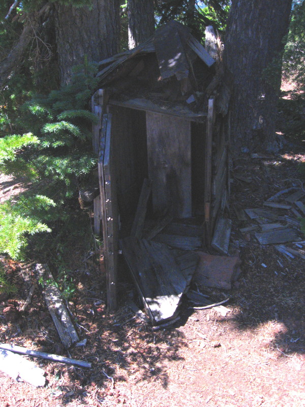 I failed to mention a third reason for clearcutting around the lookouts, probably the most important one, as a fire break should a forest fire come through the area. Tumala Mtn still has pretty good views, as does Signal Buttes. I haven't been to Salmon Butte or Frazier Mtn, but they are on my list, maybe this year. That would be neat if the phonebox was still up on Frazier. The one on Ruddy Hill is deteriorating rather fast, or has seen it's better day.
Don
I failed to mention a third reason for clearcutting around the lookouts, probably the most important one, as a fire break should a forest fire come through the area. Tumala Mtn still has pretty good views, as does Signal Buttes. I haven't been to Salmon Butte or Frazier Mtn, but they are on my list, maybe this year. That would be neat if the phonebox was still up on Frazier. The one on Ruddy Hill is deteriorating rather fast, or has seen it's better day.
Don
D
Still having views, well, Thunder Mtn, South Fork Mtn, Olallie Butte, Mt Lowe, Hawk Mtn, Squaw Mtn, High Rock, others?
High Rock is interesting with the camp details, the famous potty in the sky, the moon scape surroundings.
The most difficult to find I think would be Rho Ridge. That site burned. Kerosene accident I believe I was told. I think the GS we know collapsed in the meadow edge is below this spot. I have found it difficult to pinpoint where the panorama was taken from in this case.
Don2
K
While perusing the Collawash Mountain lookout photos, I noticed that on the left edge there is some information recorded. Most of it is readily understandable, but I couldn't figure out what the "H.I." annotation meant. I began reading We Climbed The Highest Mountains by Albert Arnst and on page 1 I read this: "Mapping onto half-inch base and topographic maps the 'seen areas' as shown on each photo."
That makes me think that the "H.I." annotation is an abbreviation for half-inch. Can anyone verify if that's the case?
D
I think "H.I." means height of instrument. It's the ground elevation plus the height of the camera lens above it. It's a surveying term, an important measurement in running elevation profiles.
K
Doug Firman said I think "H.I." means height of instrument. It's the ground elevation plus the height of the camera lens above it. It's a surveying term, an important measurement in running elevation profiles.That makes more sense than what I thought. Thanks for the elucidation. It's interesting how each photographer annotated their photos. Now I'm wondering what "SUP.NO.1." means on the Olallie Butte photo? And the number 284752 on the lower right corner?
B
This talk looks interesting:
Wednesday Oct. 19 6:30-7:30 p.m. "Fire Lookouts of Oregon" book talk with author Cheryl Hill at the Museum of the Oregon Territory in Oregon City, 211 Tumwater Dr.
Maybe she knows lookout language!
Clackamas County Historical Society
K
Bryon Boyce said This talk looks interesting: Wednesday Oct. 19 6:30-7:30 p.m. "Fire Lookouts of Oregon" book talk with author Cheryl Hill at the Museum of the Oregon Territory in Oregon City, 211 Tumwater Dr. Maybe she knows lookout language! Clackamas County Historical SocietyThanks for the notice! I'm going to put her books on my birthday wish list!
Log in to reply.