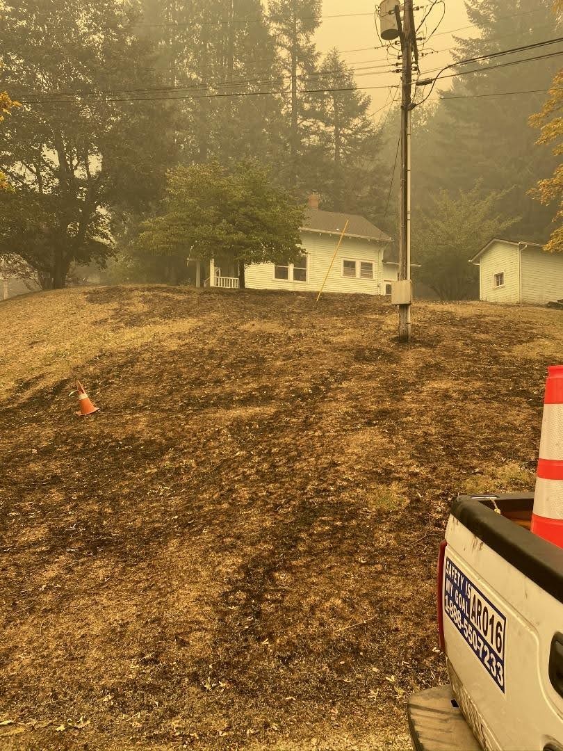
I thought I would post this link - it is a short ODOT video showing some of the burned area on 224 east/south of Estacada. It give you a small idea of what the burned area looks like:
We went out yesterday to get our first look at the damage to OR 224 east of @CityofEstacada after the #RiversideFire. Lots of down trees & debris, a few landslides, lots of burned barriers, signs down, heavy smoke & small fires still burning in the area. #oregonwildfires2020 pic.twitter.com/mLkUzmVePH
— OregonDOT (@OregonDOT) September 17, 2020
If anyone finds any other photos or videos from inside the burn area I would appreciate if you posted links to them here.
I found a couple of aerial photos of Opal Creek showing most of it burned - posted on the Opal Creek facebook page:
https://www.facebook.com/opalcreekforest/posts/10157929119084412?comment_id=10157931045094412
I tried to post them directly here but I'm guessing facebook blocked them.
Most of the buildings burned it sounds like, but one cabin is still standing.
Trail Maintenance

Trail Maintenance

That outhouse was concrete - I wouldn't think it could burn.
If you go to inciweb and click on the full size photo you can see some more detail - I'm thinking there might have been some sort of carport like thing back behind the ranger station - and that burned - but I'm not sure:
Trail Maintenance

Look at the photo here http://www.ruckerworks.com/201.....much-snow/ It shows that there was a large building next to the store which doesn't appear on the inciweb photo. Also on Google Earth:
Looks like that pile of debris is the remains of that building. It was a lot bigger than an outhouse!
This was posted to the Forest Service Facebook page a couple days ago - it is aerial footage of the Fish Creek drainage - it is kind of a sobering video:
Another video from the Promontory Park Facebook page showing 224 to Promontory park -doesn't look too bad:
https://www.facebook.com/watch/?v=375689990490399
And a picture:
Another facebook posting on the Forest Service website with some photos of a couple of campgrounds and an aerial shot:

This map shows the latest satellite imagery (like Google Maps). You need to search Estacada then scroll down to the burn area. It is sobering.
PStrobel said
This map shows the latest satellite imagery (like Google Maps). You need to search Estacada then scroll down to the burn area. It is sobering.
Wow - that's all I have to say - just WOW.
Most Users Ever Online: 114
Currently Online:
5 Guest(s)
Currently Browsing this Page:
1 Guest(s)
Top Posters:
Member Stats:
Guest Posters: 0
Members: 292
Moderators: 0
Admins: 3
Forum Stats:
Groups: 2
Forums: 8
Topics: 447
Posts: 5147
Newest Members:
FamilycampAdministrators: Admin: 14, Donovan: 714, Rob Williams: 1420