Trail Maintenance

This trail shows up on the 1938 forest map as an extension of the Mother Lode trail, crossing Elk Lake Creek and continuing east to the ridge top. I followed the trail for a half-mile or so just about a year ago.
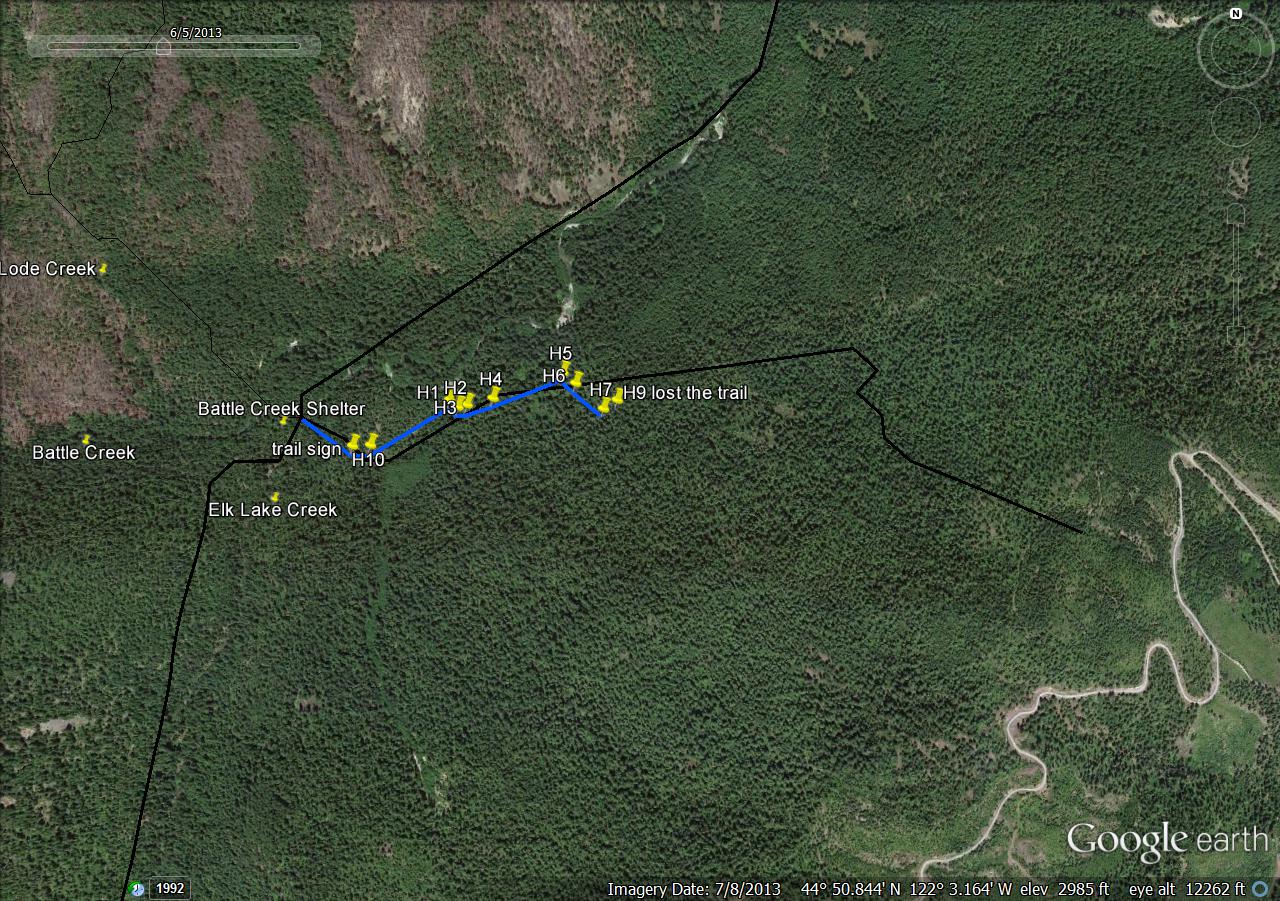
It shows up on some more recent maps as well. My gps track shows some deviation from the mapped trail. I thought I was on the trail most of the time, but maybe not. I'll be going back to check it out again.
I marked points along the way where I felt confident that I was on the trail. Again, I wonder if I wandered off-course toward the end.
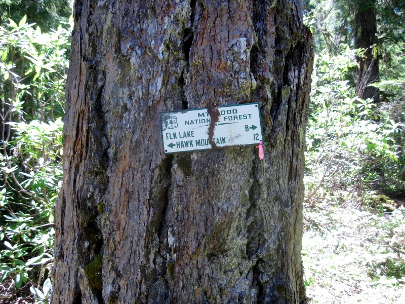
Just east of the Elk Lake Creek crossing, the trail is nicely marked by this sign. I don't understand the mileage figure to Elk Lake though. They must have been taking the scenic route.
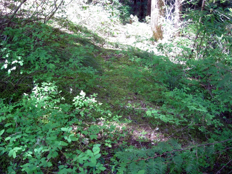
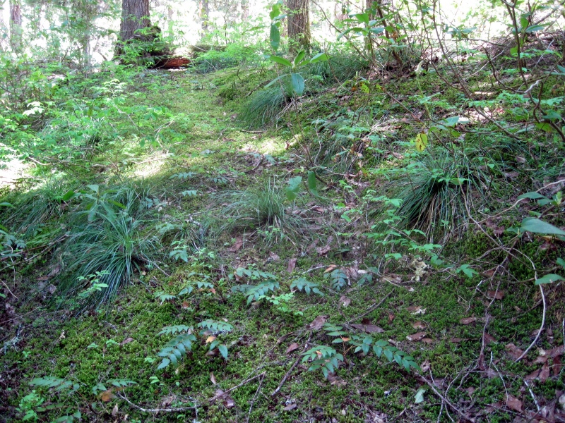
The trail just past the sign.
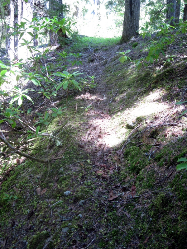
The trail heads down to cross a small stream.
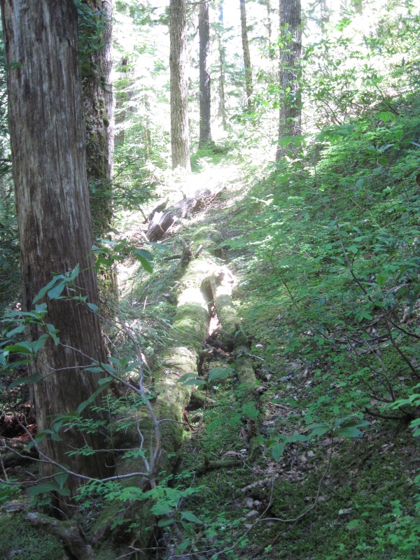
The stream crossing.
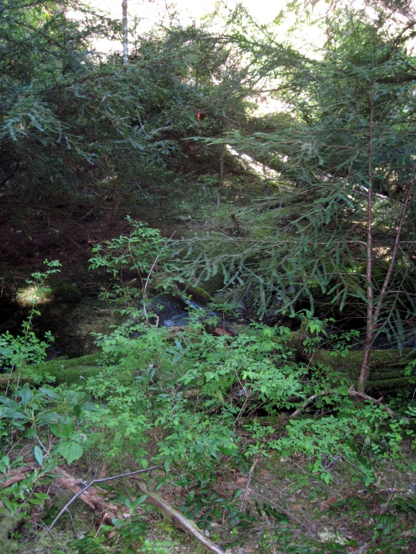
The forest is open and easy to walk through in some places.
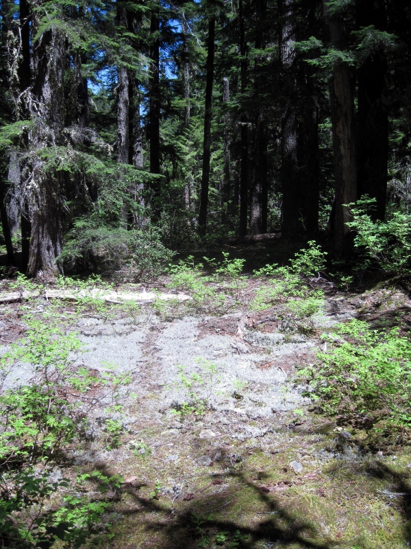
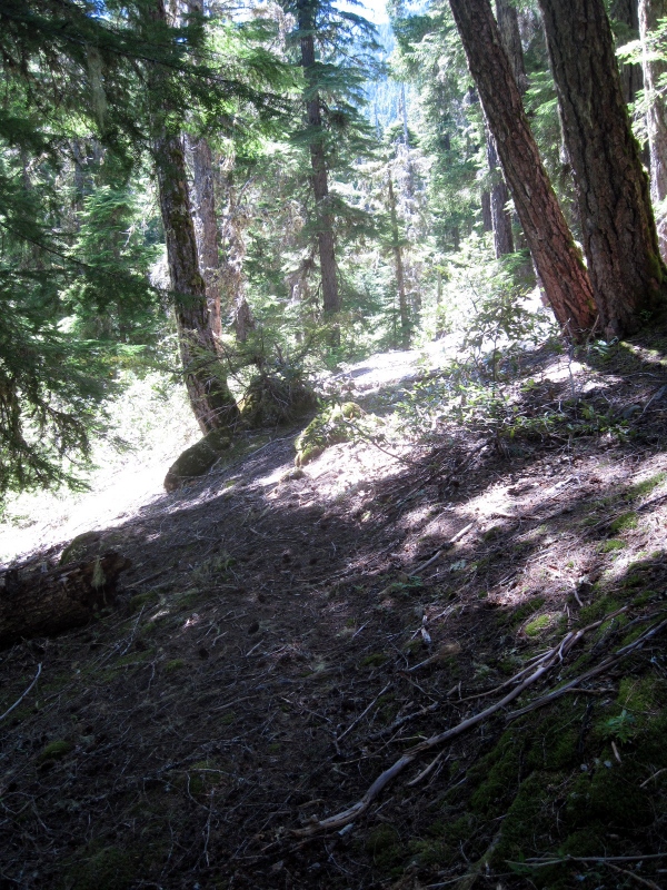
The rhodies became increasingly thick beyond this point. Somewhere past here I lost the trail.
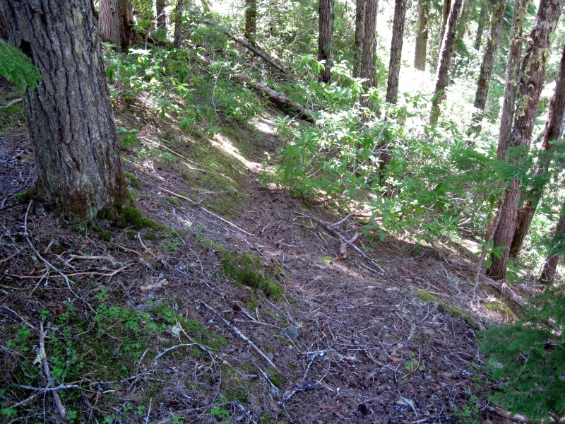
I plan to go back soon to take another look around and see if I can pick up the trail where I lost it. If I can follow it to where it starts to climb more steeply, I might have a better chance of finding the rest of it. It looks like it's been clearcut on top of the ridge, so it might be tough to locate the trail all the way to the road up there.
Trail Maintenance
Trail Maintenance

The road to the upper end of the trail, Rd 4696, is open and is a very good road. Very easy access to that area, about 6+ miles from FR 46. That's where the easy part ends, though. The forest in that area is a rhodie jungle, making things difficult for travel and trail searching. I spent a few hours up there yesterday thrashing through the rhodies myself. I had no success in locating even a bit of the trail, although I did find my way back to where I last saw it down closer to Elk Lake Creek. But it took me so long to get down there that I had no time to do much exploring and instead turned around and headed back up the hill. This visit was a spur-of-the-moment thing, something I decided on mid-day after my original hiking plan fell through. Maybe with more time and preparation some progress could be made. I can't say that I'm looking forward to fighting those rhodies again, though.
Trail Maintenance

Good info there. That is a key link (I think) in the old east west divide route from the Molalla to the Klamath Trail. With that link many pieces and some road walking one day we might be able to hike from Table Rock to Olallie country.
Rhodies are the worst. But, once cut out a hole will last a while. The elk might even use it.
D
Trail Maintenance

I went back yesterday to make another try at finding this trail, and this time I found it. A logging road, now abandoned, destroyed the first 0.4 miles from Road 4696, but beyond that the trail is there. This trail has friends. At some time in the past it has been cleared, blazed and flagged. It is not always easy to follow and is not in the best of shape in some places, but it is there. Whoever has been taking care of this trail has done a heckuva job. Thank you, whoever you are.
The beginning of the trail is marked by a small cairn at the edge of the logging road. Although there is no clear path from here through the rhodie thicket, it is possible to find a route following a path of old logs that takes you to the beginning of the cleared trail. I hung some flagging to show the route that I used. Much easier than thrashing around in the rhodies, as I did on my way in before I found the actual trail.
Many blazes like this one along the trail.
It's not all rhodie thickets. There are some open areas along the way.
A particularly nice bit of trail. Most of it is not in as good a shape as this, though.
The route on the original map doesn't quite match the actual location in some places. Nothing new about that, I guess. As you can see, I got mixed up in a couple of places, but mostly the trail is not too difficult to follow. It's well flagged where it's ambiguous. I'm guessing that if you eliminate the mileage due to my wandering around, this trail is actually about 2 miles.
Distance to the trailhead on FR 4696 is about 70 miles from Estacada. Took me an hour and 45 minutes to drive from Estacada, with no other traffic on the road.
Trail Maintenance
Trail Maintenance

It is an alternate route into the BOW, but I think "shortcut" is in the eye of the beholder. It requires fewer miles of hiking to get to Battle Creek, but lots more driving than if you were to hike in from the Collawash trailhead.
Finding this trail was greatly aided by the kmz files from the Forest Service that Rob brought to our attention. Although the black line on the photo below was mostly off-course, it was exactly right at the east end of the trail and it led me right to where I needed to be. My marker "T1" is where I found the trail in the rhodies, having followed that line from the cairn at the edge of the road. Just a fluke, but it worked for me.
Trail Maintenance
It is a long drive to that trailhead, but it is mostly paved roads. Looking at that, it would provide the ability to do a little more reasonable look hike on Geronimo - last time I did it, it was 14.5 miles - that was a long day. I just did a rough track, and it looks like it might cut 3 or 4 miles off that if I used this trail. Sounds like a plan for a future hike. My list of "new" trails to hike keeps getting longer!

I think this is a great find and I can see using it in a nice loop on trails and roads I've never been before. Park at Elk Lake and do Elk Lake Creek Trail down to the shelter then up this trail to get on the forest boundary (beat up on some brush on the way up). Older maps like the '38 show trail (lesser standard) all along the forest boundary. Google Earth shows some views along the way and there's some trail in there. Follow the forest boundary, visit Gold Butte then back to Elk Lake.
Stash a bike at the end of the 451 spur to cut off the road walk back to Elk Lake. Visit Dunlop Lake.
Going to be quite a day, thx for the info...

I'm making plans to do something in this area and was looking at the old cadastral plots. I'm not sure if particular one has been mentioned before but I thought I post a snippet. Here is a link to the BLM site for the original.
http://www.blm.gov/or/landreco.....0e_001.jpg
Shows the trail in question but also names the trail on the south side of Elk Lake Creek as the 'Old Elk Lake Creek Trail' - the 38 map shows a lesser standard trail in there. Interesting - I may go take a look. I hope to do the loop I mentioned previously this coming week so thanks Doug for posting the image of your track.
Nice find, Paul! Will be interesting to see if you find anything.
FYI, we do have all the Cadastral maps here on Trailadvocate (they were copied from the BLM website). If you use this page:
http://www.trailadvocate.org/m.....ector.html
And click in the general vicinity of the elk lake creek trail near the shelter area, it will give you a list of a whole slew of maps that cover that area. Once of them is the 1941 Cadastral map:
So I went up and hiked this trail yesterday. Thanks to Doug's great description, and a copy of his track, I was able to follow most of the trail. It gets pretty iffy in the middle - lots of blowdown and the tread gets less discernible along with lots of rhodies. It is obvious this trail has not seen real work in a long time - and no hikers for a long time either. The tread is covered in moss, but most of the route does have intact tread. It is actually pretty amazing. A day or two of lopping/brushing and maybe a bit more flagging in a few spots would make this trail relatively easy. What Doug did helped me a lot, but there are some sections that are still pretty vague.
I made it down to the creek where there are some HUGE trees - several of which have fallen. Great place to eat lunch.
And after I drove this route, I see what Doug means about it not really being a shortcut - this is a LONG drive (93 miles from my house) - took just about 2 hours, maybe a shade longer. And due to the roughness and brushiness of the trail, it isn't an easy 2+ mile hike. I was pretty tired by the end of the day after pushing through rhodies and stepping over LOTS of downed logs.
Lastly, some interesting photos from the day.
First, I think this might have been an old junction - it was just about at the halfway mark on the trail. You can't really see much tread to the right (the trail heads to the left - you can see a flag). But the tree to the right looks double blazed and it looks just like an old junction would look - and there is a bit of tread heading down to the right - it just doesn't go too far:
Next is a section marker cut into a tree - this was very close to a section line - kind of cool:
This tree looked like it might have had some sort of sign on it at some point
And lastly, the very sad state of Detroit Lake - is it always this low this time of year? Do they drain it down really low to allow water to accumulate over the winter? It looks like the water level is at least 50' below where it should be. All those docks are sitting WAY high and dry.
Trail Maintenance
Nice outing, Rob. Great to hear that trail is still followable. Long drive, but worth it.
Re Detroit Lake, it's a little surprising that it's that low still, according to weather underground, the Detroit area has gotten 7.67 inches of rain since Oct 1st! Ya it was dry there, but I'd still think that much rain spread over the drainage would increase the reservoirs level atleast some. Snowmelt seems to be the key to keeping it full. I've no idea on the politics or drain downs that may be happening.

In regards to Detroit Lake, yes, that is a typical level for this time of year. They drawdown the lake every fall in order to have room to "catch" a major rain event and prevent flooding downstream. They gradually fill it back up in the spring when they have a better idea of snowpack and spring weather so that it is full for recreation during the summer. Main mission of Detroit Lake is flood control and not recreation.
Most Users Ever Online: 93
Currently Online:
6 Guest(s)
Currently Browsing this Page:
1 Guest(s)
Top Posters:
Member Stats:
Guest Posters: 0
Members: 279
Moderators: 0
Admins: 3
Forum Stats:
Groups: 2
Forums: 8
Topics: 437
Posts: 5059
Newest Members:
estairplusplusAdministrators: Admin: 14, Donovan: 714, Rob Williams: 1375