
[Edit: What I call the Pot Creek Trail is really on Lost Creek - I get the name from the 1956 map and the USGS GNIS names database has the trail as Pot Creek Trail. That it is on Lost Creek ought to make it named as such, I'm not sure which way to go on this. An error on the part of USGS?]
I did some more recon for an Oak Grove Butte hike I want to do so I explored in detail the opposite ends of the route. In a previous post Don mentioned that there was trail on Switch Creek – I can confirm this and it is very good trail. I started out on the wrong side of the creek and I did so in lieu of considerable evidence that the trail took off from the east side of the creek – what was I thinking. I lost the trail once about 2/3s the way up in a spot where the terrain leveled out with lots of downed trees.The trail ends at a road but there was trail going west that I followed into a clear cut where it kept going. How far west does this trail go? [Edit: In re-reading a post from Don in another thread this must be the segment that ends on a road to the west]

Switch Creek Trail has much the character of the Sounds Trail – really neat stuff. There was a ridge segment:

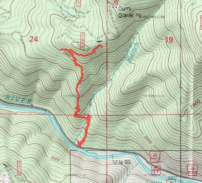
Great trail, here's the map. The 'Lost' label is the level spot where I lost the trail – I was on trail for the return trip.

Here's the Pot Creek (I'm calling it Pot Creek Trail from the name on the 1956 map) section of this report. I was able to locate a trail segment but unfortunately there is a lot of deadfall in this section. I'd have to go out an look some more but it is possible that the trail was spared from the nearby clear cut.
Here's a couple of photos from the segment I located.

This looks pretty good but looking the other way – not so good:

On the map below, the left side of the loop was my ascent through the clearcut, I descended on the right side through uncut forest of widely varying age. Now that I see the track, I was probably too close to the creek on the way down.

Nice post there Paul!
I should have mentioned that I hadn't flagged that bench on the Switch Creek Trail, for I haven't located the tread through there yet. You know flat terrain and a lot of down timber makes tread finding a lot harder. I have been following where most of the game go, up a little gully on the east end of the bench and go along the backside til you reach the westend of bench and pick up the tread again. From there it goes through a couple of faint switchbacks then is fairly easy to follow up to the trail junction with the Oak Grove Butte Trail.
I have flagged the other trail down through the clear cut to the road in the bottom, except for about a 1-200 feet section just before it switches back to the left, where I need to do some locating yet. But if you turn straight downhill where my flagging ended in the clear cut, you would run into the tread again lower down. When it reaches the edge of the clear cut, you just follow the ridge and it becomes a road. Further on down the road I located a small segment of the trail before it gets eaten up by another clearcut. So, for the most part the rest of that trail down may be history except for some small segments that didn't get logged.
That's good news about the Pot Creek Trail. I believe they call the trail that because of Pot Creek Cabin that it went to. That site I have been to, but the time I was there I didn't have time to explore for trails for I had spent most of the day clearing trails up by Olallie Lake. On another day in the same area I managed to explore for a few hours in the afternoon and went up the west of Lost Creek where I thought the trail went, but didn't see anything but the clearcut.
Don
Paul:
Here is link to a map of the last trip Don and I did up switch creek. We ended up following the same path up and down, so I think this is a pretty good representation of the "trail". We didn't go down through the clearcut, only to the edge of it, but we did go up to the camp up by the road - hope that helps a bit:
Paul:
I went out yesterday and explored for the Pot Creek Trail coming down Lost Creek. I found that switchback that you had mentioned and flagged both legs all the way out to the clearcut, but didn't see anything lower down. The upper leg comes out on the ridge where the slope changes from gradual slope above and steep below. I believe that the switchback is the last one going up the hill, for it is the only one that comes close to the creek and comes out above the steep slope. I built a rock cairn at the point where the trail is easy to follow down from the ridge.
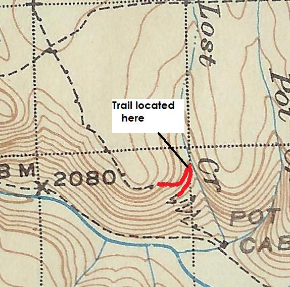
'38 map showing the segment of the Pot Creek Trail located.
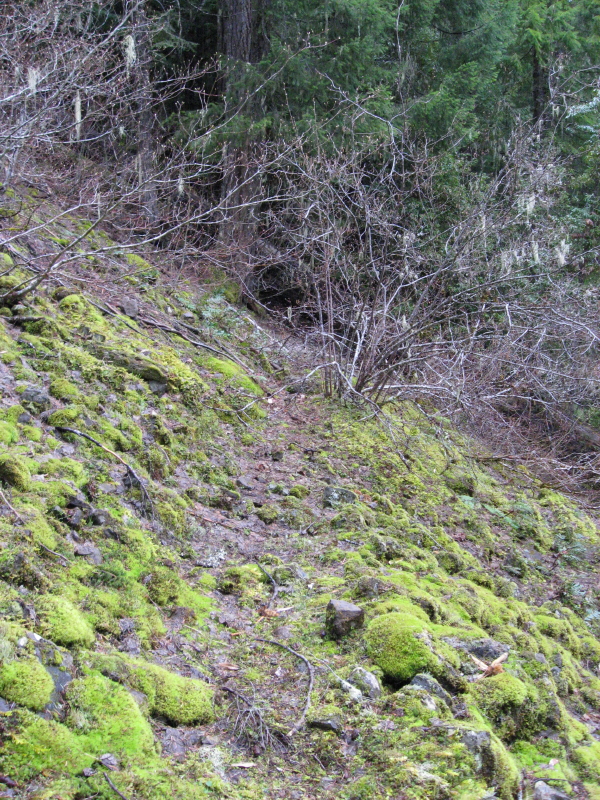
View of the trail crossing a rock field.
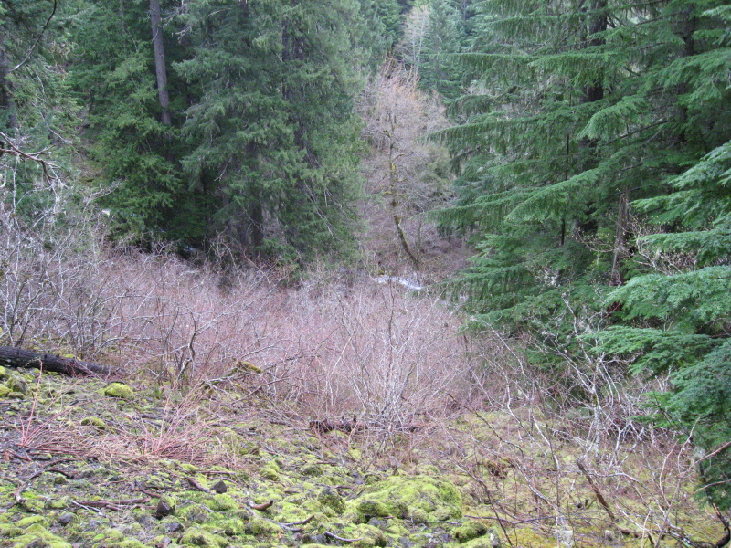
View looking down to Lost Creek from same spot on the trail.
It looks like the logging activity took out the tread in the clearcut, but I will probably get out there and look again, for now I know where to look. I found some phoneline on the ground out in the clearcut as I headed west looking for tread. Looks like it heads into some uncut timber again, so we might be able to locate some more tread over that way. I will have to see if I can drive up the 5720 road to get up on top. At 3000 feet, there wasn't hardly any snow left. What a difference a couple of weeks make.
Don
Nice to see you guys piecing it together. Keep at it and you'll get it figured and we'll have another nice route up out of the canyon.
The wire will help.
D2